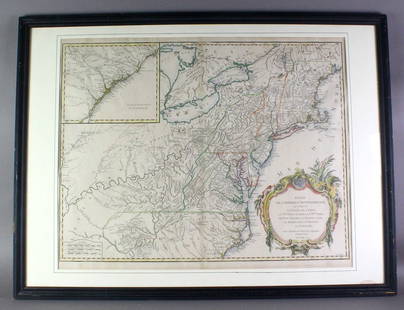
De Vaugondy map of East Indies 1750
Similar Sale History

Recommended Items


Item Details
Description
Heading: (Indonesia)
Author: De Vaugondy, Robert
Title: Archipel des Indes Orientales qui Comprend les Isles de la Sonde, Moluques et Philippines
Place Published: Paris
Publisher:
Date Published: 1750
Description:
Author: De Vaugondy, Robert
Title: Archipel des Indes Orientales qui Comprend les Isles de la Sonde, Moluques et Philippines
Place Published: Paris
Publisher:
Date Published: 1750
Description:
Copper-engraved map, hand-colored in outline. 48x59 cm. (19x23").
Present-day Indonesia, the Philippines, Timor, the Moluccas, etc.
Condition
A bit of darkening along centerfold, near fine.
Buyer's Premium
- 23%
De Vaugondy map of East Indies 1750
Estimate $200 - $300
3 bidders are watching this item.
Shipping & Pickup Options
Item located in San Francisco, CA, usSee Policy for Shipping
Payment

Related Searches
TOP


![De Vaugondy map of China: Heading: (China) Author: Robert de Vaugondy, Gilles and Didier Title: L'Empire de la Chine dressé d'après les Cartes de l'Atlas Chinois Place Published: [Paris] Publisher: Date Published: 1](https://p1.liveauctioneers.com/642/319971/171838574_1_x.jpg?height=310&quality=70&version=1708735487)

![Vaugondy's map of Virginia and Maryland, a reduction of Fry and Jefferson's landmark map: [MAP - VIRGINIA AND MARYLAND] VAUGONDY, ROBERT DE. Carte de la Virginie et du Maryland Dressee sur la Grande Carte Angloise de Mrs. Josué Fry et Pierre Jefferson. [Paris]:1755 [but circa 1778].](https://p1.liveauctioneers.com/292/326828/175962861_1_x.jpg?height=310&quality=70&version=1713473479)


