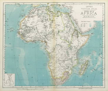
BRITISH MAP OF AFRICAN SLAVE REGIONS
Similar Sale History


Recommended Items


Item Details
Description
BRITISH MAP OF AFRICAN SLAVE REGIONS
Scarce map: A New & Accurate Map of Negroland and the Adjacent Countries also Upper Guinea, showing the Principal European Settlements & distinguishing wch. belong to England, Denmark...", 17 3/4" x 14 1/4", hand-colored copperplate engraving by Emanuel Bowen, London, 1744. The map depicts eastern Africa as the common European viewed it at the time: "Kingd. of Temian Anthropophages or Men Eaters...Guinea whence they bring Jasper and Slaves...Tooth Coast...Gold Coast...Slave Coast...", and so on, with ports and rivers also named. Very good.
Scarce map: A New & Accurate Map of Negroland and the Adjacent Countries also Upper Guinea, showing the Principal European Settlements & distinguishing wch. belong to England, Denmark...", 17 3/4" x 14 1/4", hand-colored copperplate engraving by Emanuel Bowen, London, 1744. The map depicts eastern Africa as the common European viewed it at the time: "Kingd. of Temian Anthropophages or Men Eaters...Guinea whence they bring Jasper and Slaves...Tooth Coast...Gold Coast...Slave Coast...", and so on, with ports and rivers also named. Very good.
Buyer's Premium
- 24.5%
BRITISH MAP OF AFRICAN SLAVE REGIONS
Estimate $500 - $600
3 bidders are watching this item.
Shipping & Pickup Options
Item located in Chesapeake City, MD, usSee Policy for Shipping
Payment

Related Searches
TOP


![Clarkson. ...AFRICAN SLAVE TRADE. Vol II. 1st ed.: [Slavery] Thomas Clarkson. THE HISTORY OF THE RISE, PROGRESS, AND ACCOMPLISHMENT OF THE ABOLITION OF THE AFRICAN SLAVE-TRADE BY THE BRITISH PARLIAMENT. Vol II only (of 2). Lon: R. Taylor and Co./ For](https://p1.liveauctioneers.com/179/85723/44107869_1_x.jpg?height=310&quality=70&version=1456876561)


![[African Slave Trade, 1790]: AN ACT TO AMEND AND CONTINUE, FOR A LIMITED TIME, SEVERAL ACTS OF PARLIAMENT FOR REGULATING THE SHIPPING AND CARRYING OF SLAVES IN BRITISH VESSELS FROM THE COAST OF AFRICA. London: Charles Eyre and An](https://p1.liveauctioneers.com/3532/238122/123501328_1_x.jpg?height=310&quality=70&version=1645421606)


