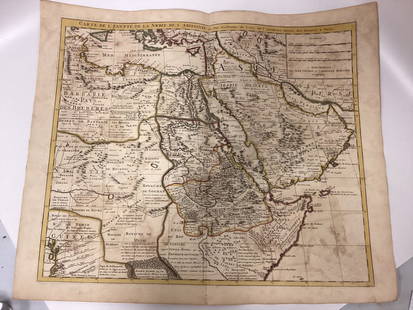
Map. Egypt and Palestine. 1829.
Similar Sale History
Recommended Items


Item Details
Description
Print from steel engraving titled „IV. Aegyptus et Palestina“.From Schul-Atlas der alten Welt. Published by Gotha Perthes. 1829.Orbis Terrarum Antiquus. School Atlas of the Ancient World edited by D'Anville, Mannert, Uckert, Reichard, Kruse, William u. A. With an introduction by JH Moller: Brief outline of the old geography. 23, enlarged edition. 1829.Egypt is a transcontinental country spanning the northeast corner of Africa and southwest corner of Asia, making it an Afro-Asiatic country via a land bridge formed by the Sinai Peninsula. Most of Egypt's territory of 1,010,000 square kilometres (390,000 sq mi) lies within the Nile Valley of North Africa, but it is also considered a Mediterranean country as well, as Egypt is bordered by the Mediterranean Sea to the north. It's also bordered by the Gaza Strip and Israel to the northeast, the Gulf of Aqaba to the east, the Red Sea to the east and south, Sudan to the south and Libya to the west. Egypt has one of the longest histories of any modern country, arising in the tenth millennium BCE as one of the world's first nation states. Considered a cradle of civilization, Ancient Egypt experienced some of the earliest developments of writing, agriculture, urbanisation, organised religion and central government in history. Its iconic monuments, such as the Giza Necropolis and its Great Sphinx, as well the ruins of Memphis, Thebes, Karnak, and the Valley of the Kings outside Luxor, reflect this legacy and remain a significant focus of archaeological study and popular interest all over the world. Egypt's rich cultural heritage is an integral part of its national identity, having endured and at times assimilated various foreign influences, including Greek, Persian, Roman, Arab, Ottoman, and European. Modern Egypt is considered to be a regional and middle power, with significant cultural, political, and military influence in North Africa, the Middle East and the Muslim world.Palestine is a geographic region in Western Asia between the Mediterranean Sea and the Jordan River. It is sometimes considered to include adjoining territories. The name was used by Ancient Greek writers, and was later used for the Roman province Syria Palaestina, the Byzantine Palaestina Prima and the Umayyad and Abbasid province of Jund Filastin. The region is also known as the Land of Israel, the Holy Land or Promised Land, and historically has been known as the Southern portion of wider regional designations such as the Levant, Canaan, Syria and as-Sham. Situated at a strategic location between Egypt, Syria and Arabia, and the birthplace of Judaism and Christianity, the region has a long and tumultuous history as a crossroads for religion, culture, commerce, and politics. The boundaries of the region have changed throughout history. Approx. image size 22 x 17/26, 2 x 22, 1 cm.
Condition
Condition: medium.
Buyer's Premium
- 0%
Map. Egypt and Palestine. 1829.
Estimate €15 - €40
1 bidder is watching this item.
Get approved to bid.
Shipping & Pickup Options
Item located in Vilnius, ltSee Policy for Shipping
Payment

Related Searches
TOP


![Antique Map of The Holy Land, Dated 1792: "Generaale Kaart Van Het Beloofde Land" colored map of The Holy Land, covering present-day Israel and Palestine, bordered by Egypt and Syria. Dated 1792, unframed. [22 x 26 inches]. Dry, losses, creas](https://p1.liveauctioneers.com/1221/303742/163342134_1_x.jpg?height=310&quality=70&version=1697564518)


![[EGYPT, PALESTINE, TURKEY]. Vintage Collection of: [EGYPT, PALESTINE, TURKEY]. Vintage Collection of Middle East Postcards. Vintage collection of over 150 postcards of Egypt, French colonies in North Africa, Algeria, Tangier, Aden, Palestine, Turkey a](https://p1.liveauctioneers.com/928/222494/114617082_1_x.jpg?height=310&quality=70&version=1634568084)


