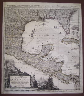
HENRY POPPLE 18th C. MAP: BRITISH EMPIRE IN AMERICA
Similar Sale History
Recommended Items


Item Details
Description
A Map of the British Empire in America with the French, Spanish and Hollandish Settlements', by Henry Popple, Covens & Mortier: Two sheets joined at the center, the left hand sheet includes an ornate cartouche with Native Americans, Tobacco, Ships and allegory of Commerce. Right sheet depicts the Atlantic to the north and Caribbean Islands to the south along with the northern coast of South America. Measures 24.75 x 42 inches, frame measures 27.5 x 45 inches. Two sheets joined.
Condition
Laid down, toning.
Buyer's Premium
- 15%
HENRY POPPLE 18th C. MAP: BRITISH EMPIRE IN AMERICA
Estimate $400 - $600
3 bidders are watching this item.
Shipping & Pickup Options
Item located in Lone Jack, MO, usSee Policy for Shipping
Payment

Related Searches
TOP


![Entrée de Norton & Détroit de Bhering. Bering Strait Norton Sound BONNE 1790 map: TITLE/CONTENT OF MAP: [Cook 3e Voyage] Carte de l'entrée de Norton et du Détroit de Bhering, où l'on voit le Cap le plus Oriental de l'Asie et la pointe la plus Occidentale de l'Amé](https://p1.liveauctioneers.com/5584/326888/175994368_1_x.jpg?height=310&quality=70&version=1713903186)
![Entrée de Norton & Détroit de Bhering. Bering Strait Norton Sound BONNE 1788 map: TITLE/CONTENT OF MAP: [Cook 3e Voyage] Carte de l'entrée de Norton et du Détroit de Bhering, où l'on voit le Cap le plus Oriental de l'Asie et la pointe la plus Occidentale de l'Amé](https://p1.liveauctioneers.com/5584/326888/175994363_1_x.jpg?height=310&quality=70&version=1713903186)


![Origin of Commerce of the British Empire: Heading: Author: [Anderson, Adam] Title: An Historical and Chronological Deduction of the Origin of Commerce From the Earliest Accounts to the Present Time. To Which is Prefixed, an Introduction, Exh](https://p1.liveauctioneers.com/642/326037/175553744_1_x.jpg?height=310&quality=70&version=1713477451)


![The first edition of Tocqueville, with an important association: TOCQUEVILLE, ALEXIS DE Democracy in America. Translated by Henry Reeve, Esq. With an Original Preface and Notes by John C. Spencer. [together with] Democracy in America. Part the Second, the Social In](https://p1.liveauctioneers.com/292/326828/175962977_1_x.jpg?height=310&quality=70&version=1713473479)