


Map of the Tennessee Government, 1795 Smith
Similar Sale History
View More Items in Maps & Atlases![Early Map of Tennessee, Daniel Smith, 1795: A MAP OF THE TENNASSEE [sic] GOVERNMENT FORMERLY PART OF NORTH CAROLINA TAKEN CHIEFLY FROM SURVEYS BY GENL. D. SMITH & OTHERS, drawn by Daniel Smith, engraved by Joseph T. Scott, for "General Atlas Fo](https://p1.liveauctioneers.com/525/272425/142901899_1_x.jpg?height=310&quality=70&version=1671337478)
![Payne/Low, Map of Tennessee Government, 1799: A MAP OF THE TENNASSEE[sic] GOVERNMENT FROM THE LATEST SURVEYS, 1799, engraved for John Payne's NEW AND COMPLETE UNIVERSAL GEOGRAPHY, published by John Low, New York, 1799. This early copperplate engr](https://p1.liveauctioneers.com/525/230966/119655004_1_x.jpg?height=310&quality=70&version=1640205832)


![[MAP]. SMITH, W.H., compiler. Smith’s Brooklyn Directory, f...: [MAP]. SMITH, W.H., compiler. Smith’s Brooklyn Directory, for the Year Ending May 1st, 1857. Being a Directory of the Inhabitants with an Avenue and Street Guide, and an Appendix. Brooklyn: Char](https://p1.liveauctioneers.com/928/274602/144224359_1_x.jpg?height=310&quality=70&version=1673894333)


Related Maps & Atlases


More Items in Maps & Atlases
View More


![[New Orleans Exposition Map]: [New Orleans Exposition Map], "The World's Industrial and Cotton Centennial Exposition, New Orleans, LA...Plan No. 2 Map of the City of New Orleans showing location of exposition grounds and all appro](https://p1.liveauctioneers.com/268/324840/174829716_1_x.jpg?height=310&quality=70&version=1712162941)


Recommended Transportation & Travel Collectibles
View More


Item Details
Description
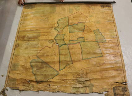
"A Map of The Tennassee [sic] Government formerly Part of North Carolina taken Chiefly from Surveys By Genl. D. Smith & others" drawn by Daniel Smith, engraved by Joseph T. Scott, published by Matthew Carey, Philadelphia, 1795. From "General Atlas For Carey's Edition Of Guthrie's Geography Improved" by Matthew Carey. Copper plate engraving of Tennessee depicting early towns, including Knoxville and Clarksville, rivers and other bodies of water, mountains, forts, and other points of interest including Cherokee Towns such as Nickajack and Crow Town, Ross's Ironworks, and notations regarding the land. Title, lower right, scale of miles, lower left. "Lon. W. from Philada", top right above map. Map surrounded by scale notations and line border. Image - 9 1/2" H x 20 3/8" W. Plate - 10 1/4" H x 21 1/8" W. Sheet - 14 3/4" H x 22 1/8" W. Provenance: Property of a private Knoxville, Tennessee collection. (Additional high-resolution photos are available at www.caseantiques.com.)
Condition
Overall good condition. Two tears, repaired with rice paper and wheat paste, largest 6 1/2", lower right and left. Minor toning, dampstaining, pinpricks, foxing spots, tears, edges of sheet.
Buyer's Premium
- 28%
Map of the Tennessee Government, 1795 Smith
Estimate $700 - $900
10 bidders are watching this item.
Shipping & Pickup Options
Item located in Knoxville, TN, usSee Policy for Shipping
Payment
Accepts seamless payments through LiveAuctioneers

TOP