Sold20231651 Sanson World Map -- Mappe-Monde, ou Carte Generale du Monde; Dessignee en DeuxTitle: 1651 Sanson World Map -- Mappe-Monde, ou Carte Generale du Monde; Dessignee en Deux Plan-Hemispheres… Cartographer: N Sanson Year / Place: 1651, Paris Map Dimension (in.): 13.8 X 20.6 in.See Sold Price
Sold2022World Map Mappe-Monde ou Carte Generale du GlobeTitle: World Map Mappe-Monde ou Carte Generale du Globe Terrestre Date Printed: 1678 Cartographer: Sanson, Nicholas Material/Medium: atlas map, engraved, hand colored Size: 17 x 23 Condition: The mapSee Sold Price
Sold2017A Blondeau: Mappe-Monde ou Carte Generale de la TerreMap: Mappe-Monde ou Carte Generale de la Terre, 1817 Maker: A Blondeau Date: 1817, Paris Description: An uncommon two hemisphere world map. The shown US border far exceeds into Canada north of MinnesoSee Sold Price
Sold2021de Fer, Nicolas 1717 World Map. California as Island"Mappe-Monde ou Carte Generale de la Terre" Copper Engraved Map Published 1717, Paris for "Introduction a la Geographie" by Nicolas de Fer. Folds as issued. Paper Size: 14 x 10 inch (36 x 25cm) Very mSee Sold Price
Sold2019Delamarche, Felix 1829 Map of World Hemispheres"Mappe-Monde ou Carte Generale du Globe Terrestre" Copper Engraved Map Published 1829, Paris for "Atlas de La Geographie..." by Felix Delamarche. Contemporary outline hand colour. Centre fold as publiSee Sold Price
Sold2020DANET, GUILLAUME; after DE FER, NICOLAS. Mappe-Monde ouDANET, GUILLAUME; after DE FER, NICOLAS. Mappe-Monde ou Carte Generale de la Terre. Engraved decorative double-hemispheric wall map of the world on two sheets joined with additional title-banner and bSee Sold Price
2021MAP OF THE WORLDMappe-Monde. Carte Generale du globe terrestre par F. Delamarche. 1828 framed. 32 x 47 cm.See Sold Price
Sold2020Covens & Mortier Map of the World ca. 1700 CalifoJohannes Covens (1697-1774) and Cornelius Mortier (1699-1783), "Carte Generale du Monde, ou Description du Monde Terrestre & Aquatique," Amsterdam, ca. 1700. This map of the world shows California asSee Sold Price
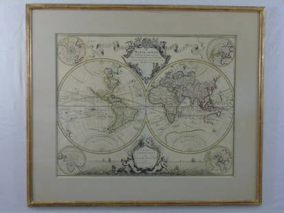
Sold2017Nicolas De Fer: Carte Generale du Globe Terrestre, 1705Map: Carte Generale du Globe Terrestre et Aquatiques ou Mappemonde en Deux Plans-Hemisphere [Scarce 1705 antique map with California as an island] Maker: Nicolas De Fer Size: 8.125 x 11.125 (10.25 x 1See Sold Price
Sold2017Chatelain: Double Hemisphere Antique World Map, 1705Map: Mappemonde ou Description General du Globe Terrestre Cartographer: Henri Chatelain Place & Date: Amsterdam / 1705 Size: 17 1/4" x 13 1/4" Condition: wash color; overall age toning, repaired splitSee Sold Price
Sold2023Ches. I.B. Elwe Map of the WorldFrance,1792 Map of the world by Ches. I.B. Elwe titled "Mappe Monde ou Description DU GLOBE Terrestre & Aquatique" surrounded by figures in diaphanous dresses, camels, monkeys, and other animals. ImagSee Sold Price
Sold2015LG FRAMED PRINT - FLAT MAP OF THE WORLDLARGE FRAMED PRINT - MAPPE MONDE OU DESCRIPTION DU GLOBE - FLAT MAP OF THE WORLD - PROFESSIONALLY FRAMED AND MATTED - MINOR SCRATCH ON FRAME - 34''x 40'' FRAMED - BUYER RESPONSIBLE FOR MAKING SHIPPINGSee Sold Price
Sold2022World.- Mortier (Pierre) Carte Generale de Toutes les Costes du Monde et les Pays NouvellementWorld.- Mortier (Pierre) Carte Generale de Toutes les Costes du Monde et les Pays Nouvellement Decouvert, large two sheet map of the world, showing California as an island and recent coastal discoveriSee Sold Price
Sold2019WORLD. Globe Terrestre; Carte ou Planisphere General duTITLE OF THE MAP: 'Globe Terrestre; Carte ou Planisphere General du Monde' Partial outline of Terra Australis, the hypothesised southern continent, is shown. DATE PRINTED: 1683 IMAGE SIZE: Approx OverSee Sold Price
Sold20181745 Covens and Mortier World Map -- Mappe-MondeTitle/Content of Map: 1745 Covens and Mortier World Map -- Mappe-Monde Dressee sur les Observations de Mrs. de l'Academie Royale des Sciences et Quelques Autres et sur les Memoires les Plus Recens DatSee Sold Price
20181745 Covens and Mortier World Map -- Mappe-MondeTitle/Content of Map: 1745 Covens and Mortier World Map -- Mappe-Monde Dressee sur les Observations de Mrs. de l'Academie Royale des Sciences et Quelques Autres et sur les Memoires les Plus Recens DatSee Sold Price
2018Covens and Mortier: Antique World Map, 1745Title/Content of Map: 1745 Covens and Mortier World Map -- Mappe-Monde Dressee sur les Observations de Mrs. de l'Academie Royale des Sciences et Quelques Autres et sur les Memoires les Plus Recens DatSee Sold Price
Sold2016LOUIS CLAUDE DE VEZOU 1760Mappe-Monde Geo Spherique ou Nouvelle Carte Ideale Du Globe Terrestre Pour servir d'Introduction a la Geographie, L'Hydrographie, et a la Sphere Armillaire . . . 1760 Hand color engraving on paper DimSee Sold Price
Sold2015AFTER GERARD VALCK MAP 1827AFTER GERARD VALCK (1651-1726), MAP, 1827, 17'' X 21'', MAPPE MONDE GEO HYDROGRAPHIQUE DU GLOBE, NOT FRAMED:Engraved, hand colored map showing the southern polar region, northern polar regions, and twSee Sold Price
Sold2015Lg Framed early 19th c. Map of the WorldLg Framed early 19th c. Map of the World, "Mappe Monde", Indication des trois voyages du Capitaine Cook, French 1816 in floral gilt 32" x 46" frame Condition; was folded, some wear along fold lines frSee Sold Price
Sold20171746 Homann World MapTitle: 1746 Homann World Map -- Planiglobii Terrestris Mappa Universalis utrumque Hemisphaerium Orient et Occidentale Repraesentans ex IV. Mappis Generalibus ... / Mappe-Monde qui Represente les DeuxSee Sold Price
Sold20231753 Homann World Map -- Planiglobii Terrestris Mappa Universalis utrumque Hemisphaerium Orient etTitle: 1753 Homann World Map -- Planiglobii Terrestris Mappa Universalis utrumque Hemisphaerium Orient et Occidentale Repraesentans ex IV. Mappis Generalibus … / Mappe-Monde qui Represente les DSee Sold Price
Sold2016Large Framed World Map w/ Latin InscriptionsLarge Framed World Map w/ Latin Inscriptions. Hand colored. Professionally framed and matted. Titled Mappe Monde. Measures 28 by 33 inches.See Sold Price
Sold2021Rare Jaeger LeCoultre Mappemonde Illuminated Deco DeskBrand: Jaeger Le Coultre Model: World Map Illuminated Table Clock Approximate Dimensions: 250mm height x 200mm diameter Base: Octagonal Marble Base MovemeSee Sold Price
15 hrs LeftTrillium Antique Prints & Rare BooksSanson - Map of Canada or New France with the Great Lakes$75(1 bid)
15 hrs LeftTrillium Antique Prints & Rare BooksSanson - Map of Florida (encompassing most of Southeast North America)$130(2 bids)
15 hrs LeftTrillium Antique Prints & Rare BooksSanson - Map of the British Isles (Ireland, Scotland, England)$75
Jun 08Trillium Antique Prints & Rare BooksSanson - Map of California as an Island, Mexico (Audience de Guadalajara)$75
Jun 08Trillium Antique Prints & Rare BooksSanson - Map of North America with California as an Island$75(1 bid)
4 days LeftJasper521641 MAP of ITALY antique authentic TERRITORIUM BONONIENSE IL BOLOGNESE original$160
5 days LeftJasper52L'Afrique Françoise ou du Senegal'. French West Africa. DE L’ISLE 1727 map$100
BonhamsSPEED (JOHN) AND WILLEM BLAEU Pictorial title-pages to Speed's 'Theatre of the Empire of Great B...£10
7 days LeftFreeman's | HindmanBELLIN, Jacques-Nicolas. Carte Reduite de L'Ocean Oriental ou Mer Des Indies. Paris, 1757. Second$150
5 days LeftJasper52Carte de la partie septentrionale d'Afrique, ou de la Barbarie… BONNE 1780 map$25


![Nicolas De Fer: Carte Generale du Globe Terrestre, 1705: Map: Carte Generale du Globe Terrestre et Aquatiques ou Mappemonde en Deux Plans-Hemisphere [Scarce 1705 antique map with California as an island] Maker: Nicolas De Fer Size: 8.125 x 11.125 (10.25 x 1](https://p1.liveauctioneers.com/5584/106187/54391534_1_x.jpg?height=310&quality=70&version=1499460562)


![[MAP]. SPEED, John. A New Mappe of the Romane Empire. 1676. (1 of 2)](https://p1.liveauctioneers.com/197/329395/177650541_1_x.jpg?height=282&quality=70&version=1715364962)


