Sold2017Bradford: Antique Map of New Hampshire, 1838Title/Content of Map: New Hampshire by Bradford Date Printed: 1838/1841 Cartographer: Thomas G. Bradford Material/Medium: Paper Size: 13" x 16 1/2" Hand colored. A General Atlas of the World with a SeSee Sold Price
Sold2020New Hampshire & Vermont, 1845Title/Content of Map: New Hampshire & Vermont, 1845 Date Printed: 1845, Hildburghausen Cartographer: Joseph Meyer/Bibliographisches Instituts. Size: 11 3/4" x 14 3/4" The beautifully detailed and coloSee Sold Price
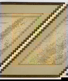
Sold2020New Hampshire 1886Title/Content of Map: New Hampshire 1886 Date Printed: 1886 Material/Medium: paper Size: 13.5x21 inches Additional Info: he People's Unrivaled Family Atlas of the World. People's Publishing Co, ChicagSee Sold Price
Sold2020New Hampshire & Vermont, 1849Title/Content of Map: New Hampshire & Vermont, 1849 Date Printed: 1849/1857, Hildburghausen Cartographer: Meyer/Bibliographisches Instituts. Size: 11 3/4" x 14 3/4" The beautifully detailed and coloreSee Sold Price
Sold2018Colton: Antique Map of New Hampshire, 1859Title/Content of Map: New Hampshire by Colton Date Printed: 1859 Cartographer: H.J. Colton Material/Medium: Paper Size: 17 1/2" x 15" Hand colored,engraved. Published in New York in 'Colton's GeneralSee Sold Price
Sold2018New Hampshire by ColtonTitle/Content of Map: New Hampshire by Colton Date Printed: 1861 Cartographer: J.H. Colton Material/Medium: Paper Size: 14" x 17" Provenance: New York From Colton's 'General Atlas.' Published in New YSee Sold Price
Sold2017Bradford: Antique Map of New Hampshire & Vermont, 1835Title/Content of Map: New Hampshire & Vermont Date Printed: 1835 Cartographer: T. G. Bradford Material/Medium: Paper Size: 9 1/2" x 13" A Comprehensive Atlas Geographical, Historical & Commercial. PubSee Sold Price
Sold2017James Carter MAP OF NEW HAMPSHIRE Portsmouth March 1831Details: CARTER, James G. (1795-1849). A Map of New Hampshire. Portsmouth: Nathaniel March, [1831]. Engraved folding pocket map, full period hand colouring. Statistical table at right side. Folds intSee Sold Price
Sold2016Map of New Hampshire, Carey & Lea 1829Title: Geographical, Historical and Statistical Map of New Hampshire Subject: New Hampshire Maker: Carey & Lea Date: 1827, Carey & Lea: Philadelphia Size: 11.8 x 8.8 inches Very detailed map showing cSee Sold Price
Sold2019Early map of New HampshireOne of the few maps specifically of New Hampshire published in the mid- 19th century. Shows superb detail regarding the cities, transportation system, geographical features and counties. Detailed mapSee Sold Price
Sold20181861 Johnson Map of New Hampshire and Vermont --Title/Content of Map: 1861 Johnson Map of New Hampshire and Vermont -- Johnson's New Hampshire and Vermont Date: 1861, New York Cartographer: Johnson & Ward Size: 24 x 17 in. This is a fantastic, verySee Sold Price
Sold20211938 R Taylor White Pictorial Map of New Hampshire --Title: 1938 R Taylor White Pictorial Map of New Hampshire -- New Hampshire Cartographer: Ruth Taylor White Year / Place: 1938, Boston Map Dimension (in.): 11.6 x 8.5 in. This is Ruth Taylor White's chSee Sold Price
Sold20211835 map of New Hampshire & Vermont, T. G. BradfordTitle: 1835 map of New Hampshire & Vermont, T. G. Bradford Description: Nice map that isolates New Hampshire and Vermont by completely filling up the frame. Signature light blue frame with red and greSee Sold Price
Sold20221862 Johnson Map of New Hampshire and Vermont --Title: 1862 Johnson Map of New Hampshire and Vermont -- Johnson's New Hampshire and Vermont Cartographer: Johnson & Browning Year/Place: 1862, New York Dimensions: 24 x 17 in. Description: This is a fSee Sold Price
Sold20221890 c. Cram Map of New Hampshire [verso] Adirondacks and White Mountain -- New Hampshire [verso]Title: 1890 c. Cram Map of New Hampshire [verso] Adirondacks and White Mountain -- New Hampshire [verso] Adirondack Mts. and White Mountains Cartographer: G Cram Year / Place: 1890 c., Chicago Map DimSee Sold Price
Jun 13Swann Auction Galleries(NEW YORK -- CATSKILL MOUNTAINS.) Edwin E. Howell. Relief map of Catskill Mountains.$450
Jun 13Swann Auction Galleries(MAINE.) J.H. Colton; and C.C. Hall. Railroad & Township Map of the State of Maine with Portions$375
Jun 12Jasper52Les Environs de Londres à sept Lieues à la Ronde… London. LE ROUGE 1745 map$420
2 days LeftHolabird Western Americana CollectionsTrinity County Mines (Wall) Map, 1894, Cowden, Johnson [177508]$250
4 days LeftHolabird Western Americana CollectionsCharles Lindbergh Medal in Original Case [179724]$100
Jun 13Swann Auction Galleries(NEW ENGLAND.) George Eldridge. A New Chart of the Coast of New England$600
2 days LeftDOYLE Auctioneers & AppraisersHideaki Miyamura Glazed Porcelain Vase Kensington, New Hampshire$225(2 bids)
2 days LeftDOYLE Auctioneers & AppraisersFour Carved and Painted Miniature Bird Figures Jess Blackstone, New Hampshire, third quarter 20th$1,300
BonhamsRICK AYOTTE (B. 1944) PAPERWEIGHT WITH SEA TURTLE, New Hampshire, signed, editioned and dated 'R...$400


![James Carter MAP OF NEW HAMPSHIRE Portsmouth March 1831: Details: CARTER, James G. (1795-1849). A Map of New Hampshire. Portsmouth: Nathaniel March, [1831]. Engraved folding pocket map, full period hand colouring. Statistical table at right side. Folds int](https://p1.liveauctioneers.com/5671/105076/53811303_1_x.jpg?height=310&quality=70&version=1496954235)


![1890 c. Cram Map of New Hampshire [verso] Adirondacks and White Mountain -- New Hampshire [verso]: Title: 1890 c. Cram Map of New Hampshire [verso] Adirondacks and White Mountain -- New Hampshire [verso] Adirondack Mts. and White Mountains Cartographer: G Cram Year / Place: 1890 c., Chicago Map Dim](https://p1.liveauctioneers.com/5584/270923/141842413_1_x.jpg?height=310&quality=70&version=1670433092)


![Trinity County Mines (Wall) Map, 1894, Cowden, Johnson [177508] (1 of 4)](https://p1.liveauctioneers.com/2699/331495/178785752_1_x.jpg?height=282&quality=70&version=1717094933)
![Engraved Maps of Spain, c1650's (2) [180169] (1 of 3)](https://p1.liveauctioneers.com/2699/331495/178785774_1_x.jpg?height=282&quality=70&version=1717094933)
![Charles Lindbergh Medal in Original Case [179724] (1 of 2)](https://p1.liveauctioneers.com/2699/331499/178846390_1_x.jpg?height=282&quality=70&version=1717095214)


