Sold2024Raymond's Geologic Map of the United States, 1873. [177507]US Mineral Commissioner Rossiter W. Raymond's Geologic Map of the United States, 1873, published originally in the 1874 volume of Mineral Resources West of the Rocky Mountains. 36 x 25", folds t fix tSee Sold Price
Sold2016Large geologic map of YellowstoneHeading: Author: U.S. Geological Survey Title: Yellowstone National Park and North Western Wyoming Place Published: Washington Publisher: Date Published: c.1885 Description:See Sold Price
Sold2024Geologic Map of the United StatesPublication Date: 1903 Title: Geologic Map of the United States Cartographer: WILLIS, BAILEY/GEORGE W. STOSE Publisher: U.S. GEOLOGICAL SURVEY Height: 7.3 Width: 12.25 "and part of Canada compiled bySee Sold Price
Sold2023Geologic Map of Cape Ann Mass. Showing Superficial DepositsPublication Date: 1881 Title: Geologic Map of Cape Ann Mass. Showing Superficial Deposits Cartographer: SHALER, N. S. Publisher: U.S.G.S. Height: 10.25 Width: 10.25 From the Ninth Annual Report U.S. GSee Sold Price
Sold2019Group of Early Maps of New Mexico(1) Rand, McNally & Co.'s New Commercial Atlas of America - Map of New Mexico. Copyright, 1911, by Rand, McNally & Co. 23 3/4 x 31 1/4 inches (2) Geologic Map of New Mexico. Two-part folding map. PartSee Sold Price
Sold2021The Story of the Praries (North Dakota)The Story of the Prairies - The Landscape Geology of North Dakota includes the separate Automobile Geologic Map of North Dakota fold-out map. The author states that one ofSee Sold Price
Sold2023Underground Water Map New Mexico Carlsbad SheetPublication Date: 1899 Title: Underground Water Map New Mexico Carlsbad Sheet Cartographer: GARDNER, FRANK D./JOHN STEWART Publisher: U.S. DEPT. AGRICULTURE Height: 21 Width: 15.75 Area geologic map.See Sold Price
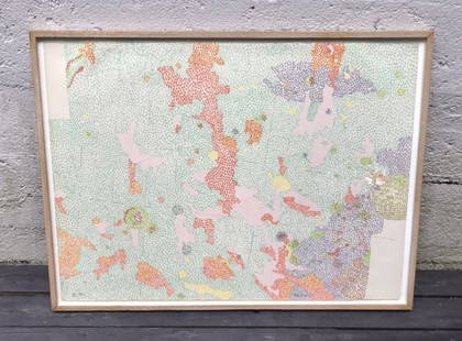
Sold2022Print, Nancy GravesNancy Graves (American, 1939-1995), "Lithograph based on Geologic Maps of Lunar Orbits and Apollo Landing Sites," 1972, lithograph in colors, pencil signed and dated lower right, edition VIII 8/100, gSee Sold Price
Sold2019Nancy Graves Lithograph, 1972Titled IIIFrom the series LITHOGRAPHS based on geologic maps of lunar orbiter and apollo landing site, 197286/100See Sold Price
Sold2022Geologic Reconnaissance Map of Prince William Sound, Alaska Showing the District from the CopperPublication Date: 1909 Title: Geologic Reconnaissance Map of Prince William Sound, Alaska Showing the District from the Copper River Delta to Resurrection Bay. Cartographer: HIGGINS, D. F./U. S. GRANTSee Sold Price
Sold2017Two Antique Maps Chili (sic) & Caribbean C. 16671) "Chili" (Chile), no publishers information, sight size 14.25" x 11.5", by Montanus A., C. 1670. (together with) 2) "Isles D'Amerique dites Caribes ov Cannibales et de Barlovento, by P. du Val d'abbSee Sold Price
Sold2021California State Division of Mines & Geology & Mineral20 Geologic & Economic Maps in Separate Map Pocket for Vacaville, Antioch, Mount Vaca, Carquinez, Mare Island, Sonoma, Santa Rosa, Petaluma & Point Reyes Quadrangles (book is 6[x=#8221/]x 9[x=#8221/]&See Sold Price
Sold2019U.S. Department Of the Interior," U S Geologic SurveyU.S. Department Of the Interior," U S Geologic Survey Map of the Choctaw Nation Indian Territory," c. 1876, H.- 38 1/2 in., W.- 32 5/8 in.See Sold Price
Sold2024The Absheron Peninsula. Azerbaijan. Sketch map 1885 old antique plan chartTITLE/CONTENT OF MAP: 'The Apsheron Peninsula' DATE PRINTED: 1885 IMAGE SIZE: Approx 10.5 x 12.0cm, 4 x 4.5 inches (Small) TYPE: Antique engraved sketch map CONDITION: Good; suitable for framing. PleaSee Sold Price
Sold2022(CALIFORNIA -- OIL FIELDS.) E.M. Douglas, Ralph Arnold, et al; for the U.S. Geological Survey.(CALIFORNIA -- OIL FIELDS.) E.M. Douglas, Ralph Arnold, et al; for the U.S. Geological Survey. Preliminary Geologic and Structural Map of the Lompoc and Guadalupe Quadrangles, California Including a LSee Sold Price
Sold2019Group of Two MapsAn Accurate Map Of Turky (sic) in Europe Drawn from the best Authorities 8 1/4" x 11 3/4" (sight) hand colored together with Tabula Freti Siculi Charibdis et ScyllaeSee Sold Price
Sold20201857 Life of Charles Napier British INDIA Sindh1857 Life of Charles Napier British INDIA Sindh Conquests Peninsular War MAP 4v William Francis Napier was a 19th-century British soldier known for his books on military history. Napier’s biographySee Sold Price
Sold20191938 U.S. Geological Survey Map of Oahu Hawaii"Geologic and Topographic Map of the Island of Hawaii. Showing well, springs, tunnels, shafts, proposed Kalihi-Waiahole tunnel, specimen localities and structure sections". Inset map of Honolulu, explSee Sold Price
Sold2023Early Map of Tennessee, Daniel Smith, 1795A MAP OF THE TENNASSEE [sic] GOVERNMENT FORMERLY PART OF NORTH CAROLINA TAKEN CHIEFLY FROM SURVEYS BY GENL. D. SMITH & OTHERS, drawn by Daniel Smith, engraved by Joseph T. Scott, for "General Atlas FoSee Sold Price
Sold2022Payne/Low, Map of Tennessee Government, 1799A MAP OF THE TENNASSEE[sic] GOVERNMENT FROM THE LATEST SURVEYS, 1799, engraved for John Payne's NEW AND COMPLETE UNIVERSAL GEOGRAPHY, published by John Low, New York, 1799. This early copperplate engrSee Sold Price
Sold2017John Carey. North America map(English, 1754-1835). "Part of North America comprehending Ohio, New England, New York, New Jersey, Pennsylvania, Maryland, Virginia, Carolinas & Georgia" (sic) hand colored map, circa 1782, 9 1/2 x 1See Sold Price
Sold2017A New and Exact Map of France Dividid HERMAN MOLLDetails: MOLL, Herman (fl. 1678-1732). A New and Exact Map of France Dividid [sic] into all its provinces and acquisitions, according to the newest observations, and that accurate survey made by theSee Sold Price
Sold2022Colored Engraving AMERICA AUSTRALIS DEI PARAE Sacred Fines Aedes erexit in quib[us] magnos ab IllaColored Engraving AMERICA AUSTRALIS DEI PARAE Sacred Fines Aedes erexit in quib[us] magnos ab Illa favors accipit. Monachii/(Munich), Joannis Caspari Bencard, (1702) Map of America, from Isla (sic) CaSee Sold Price
Sold2017Map of the West Indiescirca 1795; "A New Map of the West Indian Islands as they are Possessed by the European Powers," (sic) engraved hand- colored map, by Laurie & Whittle, 18 3/4 x 22 1/2 in.; Purchased from Charles EdwiSee Sold Price
3 days LeftCedarburg Auction & Appraisals LLCSet of Four 17th Century Maps Showing All of Spain and Portugal$450(2 bids)
3 days LeftCedarburg Auction & Appraisals LLCRare 1877 Double sided map of Milwaukee and Wisconsin$80(6 bids)
Jun 07Freeman's | Hindman[MAP]. TODESCHI, Pietro. [Nova et Acurata Totius Americae Tabula auct. G.I. Blaeu] America quarta$5,000
Jun 08Early American History Auctions1720 Colonial Northumberland County Virginia Manuscript Deed and Map Plot$400
Jun 07Freeman's | Hindman[MAP]. ORTELIUS, Abraham. Americae Sive Novi Orbis, Nova Descriptio. 1573.$1,000(1 bid)
4 days LeftAntiques Online AuctionsVintage Texas 1845 Map Printed in 1986, Compiled by John Davis$60(4 bids)
Jun 23Schilb Antiquarian Rare Books1848 Emory Military Reconnaissance 1ed California MAP Indians Texas New Mexico$2(2 bids)


![Raymond's Geologic Map of the United States, 1873. [177507]: US Mineral Commissioner Rossiter W. Raymond's Geologic Map of the United States, 1873, published originally in the 1874 volume of Mineral Resources West of the Rocky Mountains. 36 x 25", folds t fix t](https://p1.liveauctioneers.com/2699/324080/174413241_1_x.jpg?height=310&quality=70&version=1711485545)


![California State Division of Mines & Geology & Mineral: 20 Geologic & Economic Maps in Separate Map Pocket for Vacaville, Antioch, Mount Vaca, Carquinez, Mare Island, Sonoma, Santa Rosa, Petaluma & Point Reyes Quadrangles (book is 6[x=#8221/]x 9[x=#8221/]&](https://p1.liveauctioneers.com/2699/202317/102444370_1_x.jpg?height=310&quality=70&version=1619648279)


![Early Map of Tennessee, Daniel Smith, 1795: A MAP OF THE TENNASSEE [sic] GOVERNMENT FORMERLY PART OF NORTH CAROLINA TAKEN CHIEFLY FROM SURVEYS BY GENL. D. SMITH & OTHERS, drawn by Daniel Smith, engraved by Joseph T. Scott, for "General Atlas Fo](https://p1.liveauctioneers.com/525/272425/142901899_1_x.jpg?height=310&quality=70&version=1671337478)
![Payne/Low, Map of Tennessee Government, 1799: A MAP OF THE TENNASSEE[sic] GOVERNMENT FROM THE LATEST SURVEYS, 1799, engraved for John Payne's NEW AND COMPLETE UNIVERSAL GEOGRAPHY, published by John Low, New York, 1799. This early copperplate engr](https://p1.liveauctioneers.com/525/230966/119655004_1_x.jpg?height=310&quality=70&version=1640205832)

![A New and Exact Map of France Dividid HERMAN MOLL: Details: MOLL, Herman (fl. 1678-1732). A New and Exact Map of France Dividid [sic] into all its provinces and acquisitions, according to the newest observations, and that accurate survey made by the](https://p1.liveauctioneers.com/5671/103625/53044992_1_x.jpg?height=310&quality=70&version=1494009518)
![Colored Engraving AMERICA AUSTRALIS DEI PARAE Sacred Fines Aedes erexit in quib[us] magnos ab Illa: Colored Engraving AMERICA AUSTRALIS DEI PARAE Sacred Fines Aedes erexit in quib[us] magnos ab Illa favors accipit. Monachii/(Munich), Joannis Caspari Bencard, (1702) Map of America, from Isla (sic) Ca](https://p1.liveauctioneers.com/7340/260757/135825292_1_x.jpg?height=310&quality=70&version=1662496940)


![[MAP]. TODESCHI, Pietro. [Nova et Acurata Totius Americae Tabula auct. G.I. Blaeu] America quarta (1 of 1)](https://p1.liveauctioneers.com/197/329395/177650542_1_x.jpg?height=282&quality=70&version=1715364962)


![[MAP]. ORTELIUS, Abraham. Americae Sive Novi Orbis, Nova Descriptio. 1573. (1 of 2)](https://p1.liveauctioneers.com/197/329395/177650534_1_x.jpg?height=282&quality=70&version=1715364962)


![[MAP]. ORTELIUS, Abraham. Turcici Imperii Descriptio.1592. (1 of 2)](https://p1.liveauctioneers.com/197/329395/177650538_1_x.jpg?height=282&quality=70&version=1715364962)

![[MAP]. ORTELIUS, Abraham. Aevi Veteris, Typus Geographicus. 1601. (1 of 3)](https://p1.liveauctioneers.com/197/329395/177650532_1_x.jpg?height=282&quality=70&version=1715364962)


