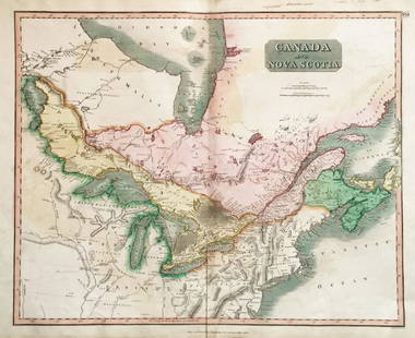
Sold2018Thomson: Antique Map of Canada & Nova Scotia, 1817Title/Content of Map: Canada and Nova Scotia. Date Printed: 1817 Cartographer: THOMSON, JOHN & CO. Size (inches): 16.1x22 No.43 (unnumbered) from Thomson's New General Atlas 1817. W. Dassauville engr.See Sold Price
Sold2021Bellin, Jacques 1746 Map of Canada & New England"A New Chart of the Coast of New England, Nova Scotia, New France or Canada, with the islands of Newfoundld. Cape Breton St. John's &c" by Jacques-Nicolas Bellin. Copper Engraved Map Published LondonSee Sold Price
Sold20241746 Large Engraved Map New England Nova ScotiaA New Chart of the Coast of New England, Nova Scotia, New France or Canada with the Islands of NewFoundl(an)d, Cape Breton, St. John and C.. by Nicolas Bellin, English version printed for Gentleman'sSee Sold Price
Sold2018Thomson: Antique Map of Canada & Nova Scotia, 1814Map: Canada and Nova Scotia Cartographer: Thomson Place & Date: Edinburgh / 1814/1817 Size: 23 3/4" x 19 1/8" Condition: wash color; light browning and minor staining in margins The superbly detailedSee Sold Price
Sold2022Three Antique Engraved Maps of Canada: From the London Magazine, 1749, Nova Scotia Drawn FromThree Antique Engraved Maps of Canada: From the London Magazine, 1749, Nova Scotia Drawn From Surveys by T. Kitching; Canada ou Nouvelles France, 1683 by A. Mallet, Paris; and Amerique SeptentrionaleHSee Sold Price
Sold2017Bellin: Antique Map of Canada Arcadia Nova Scotia, 1740Title/Content of Map: Canada. Arcadia. Or Nova Scotia Date Printed: c 1740-70's Cartographer: J.N. Bellin & J.F. La Harpe Material/Medium: Paper Size: 10" x 15" Copperplate engraved. Published in PariSee Sold Price
Sold2017Colton: Antique Map of New Brunswick, Nova Scotia, 1861Title/Content of Map: Canada, New Brunswick, Nova Scotia and Newfoundland Date Printed: 1861 Cartographer: J.H. Colton Material/Medium: Paper Size: 17 1/4" x 13" Hand colored steel engraved Map from 'See Sold Price
Sold2021Tallis, John (Pub) 1852 Map. Newfoundland & Nova ScotiaSteel Engraved Map with Original Outline Hand Color Published 1852-56 by John Tallis, London for "The Universal Pronouncing Dictionary" by Thomas Wright. Drawn & Engraved by John Rapkin. Centre fold aSee Sold Price
Sold20221850s map of British North America, W & R ChambersEngraved map titled “Principal British Possessions in North America.” Nova Scotia, New Brunswick, Lower Canada and Upper Canada are marked in original outline hand color. Above this stretcSee Sold Price
Sold2023Thomson, John (Pub) 1825 Map. Polar Regions. Canada GreenlandCopper Engraved Map Published 1825 by John Thomson, Edinburgh for "The Edinburgh School Atlas" by N. R. Hewitt. Maps Engraved by Hewitt. Original Outline Hand Colour. Rare. Paper Size: 10.5 x 8 inch (See Sold Price
Sold2023Thomson, John (Pub) 1825 Map. CanadaCopper Engraved Map Published 1825 by John Thomson, Edinburgh for "The Edinburgh School Atlas" by N. R. Hewitt. Maps Engraved by Hewitt. Original Outline Hand Colour. Rare. Paper Size: 10.5 x 8 inch (See Sold Price
Sold2018Thomson: Upper & Lower Canada, Nova ScotiaMap: Canada and Nova Scotia Cartographer: Thomson Place/Date: Edinburgh / 1814/1817 Size: 23 3/4" x 19 1/8" Condition: wash color; light browning along centerfold and in margins; some staining in uppeSee Sold Price
Sold2017Johnson: Set of 2 Antique Maps of Ontario/New FoundLandTitle/Content of Map: Canada set of 2 Maps Ontario/New Found-Land Nova Scotia Date Printed: 1868 Cartographer: A.J. Johnson Material/Medium: Paper Size: 24 1/2" x 18" Hand colored steel engraved Map.See Sold Price
Sold2017Bellin/Jefferys: Antique Map of Canada & Islands, 1746Map: A new chart of the coast of New England, Nova Scotia, New France or Canada, with the islands of Newfoundl’d. Cape Breton, St. John’s &c. Publication Date: 1746 Authors: Gentleman’s MagazineSee Sold Price
Sold2023North America by John Thomson. Forts, Missions & Indian settlements 1817 mapTitle: "North America" by John Thomson. Forts, Missions & Indian settlements 1817 map Description: North America' by Drawn & engraved by Nathaniel Robert Hewitt for John Thomson's "New General Atlas"See Sold Price
Sold2023The Coast of New England, Nova Scotia, New France or Canada. GENTS MAG 1746 mapTITLE/CONTENT OF MAP: 'A New Chart of the Coast of New England, Nova Scotia, New France or Canada with the Islands of Newfoundl.d, Cape Breton St. John's &c. Done from the Original Publish'd in 1744 aSee Sold Price
Sold2023Corea and Japan by John Thomson. East Asia. Korea 1817 old antique map chartTitle: "Corea and Japan" by John Thomson. East Asia. Korea 1817 old antique map chart Description: Corea and Japan' by Drawn & engraved by John & George Menzies for John Thomson's "New General Atlas"See Sold Price
Sold2022Corea and Japan by John Thomson. East Asia. Korea 1817 old antique map chartTITLE/CONTENT OF MAP: 'Corea and Japan' DATE PRINTED: Published in 1817. Engraved on 16th August 1815; this date is marked on the map IMAGE SIZE: Approx 52.5 x 67.0cm, 20.75 x 26.5 inches (Large); PleSee Sold Price
Sold2023America. North/South Americas. British Florida. Missions. THOMSON 1817 mapTitle: "America". North/South Americas. British Florida. Missions. THOMSON 1817 map Description: America' by Drawn & engraved by John & George Menzies for John Thomson's "New General Atlas" (PublishedSee Sold Price
Sold20162 United States Maps, including 1817.2 United States Maps, including 1817. 1st item: Northern Provinces of the United States map by John Thomson from "Thomson's New General Atlas", engraved by Nathaniel Rodgers Hewitt, 1817. Colored mapSee Sold Price
Sold2023South America. New Granada & Peru Viceroyalties. Tucuman. THOMSON 1817 mapTitle: "South America". New Granada & Peru Viceroyalties. Tucuman. THOMSON 1817 map Description: South America' by Drawn & engraved by John Moffat for John Thomson's "New General Atlas" (Published inSee Sold Price
Sold2023South America. New Granada & Peru Viceroyalties. Tucuman. THOMSON 1817 mapTitle: "South America". New Granada & Peru Viceroyalties. Tucuman. THOMSON 1817 map Description: South America' by Drawn & engraved by John Moffat for John Thomson's "New General Atlas" (Published inSee Sold Price
Sold2024Spanish North America. THOMSON. Texas, Mexico & Southwestern USA 1817 mapTitle: "Spanish North America". THOMSON. Texas, Mexico & Southwestern USA 1817 map Description: Spanish North America [northern part] by Drawn & engraved for John Thomson's "New General Atlas" (PublisSee Sold Price
Sold2023Early 19th century "Europe" by John Thomson 1817 old antique map plan chartTITLE/CONTENT OF MAP: 'Europe' DATE PRINTED: Published in 1817 IMAGE SIZE: Approx 49.0 x 56.5cm, 19.25 x 22.25 inches (Large); Please note that this is a folding map. TYPE: Antique early 19th centurySee Sold Price
May 17Albion AuctionsBlackie (Pub) 1882 Folio Map. Canada - Quebec, Nova Scotia, New Brunswick, Prince Edward$5
5 days LeftHunt and Peck Estate Services, Inc.1794 Laurie & Whittle after Thomas Jefferys Map Of The United States Of America$340(1 bid)
Featured4 days LeftJasper52The Bahamas, Cuba & Bermuda "or Summer Islands". THOMSON 1817 old antique map$180
4 days LeftJasper52Grenada, Tobago, Trinidad & Curaçao. West Indies Caribbean. THOMSON 1817 map$85
4 days LeftJasper52Grenada, Tobago, Trinidad & Curaçao. West Indies Caribbean. THOMSON 1817 map$100
4 days LeftJasper52Puerto Rico & Virgin Islands. Haiti, Hispaniola or St. Domingo. THOMSON 1817 map$130
4 days LeftJasper52Puerto Rico & Virgin Islands. Haiti, Hispaniola or St. Domingo. THOMSON 1817 map$130
11 hrs LeftTremont AuctionsJohn Speed and Francis Lamb "Map of New England and New York", ca. 1676. Hand colored engraved map$900(3 bids)
May 17Albion AuctionsClarke & Russell 1814 Hand Col Map. Canada - British Dominions in North America$5(1 bid)
May 17Albion AuctionsGlasgow Geography 1825 Antique Map. Canada - British Possessions in America$5(1 bid)


![Spanish North America. THOMSON. Texas, Mexico & Southwestern USA 1817 map: Title: "Spanish North America". THOMSON. Texas, Mexico & Southwestern USA 1817 map Description: Spanish North America [northern part] by Drawn & engraved for John Thomson's "New General Atlas" (Publis](https://p1.liveauctioneers.com/5584/314775/168780323_1_x.jpg?height=310&quality=70&version=1704837726)


