Sold2021Nautical Map / Sea Chart, #362 Block Island Sound andDescription: Nautical Map / Sea Chart, United States East Coast, New York, Long Island, Block Island Sound and Gardiner's Bay, 6th edition, Feb 10/69; Shipping: $20; different rate to California, AlasSee Sold Price
Sold2020Nautical Map / Sea Chart, #1212 Eastern Long IslandDescription: Nautical Map / Sea Chart, United States East Coast, Connecticut - New York, Long Island Sound, Eastern Part, 12th edition feb 10 / 69 ; all measurements are approximate; Folded; ShippingSee Sold Price
Sold2020Nautical Map / Sea Chart, #1211 MarthaDescription: Nautical Map / Sea Chart, United States East Coast, Rhode Island - Connecticut - New York, Block Island Sound and Approaces9th edition, dec 23/63 stamped CORRECTED ONLY FOR AIDS & HAZARDSSee Sold Price
Sold2020Nautical Map / Sea Chart, #224 Oyster & Huntington BaysUnited States East Coast, New York, Oyster & Huntington Bays, South Shore of Long Island Sound, 3rd edition feb 1/43; revised 7/21/58, note heavier bond paper and or better preserved than most; FoldedSee Sold Price
Sold2020Land Ho! Antique Fishers Island Sound, RI-CT-NY USCGDescription: Ahoy! Antique Coast Guard nautical chart of Fishers Island Sound, RI-CT-NY. Numbered C. & G. S. 358; published 1968. Material: paper. Measurement: approximate 36" x 45" (INCHES). ShippingSee Sold Price
Sold2019Land Ho! Antique Block Island Sound, RI USCGDescription: Ahoy! Antique U.S. Coast Guard nautical chart of Block Island Sound and Approaches. Numbered C. & G. S. 1211; published 1968. Material: paper. Measurement: approximate 36" x 41" (INCHES).See Sold Price
Sold2021Fishers Island Sound, RI-CT-NY USCGFishers Island Sound, RI-CT-NY USCG, Coast Guard nautical chart of Fishers Island Sound, RI-CT-NY. Numbered C. & G. S. 358; published 1968. Approximate measurements: 36" x 45" (INCHES) Materials: PapeSee Sold Price
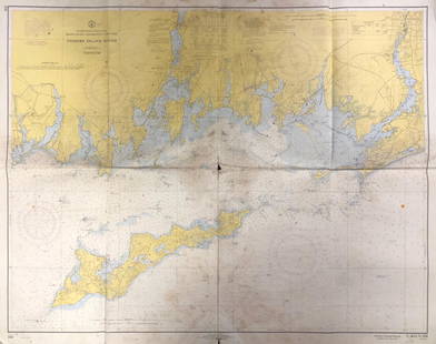
Sold2023Nautical Chart: SOUTHERN COAST OF LONG ISLAND SOUND/ MONTAUK POINT TO EAST HAMPTONDescription: SOUTHERN COAST OF LONG ISLAND SOUND/ FROM MONTAUK POINT TO EAST HAMPTON Measurement approximate: 32 x 22 InchesMaterial: PaperSee Sold Price
Sold2023NAUTICAL CHART: RHODE ISLAND/ PROVIDENCE HARBORDescription: UNITED STATES - EAST COAST RHODE ISLAND/ PROVIDENCE HARBORMeasurement approximate: 30 x 37 Inches Material: PaperSee Sold Price
Sold2023NAUTICAL CHART/ CONNECTICUT NEW YORK. NORTH SHORE OF LONG ISLAND SOUND GREENWICH POINT TO NEWDescription: NAUTICAL CHART EAST COAST/ CONNECTICUT – NEW YORK. NORTH SHORE OF LONG ISLAND SOUND GREENWICH POINT TO NEW ROCHELLE. Published at Washington D.C/ JUNE 1939 (6TH Edition) First editSee Sold Price
Sold2023NAUTICAL CHART/ CONNECTICUT NEW YORK. NORTH SHORE OF LONG ISLAND SOUND GREENWICH POINT TO NEWDescription: NAUTICAL CHART EAST COAST/ CONNECTICUT – NEW YORK. NORTH SHORE OF LONG ISLAND SOUND GREENWICH POINT TO NEW ROCHELLE. Published at Washington D.C/ JUNE 1939 (6TH Edition) First editSee Sold Price
Sold2017Mount & Page: Antique Coast Profile of Ireland, 1749Title/Content of Map: '[A description of the sea coast of Ireland]' The following places are shown or referred to on the coastal profile chart: Galloway (Galway) Aran Islands Limerick Date Printed: 17See Sold Price
Sold2016Original Imray & Son S. America Coast Chart, 1877Nautical Chart of South American coast, between Rio de la Plata and Valparaiso. Details include Cape Horn Islands, South Shetlands, Falklands, Southern tip of South American coast including Chile andSee Sold Price
Sold2019United States – Nantucket Island British AdmiraltyTitle: United States – Nantucket Island British Admiralty Chart 2489, published 1896 Date: 1896 Cartographer: British Admiralty Size: 28x41 in Hardly used sea chart of the the treacherous coast ofSee Sold Price
Sold2019West-Indies – Bahama’s, Turks Island, British AdmiraltyDetailed, unused and early chart of the coast of Turks Island. The first surveys are from 1830 by Captain R. Owen. With tidal information. Authentic, very detailed sea chart, no modern copy. On thickSee Sold Price
Sold2019Dufour/Dyonnet: Australia, Oceania with Island InsetsA superbly detailed nautical chart of the Pacific Ocean showing all of Australia, Indonesia, and Japan as well as most of North America and the west coast of South. Includes five insets: southeasternSee Sold Price
Sold2017Ferrer: Antique Nautical Chart of Norman Island, 18091809 Nautical Chart of Norman Island BVI (Treasure Island). Original engraving from José Joaquín de Ferrer y Cafranga's sea atlas, the 'Portulano de los Estados Unidos', published in Madrid in 1818.See Sold Price
Sold2017Mount & Page: Antique Coast Profile Ionian Islands 1747How these lands appear at sea' Ionian islands coast profile. The following places are shown or referred to on the coastal profile chart: Corfu Fanu Pachsu (Paxos) Antipaschu (Antipaxos) Marco ZephelonSee Sold Price
Sold2017Ferrer: Antique Nautical Chart of St. Mary's, 18091809 Nautical Chart of St. Mary's & Cumberland Island, Georgia. Original engraving from José Joaquín de Ferrer y Cafranga's sea atlas, the 'Portulano de los Estados Unidos', published in Madrid in 1See Sold Price
Sold2023NAUTICAL CHART APPROACHES TO NEW YORK FIRE ISLAND LIGHT TO SEA GIRT LIGHTDescription: NAUTICAL CHART APPROACHES TO NEW YORK FIRE ISLAND LIGHT TO SEA GIRT LIGHT. Published at Washington D.C/ US Department of Commerce National Oceanic and Atmosphere Administration National OSee Sold Price
Sold2017Ferrer: Antique Nautical Chart of Nassau River, 18091809 Nautical Chart of Nassau River and Part of Amelia Island and Talbot Island (Florida). Original engraving from José Joaquín de Ferrer y Cafranga's sea atlas, the 'Portulano de los Estados UnidosSee Sold Price
Sold2018ENGLAND EAST COAST Sea 'chart for the Newcastle Trade'.TITLE/CONTENT OF MAP: 'A chart for the Newcastle Trade describing the sea coasts of England from the South Foreland to Newcastle with the soundings, sands, shoals, harbours, buoys, beacons and seamarkSee Sold Price
Sold20181700 Pacific sea chart with Island of California andTitle: Mer de Sud ou Pacifique contenant l'Isle de Californe. Map maker: Pierre Mortier Place and Year: Amsterdam, 1700 Dimensions: 60 x 74.5 cm (23.6 x 29.3 in) Technique: Copperplate engraving ColorSee Sold Price
Sold2018NORTH SEA coast chart. East Anglia Holland Flanders.TITLE/CONTENT OF MAP: 'A correct chart of the sea coasts of England, Flanders and Holland. Shewing the sands, shoals, rocks and dangers, the bays, harbours, roads, buoys, beacons & seamarks on the saiSee Sold Price
2 days LeftJasper52South Namibia coast. Walvis Bay-Orange River ADMIRALTY sea chart 1881 (1954) map$85
2 days LeftJasper52Southern Africa Cape of Good Hope-Madagascar ADMIRALTY sea chart 1935 (1955) map$60
BonhamsEAST AFRICA DE WIT (FREDERICK) Occidentalior Tractus Indiarum Orientalium a Promontorio Bonae Sp...£300
Jun 13Swann Auction Galleries(NEW ENGLAND.) Johannes van Keulen. Pas-Kaart vande Zee Kusten van Niew Nederland Anders Genaamt$2,200
4 days LeftLeon Gallery1793 Richard Holmes Laurie/James Whittle - A Chart Of The Passages Between The Philippine And The₱150,000
BonhamsOVINGTON (JOHN) A Voyage to Surat, in the Year, 1689... Likewise a Description of Madeira, St. J...£1,000
4 days LeftLeon GalleryRobert Dudley (1573 - 1649) - Carta particolare del'Isola Mindano parte Australe con Celebes e₱500,000
Jun 10First Arts Premiers Inc.UNIDENTIFIED NUU-CHAH-NULTH ARTIST, NORTHWEST COAST, Wrangell Island Raven Pole Model Totem, c. 1910CA$4,400
5 days LeftOAB AuctionsJohn Bentham Dinsdale Oil Painting On Canvas Large Signed Nautical Ship Sea Art$1,700
2 days LeftJasper52Partie Occidentale de l’Afrique. West Africa coast Canary islands BONNE 1788 map$15(1 bid)
4 days LeftTimeLine Auctions Ltd.Natural History - Polished Amber with Spider Mite Inclusion£5(1 bid)
Featured20 hrs LeftJasper52Pair of Chinese Griswold Cabinets, Armoire's, Dessin Fournir, Chinoiserie$42,000


![Mount & Page: Antique Coast Profile of Ireland, 1749: Title/Content of Map: '[A description of the sea coast of Ireland]' The following places are shown or referred to on the coastal profile chart: Galloway (Galway) Aran Islands Limerick Date Printed: 17](https://p1.liveauctioneers.com/5584/110608/56777156_1_x.jpg?height=310&quality=70&version=1507840413)


