Sold2021Soil Map California Imperial sheet (second survey)Title: Soil Map California Imperial sheet (second survey) Cartographer: J. Garnett Holmes Publisher: U.S. Department of Agriculture Bureau of Soils Height: 24.1 Width: 16 Shows "Salton Sink" before itSee Sold Price
Sold2022U S Coast Survey 1896 LG Map. California & NevadaSheet No. 2 "Boundary Survey between California and Nevada" Large Lithograph Map Published 1896, Washington for "U.S. Coast and Geodetic Survey" Folds as issued. Paper Size:23 x 21.5 inch (58 x 55cm)See Sold Price
Sold2019U S Coast Survey 1896 Map. California Nevada Boundary"Boundary Survey between California and Nevada. Sheet 1" Lithograph Map Published 1896, Washington for "U.S. Coast and Geodetic Survey" Folds as issued. Rare. Paper Size: 20 x 19.5 inch (50 x 49cm) GoSee Sold Price
Sold2019U S Coast Survey 1896 Map. California Nevada Boundary"Boundary Survey between California and Nevada. Sheet 1" Lithograph Map Published 1896, Washington for "U.S. Coast and Geodetic Survey" Folds as issued. Rare. Paper Size: 20 x 19.5 inch (50 x 49cm) VeSee Sold Price
Sold2022GRIEVE, Harold (1901-1993). Being A Map of Hollywood from t...GRIEVE, Harold (1901-1993). Being A Map of Hollywood from the Best Surveys of the Time. Hollywood: California Poster Company, ca. 1960s. Later/second printing of a pictorial map of Hollywood ca. 1926,See Sold Price
Sold2021Soil Map. South Carolina Darlington SheetPublication Date: 1902 Title: Soil Map. South Carolina Darlington Sheet Cartographer: RICE, T. D. / F. W. TAYLOR Publisher: U.S. DEPARTMENT OF AGRICULTURE. (BUREAU OF SOILS) Height: 30.6 Width: 34 ColSee Sold Price
Sold2024Soil Map Iowa Polk County sheetPublication Date: 1918 Title: Soil Map Iowa Polk County sheet Cartographer: Thomas D. Rice, E.H. Smies, George E. Corson, Charles J. Meister Publisher: U.S. Department of Agriculture Bureau of Soils HSee Sold Price
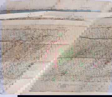
Sold20221893 Civil War Map of Northern Virginia -- Sheet 2. Survey for Military Defenses Map of NortheasternTitle: 1893 Civil War Map of Northern Virginia -- Sheet 2. Survey for Military Defenses Map of Northeastern Virginia and Vicinity of Washington [Plate VII] Cartographer: US War Department Year / PlaceSee Sold Price
Sold20201933 VT Rutland Sheet Geological Survey MapDescription: Vintage 1933 VT Rutland Sheet Geological Survey Map, reprinted from a 1893 edition. Henry Gannett, chief topographer, H.M. Wilson, geographer in charge, triangulation by U.S. Coast and GeSee Sold Price
Sold2023U.S. MILITARY FIELD MAPS OF FRANCE 1939-1945 -(3)170302 U.S. MILITARY FIELD MAPS OF FRANCE 1939-1945 -(3) U.S. military field maps of France 1939-1945 to include one France and Belgium (50000) Sittard Field Map Second Edition Sheet 48, One France (5See Sold Price
Sold2017USCGS: Antique Coastal Chart Map of Suisun Bay, 1870Title/Content of Map: 'Suisunbay California from a Trigonometrical survey under the direction of A.D. Bache, Superintendent of the survey of the Coast of the United States Published by 1872' COASTAL CSee Sold Price
Sold20191932 Reprint map of Napa California, US Geological1932 Reprint map of Napa California, US Geological survey 20" x 15 1/2"See Sold Price
Sold2021Map of Public Surveys in California to Accompany ReportPublication Date: 1862 Title: Map of Public Surveys in California to Accompany Report of Surveyor Genl. 1862. Cartographer: U.S. SURVEYOR GENERAL FOR CALIFORNIA Publisher: HOUSE OF REPRESENTATIVES HeiSee Sold Price
Sold20221853 Immense Williamson Map of California -- General Map of Explorations and Surveys In CaliforniaTitle: 1853 Immense Williamson Map of California -- General Map of Explorations and Surveys In California under the direction of the Hon. Jefferson Davis, Secretary of War… Cartographer: R WilliSee Sold Price
Sold2019"Map of Public Surveys in California," 1855, H.- 37 1/2"Map of Public Surveys in California," 1855, H.- 37 1/2 in., W.- 31 3/4 in.See Sold Price
Sold2019"Map of Public Surveys in California, Public Grants,""Map of Public Surveys in California, Public Grants," 1862, H. - 25 in., W. - 17 5/8 in.See Sold Price
Sold2023WWII U.S. MILITARY WAR MAPS OF FRANCE - (3)171283 WWII U.S. MILITARY WAR MAPS OF FRANCE - (3) WWII U.S. military war maps of France to include, one sheet 6F/6 Vire France(50000) war map second edition, one sheet 6E/6 Isigny France(50000) war mSee Sold Price
Sold2023Map of the 1849 Gold Rush To CaliforniaMap of the 1849 Gold Rush To California, Second Edition, 1849. Drawn and engraved by J.M. Atwood, published by Joseph Hutchins (J.H.) Colton, New York, New York, onion skin paper, printed "MAP OF THESee Sold Price
Sold2021Pictorial map of the Imperial Valley, 1941Heading: (California - Imperial Valley) Author: Title: Scenic Map of the Imperial Valley Desert Area (panel title) Place Published: Brawley, CA Publisher:Brawley Chamber of Commerce Date PublishSee Sold Price
Sold2016John C. Hays: California 1856Map: Map of Public Surveys in California to Accompany Report of Surveyor General Publishing: John C. Hays: Washington DC Date: 1856 Size: 35.5 x 31.25 inches Large map of all of California showing theSee Sold Price
Sold2021Rare pictorial tourist map of Imperial Valley, Cal.Heading: (California - Imperial Valley) Author: Pique, Ethel Title: Points of Interest in Imperial Valley, Land of Sunshine & Romance Place Published: El Centro, Calif. Publisher:El Centro Chamber ofSee Sold Price
Sold2024Laurie & Whittle - Map of the Island and Kingdom of SicilyThis exceptional map is from the very handsome atlas entitled A New and Elegant Imperial Sheet Atlas; Comprehending general and particular maps of every part of the world... The work was published bySee Sold Price
Sold2018U.S Coast Survey 1853 Map. Cortez Bank, California"Cortez Bank on the Western Coast of the United States" Electrotype Map Published 1843-65, Washington for "Report of the Superintendent of the U.S. Coast Survey..." Published under the supervision andSee Sold Price
Sold2023Williamson, Lieut. R. S. 1856 Map. California, New Mexico, Texas, Mexico"United States & Mexican Boundary Survery" Lithograph Map Published 1853-61, Washington for "Reports of explorations and surveys, to ascertain the most practicable and economical route for a railroadSee Sold Price
Featured2024Jasper52LSE POVERTY OS PROOF MAP Holland Park Shepherds Bush Olympia Hammersmith 1928See Sold Price
450 Lots AwayJasper52LSE POVERTY OS PROOF MAP Swiss Cottage. West/South Hampstead. Belsize Park 1928$800
2024Jasper52LSE POVERTY OS PROOF MAP Chelsea Harbour - Sands End - Walham - Fulham 1928See Sold Price
Featured2024Jasper52LSE POVERTY OS PROOF MAP Wanstead Flats - Aldersbrook - Forest Gate 1928See Sold Price
362 Lots AwayJasper52LSE POVERTY OS PROOF MAP Hackney Downs - Kingsland - Dalston - Haggerston 1928$750
2024Jasper52LSE POVERTY OS PROOF MAP West Ham Park - Plashet - Forest Gate - Woodgrange 1928See Sold Price
371 Lots AwayJasper52LSE POVERTY OS PROOF MAP West/East Ham - Plaistow - Upton Park - Greengate 1928$850
326 Lots AwayJasper52City of York #6 Heworth Monk Stray Layerthorpe. Ordnance Survey 1852 old map$460
402 Lots AwayJasper52City of York #13 Walmgate Lawrence Street Tang Hall Layerthorpe. OS 1852 map$300
448 Lots AwayJasper52City of York #5 Groves Bootham Park Hospital St. John's Heworth. OS 1852 map$420
2024Jasper52City of York #8 Marygate Museum Gardens Clifton Leeman Rd Bootham. OS 1852 mapSee Sold Price
2024Jasper52City of York #15 Clementhorpe Fulford Road Skeldergate Fishergate. OS 1852 mapSee Sold Price
396 Lots AwayJasper52City of York #11 Holgate Micklegate Bar Station City Centre. OS 1852 old map$700
2024Jasper52LSE POVERTY OS PROOF MAP St Johns Wood Maida Vale Lisson Grove Regents Park 1928See Sold Price
2024Jasper52City of York #9 Minster & Medieval centre. Aldwark Monkgate Hungate. OS 1852 mapSee Sold Price


![1893 Civil War Map of Northern Virginia -- Sheet 2. Survey for Military Defenses Map of Northeastern: Title: 1893 Civil War Map of Northern Virginia -- Sheet 2. Survey for Military Defenses Map of Northeastern Virginia and Vicinity of Washington [Plate VII] Cartographer: US War Department Year / Place](https://p1.liveauctioneers.com/5584/270923/141842311_1_x.jpg?height=310&quality=70&version=1670433092)