Sold2019Senex & Ogilby 1719 Road Map. London to Montgomery"The Road from London to Montgomery in North Wales" Copper Engraved Map Published 1719, London for "An Actual Survey of all the Principal Roads of England and Wales" by John Ogilby and John Senex. PapSee Sold Price
Sold2020Senex & Ogilby 1719 Road Map. London to Montgomery"The Road from London to Montgomery in North Wales" Copper Engraved Map Published 1719, London for "An Actual Survey of all the Principal Roads of England and Wales" by John Ogilby and John Senex. PapSee Sold Price
Sold2022England.- Ogilby (John) Ogilby's Road Maps of England and Wales from Ogilby's 'Britannia', 1675,NO RESERVE England.- Ogilby (John) Ogilby's Road Maps of England and Wales from Ogilby's 'Britannia', 1675, double- and whole-page maps, original cloth, Osprey, [1971]; and 16 others British TopographSee Sold Price
Sold2017[Maps] Britannia Depicta, 1720Bowen, Emanuel. BRITANNIA DEPICTA OR OGILBY IMPROV'D; BEING A CORRECT COPPY OF MR. OGILBY'S ACTUAL SURVEY OF ALL YE DIRECT & PRINCIPAL CROSS ROADS IN ENGLAND AND WALES. London: Tho. Bowles, 1720. 8vo.See Sold Price
Sold20181675 John Ogilby Britannia Atlas England HUGE FOLIOS1675 John Ogilby Britannia Atlas England HUGE FOLIOS Roads Scotland Wales 2v In 1675, John Ogilby, a famed Scottish cartographer, began working on his famous road atlas known as ‘The Britannia.’ BSee Sold Price
Sold20241645 Road Map by John Ogilby Buckingham to Bridgnorth Plate 23An antique road map showing the first accurate survey of the roads of England and Wales. This map shows the continuation of the extended road from Buckingham to Bridgnorth. 1 of over 100 maps publisheSee Sold Price
Sold2017Road Map from London to Oxford by John Ogilby Road MapRoad Map from London to Oxford by John Ogilby, 1675, reproduced from the original in the Rand McNally & Company collection, roads in ribbon design, professionally framed and matted, gold painted woodSee Sold Price
Sold2017Road Map from London to Oxford by John Ogilby Road MapRoad Map from London to Oxford by John Ogilby, 1675, reproduced from the original in the Rand McNally & Company collection, roads in ribbon design, professionally framed and matted, gold painted woodSee Sold Price
Sold20221675 Ogilby Road Map from London to Flambourough HeadTitle: 1675 Ogilby Road Map from London to Flambourough Head -- The Road from London to Flambourough Head in Com Ebor… Cartographer: J Ogilby Year / Place: 1675, London Map Dimension (in.): 13.4 X 1See Sold Price
Sold20221675 Ogilby Strip road Map of York to Scarborough -- The Roads from York to Whitby and ScarboroughTitle: 1675 Ogilby Strip road Map of York to Scarborough -- The Roads from York to Whitby and Scarborough in Yorkshi:… Cartographer: J Ogilby Year / Place: 1675, London Map Dimension (in.): 12.8See Sold Price
Sold2022Britain.- Cary (John) Cary's Traveller's Companion or a Delineation of the Turnpike Roads of EnglandBritain.- Cary (John) Cary's Traveller's Companion or a Delineation of the Turnpike Roads of England and Wales, engraved throughout, title, advertisement and contents ff., 43 maps, hand-coloured in ouSee Sold Price
Sold2018MAPS: Roads of England and Wales c1860 color mapMAPS: Roads of England and Wales c1860 color map, The Roads of England and Wales, with the whole of Scotland, showing the Distances between each Town, and from London; also the tracks of the Steam NavSee Sold Price
Sold2022John Ogilby, three road maps, including London to Norwich, hand coloured engravings, late 17thJohn Ogilby, three road maps, including London to Norwich, hand coloured engravings, late 17th century, 35 x 45cmSee Sold Price
Sold2018Bacons Motor Road Map: England & Wales, North. c.1920sTitle/Content of Map:Bacons Motor Road Map: England & Wales, North. c.1920s Date: c.1920s Cartographer: Bacons Motor Road Maps Material/Medium: Folded in boards color map reinforced with original gauzSee Sold Price
Sold20226-New England Road Maps/Bookletsrated 7 to 8, 9"x4" or less in size, all have good color, all have minor wear.See Sold Price
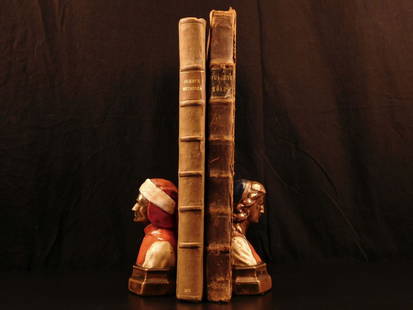
Sold2022GARDNER (THOMAS)] Pocket-guide to the English Traveller: Being a Compleat Survey and Admeasureme...[GARDNER (THOMAS)] Pocket-guide to the English Traveller: Being a Compleat Survey and Admeasurement of all the Principal Roads and Most Considerable Cross-roads in England and Wales, 2 parts in 1, FIRSee Sold Price
Sold2020Richard Henry Wright Watercolor Gouache of Chartres,Richard Henry Wright signed Watercolor Gouache of Chateres France dated 1906. Gallery label on Reverse Chatman Brothers King Roads Chelsea England. Richard Henry Wright's work has been sold at ChristiSee Sold Price
Sold202118th c. Print England and Wales Road Map by Condor"A New Most Accurate & Complete Map of all the Direct and the Principal Cross Roads in England and Wales". Original detailed map shows distances of major roadways across England and Wales, measured inSee Sold Price
Sold20181695 Moll map of England with Road Distances betweenReserve Reduced! Title/Content of Map: 1695 Moll map of England with Road Distances between Towns -- A New Mapp of the Roads of England Showing the Reputed Distances from One Town to Another … Date:See Sold Price
Sold2023Railway Tickets 1800s (16) New EnglandGroup of 16 railroad tickets from the 1800's. Some dated like the Eastern 1870 and 1872. Salem & Lowell is quite rare, Several other New England roads are represented.See Sold Price
Sold2022Bowen, Thomas 1782 Large Map of England & Wales"A New & Most Accurate Map of the Roads of England and Wales" Copper Engraved Map Published 1779-82 by J. Cooke, London for "The Modern Universal British Traveller or, a New, Complete, and Accurate toSee Sold Price
Sold2018English Sturge House 1800 From Vivian Green MuseumEnglish Sturge House circa 1800 with original shipping label to Miss Sturge Cotham Road Bristol England. This house was purchased by Mrs. Mahoney from the Vivian Green Museum in England and then soldSee Sold Price
Sold2016B.B. King AutographHand signed gloss photo autographed B.B. King at King Edwards Road, Birmingham, England during June of 2010 Measures: 8 x 10 inches COA includedSee Sold Price
5 days LeftJasper52Cary's reduction of his large map of England & Wales'. Turnpikes canals &c 1834$360
5 days LeftJasper52Cary's reduction of his large map of England & Wales'. Turnpikes canals &c 1837$360
5 days LeftJasper52Cary's reduction of his large map of England & Wales'. Turnpikes canals &c 1816$360
5 days LeftJasper52Cary's reduction of his large map of England & Wales'. Turnpikes canals &c 1821$360
5 days LeftJasper52Cary's reduction of his large map of England & Wales'. Turnpikes canals &c 1816$360
5 days LeftJasper52Cary's reduction of his large map of England & Wales'. Turnpikes canals &c 1834$360
5 days LeftJasper52Cary's reduction of his large map of England & Wales'. Turnpikes canals &c 1805$360
5 days LeftJasper52Cary's reduction of his large map of England & Wales'. Turnpikes canals &c 1796$420
3 days LeftJasper521866 Johnson's Vermont, New Hampshire, Massachusetts, Rhode Island, and Connecticut$50
5 days LeftJasper52Cartes des Isles Britanniques qui renferment… British Isles DELAMARCHE 1804 map$260
5 days LeftJasper52London Greenwich Chatham Sittingbourne Canterbury Dover OGILBY road map #28 1675$280
5 days LeftForum AuctionsLondon.- Ogilby (John) The Road from London to Aberistwith...; The Continuation of ye Road from£75
C & T Auctioneers and Valuers LtdMatchbox Lesney Superfast MB-19 Road Dragster with Light Red body, Vertical 8 labels£26
May 10Rail & Road AuctionsOrder of the Road 43 Year Driver - Enameled Badge / License Plate Topper - Britain / England$10


![England.- Ogilby (John) Ogilby's Road Maps of England and Wales from Ogilby's 'Britannia', 1675,: NO RESERVE England.- Ogilby (John) Ogilby's Road Maps of England and Wales from Ogilby's 'Britannia', 1675, double- and whole-page maps, original cloth, Osprey, [1971]; and 16 others British Topograph](https://p1.liveauctioneers.com/5458/257239/133765092_1_x.jpg?height=310&quality=70&version=1659622051)
![[Maps] Britannia Depicta, 1720: Bowen, Emanuel. BRITANNIA DEPICTA OR OGILBY IMPROV'D; BEING A CORRECT COPPY OF MR. OGILBY'S ACTUAL SURVEY OF ALL YE DIRECT & PRINCIPAL CROSS ROADS IN ENGLAND AND WALES. London: Tho. Bowles, 1720. 8vo.](https://p1.liveauctioneers.com/3532/111460/57224161_1_x.jpg?height=310&quality=70&version=1509131847)


![GARDNER (THOMAS)] Pocket-guide to the English Traveller: Being a Compleat Survey and Admeasureme...: [GARDNER (THOMAS)] Pocket-guide to the English Traveller: Being a Compleat Survey and Admeasurement of all the Principal Roads and Most Considerable Cross-roads in England and Wales, 2 parts in 1, FIR](https://p1.liveauctioneers.com/1043/250376/130017565_1_x.jpg?height=310&quality=70&version=1654076918)


