Sold20191898 Cram map of the Bahamas [verso] Haiti, DominicanTitle/Content of Map: 1898 Cram map of the Bahamas [verso] Haiti, Dominican Republic and Jamaica -- Map of the Bahama Islands [verso] Map of Jamaica, Haiti and San Domingo Date: 1898, ChicagoCartograpSee Sold Price
Sold2019Bahama Islands, Harbours and Anchorages, BritishTitle/Content of Map: Bahama Islands, Harbours and Anchorages, British Admiralty Chart 409, published 1897 Date Printed: Surveyed in 1830 – 1835 Published: 1897 Edition: 1rst publication CartograpSee Sold Price
Sold2017Cram: Antique Map of Bahama Islands, 1892Map: Map of the Bahama Islands Cartographer: George Cram Place & Date: Chicago / 1892 Size: 19 1/2" x 13 1/2" Condition: full color; light overall age toning; red color registration slightly off. TheSee Sold Price
Sold2016Antique Map - Cuba & The Bahama Islands - 1889Antique Map - Cuba & The Bahama Islands - 1889 from Cram's Atlas 1889. Size : 14.5" x 11"See Sold Price
Sold2017Isles Lucayes Map, Mallet, 1683Isles Lucayes Map. A charming map of the Bahama Islands with part of central Cuba and a sea battle in progress near the islands, from Mallet's Description de l'Univers. Cartographer: Mallet. Place & DSee Sold Price
Sold2024Cuba & The Bahama Islands 1889Title/Content of Map: Cuba & The Bahama Islands 1889 Date Printed: 1889 Material/Medium: paper Size: approx. 14.5"x10.75" George F. Cram, Chicago Reserve: $35.00 Shipping: Domestic: Flat-rate of $15.See Sold Price
Sold2018West Indies the Bahama Islands Exuma to New ProvidenceTitle/Content of Map: West Indies the Bahama Islands Exuma to New Providence Date Printed: 01/07/1975 Cartographer: HYDROGRAPHIC OFFICE. ROYAL NAVY Size (inches): 38X25 Detailed nautical chart. CopiouSee Sold Price
Sold20201898 Map of the Philippine IslandsAuthor: Cram Title: 1898 Map of the Philippine Islands Medium: Ink on PaperDimensions: 14.5"X22" Map of the Philippine Islands dated 1898. Engraved and published by George Cram in Chicago. Double foliSee Sold Price
Sold2016James Wyld, "Map of the West India and Bahama IslandsJames Wyld, "Map of the West India and Bahama Islands with the Adjacent Coasts of Yucatan, ……..". image size 21" x 30 1/2" vertical crease, no stains apparent. Framed and matted. A very detailed mSee Sold Price
Sold2021West Indies.- Bahamas.- Shattuck (George Burbank) TheNO RESERVE West Indies.- Bahamas.- Shattuck (George Burbank) The Bahama Islands, half-title, plates, folding map (short tear), folding table, cracked hinges, ex-Ministry of Defence library with bookplSee Sold Price
Sold2019Cuba and the Bahama IslandsTitle/Content of Map: Cuba and the Bahama Islands Date: 1889 Cartographer: CRAM, GEO. F. Publisher: CRAM, GEO. F. Size: 9Height - 12Width Map detailing the tip of FL, the Bahama islands, Cuba, JamaicaSee Sold Price
Sold2021West Indies.- Bahamas.- Stark (James H.) Stark'sNO RESERVE West Indies.- Bahamas.- Stark (James H.) Stark's History and Guide to the Bahama Islands, plain plates, 2 folding maps, ink ownership inscription to front pastedown, original pictorial boarSee Sold Price
Sold2024West Indies Caribbean Florida Bahamas Cuba ADMIRALTY chart 1876 (1949) old mapTITLE/CONTENT OF MAP: 'West Indian Islands and Caribbean Sea - Sheet I - Comprising Florida Strait, Bahama Islands and the Greater Antilles' DATE PRINTED: Surveyed to 1948. Published 1876. New editionSee Sold Price
Sold2022West Indies.- Bahamas.- Shattuck (George Burbank) The Bahama Islands, 1905.West Indies.- Bahamas.- Shattuck (George Burbank) The Bahama Islands, extensively illustrated with plates and maps, some in colour, some folding or double page, errata slip, a few library stamps and iSee Sold Price
Sold2021Boating Maps, Bahamas for out islands, The BahamaMaps from 1981 tropic Isle publishers, Inc By Harry Klein, Bahamas far out islands, The Bahama Islands, airstrip locations.See Sold Price
Sold2016Rand, McNally & Co: Connecticut, Rhode Island, 1898Map: Connecticut, Rhode Island Size: 21 x 15 inchesMaker: Rand, McNally & Co Date: 1898From: New Standard Atlas of the World No Reserve: This lot starts at $1 and has no reserve as a courtesy so thatSee Sold Price
Sold2022JEFFERYS, THOMAS The Coast of West Florida and Louisiana/ The Peninsula and Gulf of Florida orJEFFERYS, THOMAS The Coast of West Florida and Louisiana/ The Peninsula and Gulf of Florida or Channel of Bahama with the Bahama Islands. London: Robert Sayer, 20 February 1775. Engraved map on joinedSee Sold Price
Sold2023Map of Spanish Empire in the Americas, the Pacific and Europe until 1898Map of Spanish Empire in the Americas (Cuba y Puerto Rico), the Pacific (the Philippine archipelago) and Europe (Canary Islands) until 1898. Size: 24x16. Condition: good.; Until 1898 Spain maintainedSee Sold Price
Sold2022Ruth Haviland Sutton "Map of Nantucket Island"Ruth Haviland Sutton (1898-1960) Lithograph "Map of Nantucket Island", planned and drawn by Ruth Haviland Sutton, 1946 and lithographed by George C. Miller & Son, Inc. copyright 1964, with numerouSee Sold Price
Sold2024West India Islands. West Indies Caribbean Jamaica Antilles. BARTHOLOMEW 1898 mapTITLE OF MAP (NOT PRINTED ON THE PAGE):'West India Islands' DATE PRINTED: 1898 IMAGE SIZE: Approx 29.5 x 40.5cm, 11.5 x 16 inches (Large) TYPE: Antique atlas map CONDITION: Good; suitable for framing.See Sold Price
Sold2017Map of Hawaii and the Philippines, 1898Map: 1898 Map of Hawaii and the Philippines -- The Philippine Islands and Hawaii Cartographer: Century Co. Year / Place: 1898, New York Map Dimensions: 10.4 x 14.7 in. An unsual, rare and interestingSee Sold Price
Sold2017Bartholomew: Map of Asia, 1898Map: Asia Date: 1898 Size: 17.75 x 14 inches With inset of the Island of Singapore From Bartholomew's "The Citizen Atlas of the World" Please note that this lot has a confidential reserve. When you leSee Sold Price
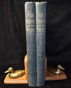
Sold2022Cory. Birds of the Bahama Islands.[Ornithology] Cory, Charles B. Birds of the Bahama Islands; Containing Many Birds New to the Islands, and a Number of Undescribed Winter Plumages of North American Species. Estes & Lauriat, Boston, 18See Sold Price
Sold2022Cory. Birds of the Bahama Islands.[Ornithology] Cory, Charles B. Birds of the Bahama Islands; Containing Many Birds New to the Islands, and a Number of Undescribed Winter Plumages of North American Species. Estes & Lauriat, Boston, 18See Sold Price
17 hrs LeftTrillium Antique Prints & Rare BooksCatesby, Folio - Magnolia - The Umbrella Tree (Big Leaf Magnolia). 2-80$200
17 hrs LeftTrillium Antique Prints & Rare BooksCatesby, Folio - Foxcoloured Thrush with Clustered Black Cherry. 1-28$200
17 hrs LeftTrillium Antique Prints & Rare BooksCatesby, Folio - Ichneumon fly with Smooth Sumac. Sup-4$200
Apr 27Trillium Antique Prints & Rare BooksCatesby, Folio - Goldcrest & Ichneumon Wasp with Stewartia. Sup-13$200
Apr 30Willow Creek Coin & CollectiblesMark Catesby (1682-1749) "The White Headed Pigeon" etching, circa 1731$200
5 days LeftJasper52London in 1897 with street improvements since 1855. 80x105 cm. Edwards 1898 map$260
16 hrs LeftNorth American Artifact Auctions1898 Our Islands and Their People As Seen With Camera and Pencil 1st ed$10(1 bid)
Featured4 days LeftJasper521912 Topographical Map of Kauai, Hawaii -- Topographic Map of the Island of Kauai, Kauai County,$120
Featured4 days LeftJasper521822 MAP of LEEWARD ISLANDS GEOGRAPHICAL STATISTICAL HISTORICAL antique 17.5x22"$120
5 days LeftJasper52Descrittione dell' Isole Molucche. PORCACCHI. East Indies & Indochina 1620 map$440


![1898 Cram map of the Bahamas [verso] Haiti, Dominican: Title/Content of Map: 1898 Cram map of the Bahamas [verso] Haiti, Dominican Republic and Jamaica -- Map of the Bahama Islands [verso] Map of Jamaica, Haiti and San Domingo Date: 1898, ChicagoCartograp](https://p1.liveauctioneers.com/5584/144953/73284241_1_x.jpg?height=310&quality=70&version=1562102885)


![Cory. Birds of the Bahama Islands.: [Ornithology] Cory, Charles B. Birds of the Bahama Islands; Containing Many Birds New to the Islands, and a Number of Undescribed Winter Plumages of North American Species. Estes & Lauriat, Boston, 18](https://p1.liveauctioneers.com/179/268856/140616160_1_x.jpg?height=310&quality=70&version=1668545725)
![Cory. Birds of the Bahama Islands.: [Ornithology] Cory, Charles B. Birds of the Bahama Islands; Containing Many Birds New to the Islands, and a Number of Undescribed Winter Plumages of North American Species. Estes & Lauriat, Boston, 18](https://p1.liveauctioneers.com/179/268856/140616162_1_x.jpg?height=310&quality=70&version=1668545725)