Sold20212 Signed Framed Sketches Nantucket Island 8x62 Signed Framed Sketches Nantucket Island 8x6See Sold Price
Sold2023Framed Map of Nantucket Island Print by George Buctel, 1973Framed Map of Nantucket Island Print, drawn by George Buctel, 1973, by Mitchell's Book Corner, double matted and framed 15.5 in. x 20.25 in. Framed 20 in. x 25 in.See Sold Price
Sold2022Framed Chart of the West Indian IslandsFramed Chart of the West Indian Islands, for Rob Sager and J Bennett - colored. Plate Sized 19"H by 23"WDimensions: 19"H by 23"W Shipping is the buyer's responsibility! We recommend obtaining a quoteSee Sold Price
Sold2019United States – Nantucket Island British AdmiraltyTitle: United States – Nantucket Island British Admiralty Chart 2489, published 1896 Date: 1896 Cartographer: British Admiralty Size: 28x41 in Hardly used sea chart of the the treacherous coast ofSee Sold Price
Sold2021Kerry Hallam Acrylic on Coastal Chart - Long IslandKerry Hallam (British 1937-2020) Acrylic on Coastal Chart - Long Island Sound, Nantucket Sound and New England Coastline, signed lower left 26 in. x 43.5 in. Overall 29.5 in. x 47.5 in. Dimensions 26See Sold Price
Sold2019United States East Coast – Block Island, Nantucket,Title: United States East Coast – Block Island, Nantucket, Rhode Island British Admiralty Chart 2492, published 1887 Date: 1887 Cartographer: British Admiralty Size: 28x41 in Hardly used, small scalSee Sold Price
Sold2021Painted & Dye ChartGroup of 3 pieces. An original oil on board signed Janet Cavelero Navajo Dye Chart & Framed Mola from San Blas IslandSee Sold Price
Sold20192 1850s LOUIS VAN HOUTTE BOTANICAL LITHOGRAPHSPair of Louis Van Houtte (1810 - 1876) Botanical Lithographic Plates c. 1850s. Professsionally framed and matted, purchased at Portobello on Nantucket Island. Each 15"x19"x 1/2". Weight combined 6 pdsSee Sold Price
Sold20231926 Tony Sarg Colored Lithograph Map of Nantucket in the State of Massachusetts1926 Tony Sarg (1880-1942) Colored Lithograph Map of Nantucket in the State of Massachusetts, depicting founders of Nantucket Island and numerous landmarks, matted and framed Sight 16 in. x 18.5 in. OSee Sold Price
Sold2021Framed Original Menu Cover, The Chanticleer; NantucketOriginal framed and matted vintage menu cover for the Chanticleer, Nantucket Island. "The Chanticleer; Sconset on Nantucket Island" printed in fine text on archival paper with blind embossed relief emSee Sold Price
Sold2018John Stobart (b. 1929) Nantucket, the Island Port byJohn Stobart (b. 1929) Nantucket, the Island Port by Moonlight at the Turn of the Century, Lithograph, Signed and numbered 240/650 lower right in pencil. Signed and dated 1990 in print. Framed dimensiSee Sold Price
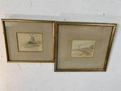
Sold2020Old Nantucket Mill & Jackenuck Island WatercolorsDated 1746 Old Nantucket Mill Watercolor On Paper And On Jackenuck Island,Mass.Watercolor.Both Matted and Framed in Early Giltwood Frames.Old Nantucket Framed Measures at 9 1/2.”Wide x 8 1/2” HighSee Sold Price
Sold2021Preliminary Chart of Nantucket Shoals together withPreliminary Chart of Nantucket Shoals together with Tidal Currents of Nantucket Shoals, 1854, Chart in a molded Bird's Eye Maple, Tidal Currents matted and framed 18.25 in. x 19.5 in. Overall 24 in. xSee Sold Price
Sold2024Antique 1883 Eldridge's Chart Long Island SoundAntique 1883 Eldridge's Chart Long Island Sound From Newport to New York by Geo. Eldridge, Hydrographer and Published by S. Thaxter & Son. The map is framed in a metal map frame with no glass. The mapSee Sold Price
Sold2020ELDRIDGES CHART OF VINEYARD SOUND 1907Rare 1907 original George Eldridge chart of Nantucket, Martha's Vineyard and the Nantucket Shoals. An exceptionally rare ans seldom seen chart with strong graphics and so many Cape Cod and island harbSee Sold Price
Sold2020Nantucket Map, c. 1890Two U.S. geological survey topographical chart maps framed and matted together, showing Nantucket Tuckernuck and Muskeget,c.1890, Overall, 35” x 45”See Sold Price
Sold2023Kerry Hallam Acrylic on Nantucket Sound Chart "Regatta"Kerry Hallam (British-American 1937-2020) Acrylic on Nantucket Sound Chart "Regatta", signed lower left Kerry Hallam 33 in. x 42.75 in. Framed 43 in. x 53 in.See Sold Price
Sold2024FIVE ARTWORKS Largest 14" x 12". Framed.FIVE ARTWORKS1) Sketch by Gerald Burke, Nantucket, 1981.2) Lithograph "Town of Sherburne in the Island of Nantucket".3) Print on rice paper depicting a girl with sandals.4) A print of tulips.5) PrintSee Sold Price
Sold2020Harbor Chart of Thimble Islands and Stony CreekHarbor Chart of Thimble Islands and Stony Creek. . Title: Harbor Chart of Thimble Islands & Stony,. Medium: Print. Size: 15 X 20 in. Signature: Unsigned. Artist: Geo. W. Eldridge. Framed.See Sold Price
Sold2023Block Island To Nantucket: Narragansett and Buzzards Bay, Block Island, Vineyard and NantucketBlanchard wrote this book as a comprehensive history and guide to the area. Published by D.Van Nostrand, 1961, photos, charts, diagrams etc. 253pp with Index. BOX 2 Reserve: $25.00 Shipping: Domestic:See Sold Price
Sold2021THE MAYHEW FAMILY TREE LITHOGRAPHHand colored noting Thomas as Governor and Patentee of Martha's Vineyard, Nantucket and Elizabeths Islands, drawn by F. Mayhew, 1826, sight size: 20 x 26 1/2 inches, framed: 22 3/4 x 29 inchesSee Sold Price
Sold2022Minna G. Webb Oil on Board "Island Service Wharf, Nantucket"Minna G. Webb (1885-1969) Oil on Board "Island Service Wharf, Nantucket," signed lower left Minna Webb in contemporary gilt frame 11.5 in. x 15.5 in. Framed 15.75 in x 19.75 in.See Sold Price
Sold2021Two Framed Vintage Maps of NantucketOne is a map of the island, the other a street map with vignettes of historical landmarks. Both published by Mitchell's Book Corner in 1973, both 17H inches x 22W inchesSee Sold Price
Sold2021KERRY HALLAM PAINTED NAUTICAL CHARTLarge hand painted nautical chart (NOAA, Conn. Long Island Sound, 1983) with mixed media scene of yachts signed Kerry Hallam. Image 33 x 43 inches, framed 50 x 59 inches. VG condition. (Kerry Hallam,See Sold Price
22 hrs LeftLeland LittleJose Formosa Reyes (Filipino/American, 1902-1980), Nantucket Lightship Basket$225(2 bids)
4 days LeftRapid Estate Liquidators and Auction GalleryVintage Framed Cat Island Nautical Map Print$55
1 hr LeftRobinhood AuctionsCharles Fazzino, "There's Music: New Jersey, New York, Long Island Too!! (Sky Blue)" Framed 3D$1,000
1 day LeftRapid Estate Liquidators and Auction GalleryFramed Maria Reyes Jones Date Palms Original Mixed Media$3,500
4 days LeftRapid Estate Liquidators and Auction GalleryS&N Martin Barry B/W Sharps Island Lighthouse Print$100
2 days LeftAssociated Estate & Appraisal Co., Inc.Francis Kornbluth Oil on Canvas Abstract$950(2 bids)