Sold2017Nicolas De Fer: Carte Generale du Globe Terrestre, 1705Map: Carte Generale du Globe Terrestre et Aquatiques ou Mappemonde en Deux Plans-Hemisphere [Scarce 1705 antique map with California as an island] Maker: Nicolas De Fer Size: 8.125 x 11.125 (10.25 x 1See Sold Price
Sold2019Delamarche, Felix 1829 Map of World Hemispheres"Mappe-Monde ou Carte Generale du Globe Terrestre" Copper Engraved Map Published 1829, Paris for "Atlas de La Geographie..." by Felix Delamarche. Contemporary outline hand colour. Centre fold as publiSee Sold Price
Sold2022MAP, World, BellinWorld. Jacques Nicolas Bellin, Carte Reduite des Parties Connues du Globe Terrestre Dressee au Depost des Cartes Plans et Journaux de la Marine..., 1755 (dated). Hand Color. This is the rare first ediSee Sold Price
2021MAP OF THE WORLDMappe-Monde. Carte Generale du globe terrestre par F. Delamarche. 1828 framed. 32 x 47 cm.See Sold Price
Sold2019[Jacques Nicolas Bellin (1703-1772)]. Carte Reduite Du[Jacques Nicolas Bellin (1703-1772)]. Carte Reduite Du Globe Terrestre. N.p; n.p, ca 1764. Engraved map with hand-coloring in wash and outline, visible area 9 1/4 x 14 in. (236 x 356 mm), matted and fSee Sold Price
Sold2020DANET, GUILLAUME; after DE FER, NICOLAS. Mappe-Monde ouDANET, GUILLAUME; after DE FER, NICOLAS. Mappe-Monde ou Carte Generale de la Terre. Engraved decorative double-hemispheric wall map of the world on two sheets joined with additional title-banner and bSee Sold Price
Sold2019Nicolas De Fer (1646-1720), "Cette Carte de CalifornieNicolas De Fer (1646-1720), "Cette Carte de Californie et du Nouveau Mexique," 1700, hand colored, H.- 11 1/2 in., W.- 15 1/4 in.See Sold Price
Sold2021de Fer, Nicolas 1717 World Map. California as Island"Mappe-Monde ou Carte Generale de la Terre" Copper Engraved Map Published 1717, Paris for "Introduction a la Geographie" by Nicolas de Fer. Folds as issued. Paper Size: 14 x 10 inch (36 x 25cm) Very mSee Sold Price
Sold2016LOUIS CLAUDE DE VEZOU 1760Mappe-Monde Geo Spherique ou Nouvelle Carte Ideale Du Globe Terrestre Pour servir d'Introduction a la Geographie, L'Hydrographie, et a la Sphere Armillaire . . . 1760 Hand color engraving on paper DimSee Sold Price
Sold2023MAP, Lesser Antilles, BonneLesser Antilles. Rigobert Bonne, Supplement pour les Isles Antilles, Extrait des Cartes Angloises, from Atlas de Toutes les Parties Connues du Globe Terrestre, 1780 (circa). Hand Color. At the top ofSee Sold Price
Sold2024Nicholas de Fer, Map of California of 1705Nicholas de Fer (1646-1720) Map of California of 1705 (Cette carte de Californie et du Nouveau Mexique, 1705); together with two other California related framed ephemera.Assumed second state (1705) ofSee Sold Price
Sold2020[JAPAN]. A lot of 3 maps sold together[JAPAN]. A lot of 3 maps sold together. Engravings on paper, generally fine. Including: Guillaume Sanson. DE EILANDEN VAN JAPAN. 8.5 x 24cm. [1705] ** Jacques Nicolas Bellin. CARTE DES ÃŽLES DU JAPOSee Sold Price
Sold2023MAP, Philippines, BellinSouthern Philippines. Jacques Nicolas Bellin, Carte des Isles Philippines Dressee sur la Carte Espagnole du R.P. Murillo de Velarde. 2e. Feuille..., from Histoire Generale des Voyages, 1752 (dated). HSee Sold Price
Sold2023MAP, China, BellinChina, Korea & Japan. Jacques Nicolas Bellin, Carte des Isles du Japon et la Presqu' Isle de Coree avec les Costes de la Chine Depuis Pekin Jusqua Canton, from Prevost's Histoire Generale des Voyages�See Sold Price
Sold202318TH C. MAP OF THE COAST OF BRAZIL BY BELLIN"Carte du Bresil, Prem Partie. Depuis la Riviere des Amazones jusqua la Baye de Tous les Saints, Pour Servir a l'Histoire Generale des Voyages" by Jacques-Nicolas Bellin, 1780 (undated). In oak half-rSee Sold Price
Sold2022World Map Mappe-Monde ou Carte Generale du GlobeTitle: World Map Mappe-Monde ou Carte Generale du Globe Terrestre Date Printed: 1678 Cartographer: Sanson, Nicholas Material/Medium: atlas map, engraved, hand colored Size: 17 x 23 Condition: The mapSee Sold Price
Sold2024'Profil del la Forteresse de Mongast' Etching by Nicolas de Fer 17051705 Nicolas de Fer ''Profil del la Forteresse de Mongast' Etching 11 1/2" x 12 1/2" Fair to good condition. Some foxing, toning, creasing, and tears to edges.See Sold Price
Sold2016The Hemispheres. Jean-Baptiste Louis Clouet.De la Division du Globe Terrestre. Geographie Moderne. Maker: Clouet, Jean-Baptiste Louis. Origin: Paris, 1787. Medium: Original engraving hand-colored at publication. Sheet size: 19 3/4 x 26 3/4 in.See Sold Price
Sold2019Nicolas De Fer (1646-1720), "Mappe Mondeou CarteNicolas De Fer (1646-1720), "Mappe Mondeou Carte Universal," 1702, hand colored, H. - 11 1/4 in., W.- 15 1/4 in.See Sold Price
Sold2018Bonne: Antique Map of North America, 1787Very beautiful map of North America Author: Bonne, Rigobert (1727-1794). Atlas: Atlas de toutes parties connues du globe terrestre... Date: 1787 Technique: etching on copper Leaf Dimension: 38x30 cm (See Sold Price
Sold2018Bonne: Antique Map of Asia, 1787Item: Map of Asia 1787 Bonne Etching On Copper Very beautiful map of Asia Author: Bonne Rigobert (1727-1794) Atlas: Atlas de toutes parties connues du globe terrestre... Date: 1787 Technique: etchingSee Sold Price
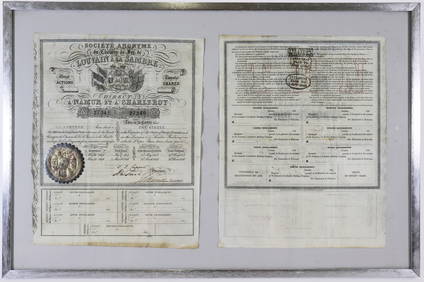
Sold2022BONNE, RIGOBERT; and GUILLAUME THOMAS FRANÇOIS RAYNAL. Atlas de Toutes les Parties Connues duBONNE, RIGOBERT; and GUILLAUME THOMAS FRANÇOIS RAYNAL. Atlas de Toutes les Parties Connues du Globe Terrestre. Letterpress title, [3], 28 pages, 50 double-page engraved maps (1-49, including 17biSee Sold Price
Sold2020Atlas. RAYNAL – BONNE. Atlas de toutes lesRAYNAL, Guillaume – BONNE, Rigobert. Atlas de toutes les parties connues du globe terrestre.Genève, 1781 ca 4to, 250x200 mm; Legatura coeva mezza pelle, titolo in oro su tassello al dorso;See Sold Price
Sold2018BONNE, Rigobert (1727-1794) and Guillaume RAYNALBONNE, Rigobert (1727-1794) and Guillaume RAYNAL (1713-1796). Atlas de toutes les parties connues du globe terrestre. [Geneva: Jean-Leonard Pellet, 1782?]. 4to (266 x 205 mm). 22pp. text including 2ppSee Sold Price
5 days LeftDaniels Auction GalleryAlexis Hubert-Jaillot, French, Mappe-Monde Geo-Hydrographique, 1691$500
5 days LeftJasper52Cartes des Isles Britanniques qui renferment… British Isles VAUGONDY 1780 map$260
4 days LeftJasper521758 MAP PARTIE DE LA MER GLACIALE contenants La Nouvelle Zemble RUSSIA antique$55
14 hrs LeftTrillium Antique Prints & Rare BooksBonne & Desmarest - Map of the Louisiana Territory from Great Lakes to Florida (Middle America)$50
14 hrs LeftTrillium Antique Prints & Rare BooksBonne & Desmarest - 5 Maps of the West Indies or Antilles Islands$50
14 hrs LeftTrillium Antique Prints & Rare BooksBonne & Desmarest - 4 Maps of Italy or surrounding Islands$50
5 days LeftJasper52Carte de la Virginie et du Maryland Virginia Chesapeake Bay. VAUGONDY 1755 map$1,500
May 01Doyle New YorkVaugondy's map of Virginia and Maryland, a reduction of Fry and Jefferson's landmark map$600
BonhamsPOCKET GLOBE; FOREST, J. [Globe Terrestre.] Paris: Forest, Géographe-Éditeur, 17 Rue d...$300(15 bids)
3 days LeftBonhamsGlobe terrestre lumineux, à structure métallique chromé, circa 1940€650
4 days LeftChristie'sPENDULE MONUMENTALE 'À CERCLES TOURNANTS' D'ÉPOQUE NAPOLÉON IIIPreview Only
5 days LeftJasper52Carte L’Asie. Asia. Mughal Empire. Oirat Kingdom. Tartary. VAUGONDY 1750 map$280


![Nicolas De Fer: Carte Generale du Globe Terrestre, 1705: Map: Carte Generale du Globe Terrestre et Aquatiques ou Mappemonde en Deux Plans-Hemisphere [Scarce 1705 antique map with California as an island] Maker: Nicolas De Fer Size: 8.125 x 11.125 (10.25 x 1](https://p1.liveauctioneers.com/5584/106187/54391534_1_x.jpg?height=310&quality=70&version=1499460562)


![[Jacques Nicolas Bellin (1703-1772)]. Carte Reduite Du: [Jacques Nicolas Bellin (1703-1772)]. Carte Reduite Du Globe Terrestre. N.p; n.p, ca 1764. Engraved map with hand-coloring in wash and outline, visible area 9 1/4 x 14 in. (236 x 356 mm), matted and f](https://p1.liveauctioneers.com/197/144217/72930596_1_x.jpg?height=310&quality=70&version=1560547084)


![[JAPAN]. A lot of 3 maps sold together: [JAPAN]. A lot of 3 maps sold together. Engravings on paper, generally fine. Including: Guillaume Sanson. DE EILANDEN VAN JAPAN. 8.5 x 24cm. [1705] ** Jacques Nicolas Bellin. CARTE DES ÃŽLES DU JAPO](https://p1.liveauctioneers.com/1124/187577/94368871_1_x.jpg?height=310&quality=70&version=1607095126)


![BONNE, RIGOBERT; and GUILLAUME THOMAS FRANÇOIS RAYNAL. Atlas de Toutes les Parties Connues du: BONNE, RIGOBERT; and GUILLAUME THOMAS FRANÇOIS RAYNAL. Atlas de Toutes les Parties Connues du Globe Terrestre. Letterpress title, [3], 28 pages, 50 double-page engraved maps (1-49, including 17bi](https://p1.liveauctioneers.com/199/251723/130782453_1_x.jpg?height=310&quality=70&version=1655133895)

![BONNE, Rigobert (1727-1794) and Guillaume RAYNAL: BONNE, Rigobert (1727-1794) and Guillaume RAYNAL (1713-1796). Atlas de toutes les parties connues du globe terrestre. [Geneva: Jean-Leonard Pellet, 1782?]. 4to (266 x 205 mm). 22pp. text including 2pp](https://p1.liveauctioneers.com/197/119933/61100802_1_x.jpg?height=310&quality=70&version=1522758048)


![CHATELAIN, HENRI. 1684-1743. Carte De La Nouvelle France.... [Amsterdam: 1719.] (1 of 3)](https://p1.liveauctioneers.com/1043/324005/175444939_1_x.jpg?height=282&quality=70&version=1713537622)
![POCKET GLOBE; FOREST, J. [Globe Terrestre.] Paris: Forest, Géographe-Éditeur, 17 Rue d... (1 of 1)](https://p1.liveauctioneers.com/1043/322173/175618644_1_x.jpg?height=282&quality=70&version=1713454728)


