Sold2017Weller: Antique Map of Salt Lake Mormon City, 1863Title/Content of Map: 'The Great Salt Lake (Morman) City and Surrounding Country; Map of the Great Salt Lake and Adjacent Country in the Territory of Utah' Date Printed: 1863 Image Size: Approx 44.5 xSee Sold Price
2017The Great Salt Lake (Mormon) CityDescription: The Great Salt Lake (Mormon) City. Town plan & environs maps. WELLER, 1863 Dimensions: Approx 44.5 x 31.5cm, 17.5 x 12.25 inches Please note that this lot has a confidential reserve. WhenSee Sold Price
Sold2018THE GREAT SALT LAKE (MORMON) CITY'. Town plan &TITLE/CONTENT OF MAP: 'The Great Salt Lake (Morman) City and Surrounding Country; Map of the Great Salt Lake and Adjacent Country in the Territory of Utah' DATE PRINTED: 1863 IMAGE SIZE: Approx 44.5 xSee Sold Price
Sold2018Weller: Antique Map of Great Northern Railway, 1863TITLE/CONTENT OF MAP: 'Great Northern Railway (Sheet 1. London to Grantham & Nottingham)' The route (including all branches shown) runs through the towns of London, Hatfield, Hertford, Stevenage, HitcSee Sold Price
Sold2019Samuel Augustus Mitchell (1790-1868), " County Map ofSamuel Augustus Mitchell (1790-1868), " County Map of California with an inset of San Francisco and the Settlements of Great Salt Lake Country, Utah," 1867, hand colored, H.-15 1/8 in., W.-12 1/2 in.See Sold Price
Sold20191863 Johnson’s Neb., Dak., Col., Ida., Kans.Johnson and Ward's rare 1863 map of the territories of Idaho, Dakota, Nebraska, Colorado and Kansas. Extends west as far as the Great Salt Lake and east to Lake Superior. Depicts this area during inteSee Sold Price
Sold2022Antique advertising thermometer Intermountain Lloyds insurance Salt Lake CityEarly Thermometer. Great subject matter mentioning Fire Auto and Burglary. Great patina. Measures 9 inches in diameter. Please examine photos carefully in order to determine the condition of the item.See Sold Price
Sold2017BRIGHAM YOUNG Signed 1849 G.S.L.C Mormon $1 NoteAutographs Outstanding Brigham Young Signed 1849 Great Salt Lake City $1 Mormon Currency Note PCGS Certified Very Choice New-64 Premium Paper Quality BRIGHAM YOUNG (1801-1877). Mormon Leader, PresidenSee Sold Price
Sold20231857 (MORMON HISTORY) Historic Mountain Meadows Massacre Firsthand Interview DocumentationPost-Revolutionary War to Civil War 1860 (MORMON HISTORY) Document titled, "THE MOUNTAIN MEADOWS MASSACRE:" for the "The Valley Tan." (Newspaper) Great Salt Lake City... Regarding the 1857 Mormon "MouSee Sold Price
Sold2022Early Utah Territory newspaper, 1866Heading: (Utah) Author: Title: The Daily Union Vedette Place Published: Great Salt Lake City, U.T. Publisher: Date Published: July 2, 1866 Description: Vol. V, No. 152. 4 pSee Sold Price
Sold20211869 Richardson Birds Eye View of Salt Lake City --Title: 1869 Richardson Birds Eye View of Salt Lake City -- Great Salt Lake City, Utah, 1867 Cartographer: A Richardson Year / Place: 1869, Hartford Map Dimension (in.): 4 X 6.5 in. This is a very niceSee Sold Price
Sold2017d'Anville / Santini: Antique Map of Great Lakes, 1775Map: Partie Occidentale du Canada et Septentrionale de la Louisiane Cartographer: d'Anville / Santini Place & Date: Venice / 1775 Size: 22 1/4" x 19" Condition: outline color; light overall age toningSee Sold Price
Sold2017Bellin: Antique Map of the Great Lakes, 1755Map: 1755 Bellin Map of Great Lakes -- Partie Occidentale de la Nouvelle France… Cartographer: J N Bellin, Homann issue Year / Place: 1755, Nurnberg Map Dimensions: 24 x 19 in. Condition: Very goodSee Sold Price
Sold20231870 Life in Utah 1ed MORMON Mysteries Polygamy LDS Salt Lake City Map INDIANS1870 Life in Utah 1ed MORMON Mysteries Polygamy LDS Salt Lake City Map INDIANS “Life in Utah; or, the Mysteries and Crimes of Mormonism” by John Hanson Beadle is a 19th-century travelogueSee Sold Price
Sold2017Weller: Antique Map of Borneo & Philippines, 1863Title/Content of Map: 'Borneo; The Philippine Islands' East Indies. Manila Zebu/Cebu. Date Printed: 1863 Image Size: Approx 32.0 x 43.5cm, 12.5 x 17.25 inches (Large) Type: Antique map with original oSee Sold Price
Sold2017Weller: Antique Map of Indian Archipelago, 1863Title/Content of Map: 'The Indian Archipelago' East Indies. The map shows the Kingdom of Sarawak, a state in Borneo established by Sir James Brooke in 1841 by receiving independent kingdom status fromSee Sold Price
Sold2018Weller: Antique Map of Dublin Environs, 1863Title/Content of Map: 'The Environs of Dublin' Wicklow Mountains. Railways. Ireland. Date Printed: 1863 Image Size: Approx 43.5 x 32.5cm, 17.25 x 12.75 inches (Large) Type: Antique map with original oSee Sold Price
Sold20231855 Beckwith Map of Northern Utah and Nevada -- Map No. 2 From Great Salt Lake to the HumboldtTitle: 1855 Beckwith Map of Northern Utah and Nevada -- Map No. 2 From Great Salt Lake to the Humboldt Mountains from Explorations and Surveys Made Under the Direction of Hon. Jefferson Davis, Sec. ofSee Sold Price
Sold2018Weller: Antique Map of British India, 1863TITLE/CONTENT OF MAP: 'India the North West Provinces and Oude' Dehli. Nepal. DATE PRINTED: 1863 IMAGE SIZE: Approx 31.5 x 44.5cm, 12.5 x 17.5 inches (Large) TYPE: Antique map with original outline coSee Sold Price
Sold2018Weller: Antique Map of Northeast Spain, 1863Title/Content of Map: 'Spain &c. (North East sheet)' Catalonia Aragon Navarre. Barcelona-Zaragoza railway. Date Printed: 1863 Image Size: Approx 32.5 x 45.0cm, 12.75 x 17.75 inches (Large) Type: AntiqSee Sold Price
Sold2018Morden: Antique Map of Florida & the Great Lakes, 16931693 map of Florida and the Great Lakes by Robert Morden. 5 x 5 inches. A very special map--one of the very earliest obtainable English maps of the American colonies. A Map of Florida and Ye Great LakSee Sold Price
Sold2017de Vaugondy: Antique Map of New France & Great LakesMap: Partie de l'Amerique Septent. qui comprend la Nouvelle France ou le Canada Cartographer: Robert de Vaugondy Place & Date: Paris / 1755 Size: 23 5/8" x 19" Condition: outline color; some water staSee Sold Price
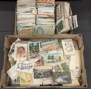
Sold2022Mixed Postcards incl. Atlantic City, Historic EtcLarge Group of Mixed Postcards including Atlantic City, Great Salt Lake, historic US views, etc -See Sold Price
Sold20221855 Beckwith Map of Northern Utah and Nevada -- MapTitle: 1855 Beckwith Map of Northern Utah and Nevada -- Map No. 2 From Great Salt Lake to the Humboldt Mountains from Explorations and Surveys Made Under the Direction of Hon. Jefferson Davis, Sec. ofSee Sold Price
5 hrs LeftJasper52OS #98 Lake District South & Cumbria Fells. Ambleside Windermere Kendal 1883 map$260
5 hrs LeftJasper52Carte du Lac de Genève et des pays circonvoisins'. Geneva plan. CHOPY 1740 map$550
22 hrs LeftRapid Estate Liquidators and Auction Gallery3 Sets Of 2002 Winter Salt Lake City Olympics Pins F18$20
May 14Fleischer's AuctionsLincoln's Funeral Cortège Book by Custodian of Lincoln's Tomb$150(2 bids)
May 04Jay Anderson AuctionCirca 1950's Cast Brass Dolphins Sculpture Riding on a wave. W 29" h 29" d 11". Very nice yard art.$50
6 days LeftJasper521824 Cary Map of the British Isles -- Cary's Reduction of his Six Sheet Map of the British Isles;$320
4 hrs LeftJasper52Great example of Johnson’s 1861 RR map of Illinois – Johnson/Browning$10
May 12Schilb Antiquarian Rare Books1883 America Illustrated Yellowstone Erie Canal Saratoga Springs Niagara Falls$14(2 bids)
May 14Fleischer's Auctions1755 Map Partie de l'Amerique Septentrionale, qui comprend Le Cours de L'Ohio...$200(3 bids)