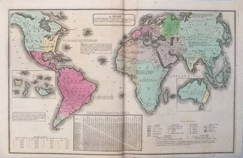
Sold2017Smith: Antique Map of the World, 1835Map: 1835 Smith World Map -- A Chart Exhibiting the Actual and Comparative Size of each Country, Nation, or Kingdom; its Population as a Whole and to a Square Mile. Also the Different States of SocietSee Sold Price
Sold20211835 Smith World Map -- A Chart Exhibiting the ActualTitle: 1835 Smith World Map -- A Chart Exhibiting the Actual and Comparative Size of each Country, Nation, or Kingdom; its Population as a Whole and to a Square Mile. Also the Different States of SociSee Sold Price
Sold2018Smith/Burgess: Antique Map of Africa, 1835Title/Content of Map: 1835 Smith/Burgess Map of Africa -- Africa Date Printed: 1835, Hartford Cartographer: C Smith / D Burgess Size: 8.7 x 10.4 in. This is a very nice map of Africa from the early 19See Sold Price
Sold2021Barlow 1807 Antique Map. World HemispheresCopper Engraved Map Published 1807 by Brightly & Kinnersley, Bungay, England for "A General View of the World, Geographical, Historical and Philosophical" by The Rev. E. Blomfield. Engraved by Barlow.See Sold Price
Sold2023Brookes & Baker 1797 Antique Map. World HemispheresCopper Engraved Map Published 1797, London for "The General Gazetteer; Or, Compendious Geographical Dictionary" by Richard Brookes. Engraved by B. Baker. Original outline hand colour. Folds as issued.See Sold Price
Sold2023Becker, F. P. C1845 Antique Map. World on Mercators ProjectionSteel Engraved Map Published C1845, London for "A Complete and Universal English Dictionary" by the Rev. James Barclay and B. B. Woodward. Maps by F. P. Becker. Outline hand color. Paper Size: 11 x 8See Sold Price
Sold2023Brookes, Richard 1791 Antique Map. World HemispheresCopper Engraved Map Published 1791, London for "The General Gazetteer; Or, Compendious Geographical Dictionary" by Richard Brookes. Folds as issued. Paper Size: 12 x 8 inch (31 x 21cm) A few small marSee Sold Price
Sold2024Russell, J. 1804 Antique Map. World HemispheresCopper Engraved Map with outline hand color Published 1804 by W. Peacock, London for "A Compendious Geographical Dictionary" Drawn and Engraved by J. Russell. Folds as issued. Paper Size: 6.5 x 5 inchSee Sold Price
Sold2020Becker, F. C1838 Antique Map. World on Mercator's Proj.Steel Engraved Map with outline hand color Published C1838, London for "A Complete and Universal English Dictionary" by the Rev. James Barclay et al. Maps by F. Becker and others. Paper Size: 10.5 x 8See Sold Price
Sold2020Becker, F. C1850 Antique Map. World on Mercator's Proj.Steel Engraved Map with outline hand color Published C1850 "A Complete and Universal English Dictionary" by the Rev. James Barclay et al. Maps by F. Becker and others. Paper Size: 10.5 x 8 inch (27 xSee Sold Price
Sold2022Rapkin, John 1860 Antique Map. World HemispheresSteel Engraved Map Published 1860 by The London Printing & Published Company, London for "The Royal Dictionary-Cyclopedia for Universal Reference" by Thomas Wright. Drawn & Engraved by John Rapkin. FoSee Sold Price
Sold2023Vyse, Charles 1805 Antique Map. World HemipsheresCopper Engraved Map Published 1805 (Map dated 1799) London for "Geography for Youth. A New Grammar: Containing A Comprehensive System of Modern Geography…" by Charles Vyse. Folds as issued, Paper SiSee Sold Price
Sold2022Brewster, David 1830 Antique Map. World on Mercator's Projection"Charte of the World on Mercator's Projection with the dip and variation of the Compass. The Trade Winds & Monsoons" Copper Engraved Map Published 1808-1830, Edinburgh for "The Edinburgh EncyclopaediaSee Sold Price
Sold2023Barclay & Milton C1810 Antique Map. World HemispheresCopper Engraved Map Published C1810, London for "Barclay's Universal Dictionary" by James Barclay. Original outline hand colour. Maps Engraved by W. Milton. Paper Size: 17 x 10.5 inch (43 x 27cm) MinoSee Sold Price
Sold2023Walker, John C1805 Antique Map. World HemispheresCopper Engraved Map Published C1805, London for "The Universal Gazetteer: Being a Concise Description" [Walker's Geography] by John Walker. Folds as issued. Paper Size: 13.5 x 8 inch (35 x 20cm) SomeSee Sold Price
Sold2022Brewster, David 1830 Antique Map. World HemipsheresCopper Engraved Map Published 1808-1830, Edinburgh for "The Edinburgh Encyclopaedia" Conducted by David Brewster. Folds as issued. Paper Size: 17 x 10.5 inch (43 x 27cm) Very minor background toning/oSee Sold Price
Sold2022Nat. Encyclo. 1891 Antique Map. World HemispheresLithograph Map Published 1891-1901 by William Mackenzie, London for "The National Encyclopedia: A dictionary of Universal Knowledge" Centre Fold as issued. Paper Size: 12 x 9.5 inch (31 x 24cm) Good CSee Sold Price
2018Covens and Mortier: Antique World Map, 1745Title/Content of Map: 1745 Covens and Mortier World Map -- Mappe-Monde Dressee sur les Observations de Mrs. de l'Academie Royale des Sciences et Quelques Autres et sur les Memoires les Plus Recens DatSee Sold Price
Sold2017Chatelain: Double Hemisphere Antique World Map, 1705Map: Mappemonde ou Description General du Globe Terrestre Cartographer: Henri Chatelain Place & Date: Amsterdam / 1705 Size: 17 1/4" x 13 1/4" Condition: wash color; overall age toning, repaired splitSee Sold Price
Sold2021VINTAGE GOLD FOIL 1630 ANTIQUE WORLD MAPVINTAGE GOLD FOIL 1630 ANTIQUE WORLD MAP "Nova Totius Terrarum Orbis Geographica Ac Hydrographica TAbvla" Print, Framed. Size: 23 X 19 inches. Private Collection.See Sold Price
Sold2023FRAMED ANTIQUE WORLD MAP BY PETER APIAN - 1520Description: FRAMED ANTIQUE WORLD MAP BY PETER APIAN - 1520Measurement approximate:Material: PaperSee Sold Price
Sold2017Rand McNally: Antique World Map, Rivers & MountainsMap: Rand McNally World Map and Comperative Chart of Rivers and Mountains -- The World on Mercator's Projection [verso] Western Hemisphere Cartographer: Rand McNally Year / Place: 1898, Chicago Map DiSee Sold Price
Sold2022Antique World Map - Colored Etching Pre 1775World Map. Due to laid paper technique, we believe it may be pre-1775. This map is based on the 1594 world map by Peter Plancius, but what draws the eye are the lively figures depicted in the corner sSee Sold Price
Sold2017Mitchell: Multi-Projection Antique World Map, 1867Map: The World in Hemispheres with Other Projections Cartographer: S. A. Mitchell Place & Date: Philadelphia / 1867/1870 Size: 13" x 11 1/4" Condition: wash color; overall age toning; nicks and frayinSee Sold Price
5 days LeftJasper52c1720 World showing Dutch East India Co possessions. CA as a island. By J.Malherbe$650
Featured5 days LeftJasper521771 ASTRONOMY by Joseph M. de La Lande 2 VOLUMES ILLUSTRATED antique in FRENCH$480
2 days LeftTrillium Antique Prints & Rare BooksPtolemy & Magini, pub. 1620 - Double Hemisphere Map of the World$400(5 bids)
2 days LeftTrillium Antique Prints & Rare BooksPtolemy & Magini, pub. 1620 - Map of the World with Six Windheads$130(4 bids)
Featured6 days LeftJasper52Bismarck Archipelago New Guinea New Britain 1943/4. Ports. World War 2 1961 map$8
2 days LeftTrillium Antique Prints & Rare BooksCarey, pub. 1814 - Map of the State of Tennessee$50(1 bid)
2 days LeftTrillium Antique Prints & Rare BooksCarey, pub. 1814 - Map of the Mississippi Territory$60(2 bids)
2 days LeftTrillium Antique Prints & Rare BooksCarey, pub. 1814 - Map of Scotland with the Principal Roads$50
6 days LeftJasper52MELANESIA.New Caledonia.Ponérihouen-Bourail.WW2 ROYAL NAVY INTELLIGENCE MAP 1944$10


![Walker, John C1805 Antique Map. World Hemispheres: Copper Engraved Map Published C1805, London for "The Universal Gazetteer: Being a Concise Description" [Walker's Geography] by John Walker. Folds as issued. Paper Size: 13.5 x 8 inch (35 x 20cm) Some](https://p1.liveauctioneers.com/3952/311930/166897808_1_x.jpg?height=310&quality=70&version=1701713718)


![Rand McNally: Antique World Map, Rivers & Mountains: Map: Rand McNally World Map and Comperative Chart of Rivers and Mountains -- The World on Mercator's Projection [verso] Western Hemisphere Cartographer: Rand McNally Year / Place: 1898, Chicago Map Di](https://p1.liveauctioneers.com/5584/108569/55677982_1_x.jpg?height=310&quality=70&version=1504123318)


