Sold201718th Century French Map of North AmericaL’Amerique Septentrionale. Daniel de la Feuille (1640-1709). Engraved map with hand color in full. Amsterdam, 1702 or 1706. 6 x 8 inches visible, 13 x 14 1/2 inches framed. Nicely colored early 18thSee Sold Price
Sold201718th C. French Map w/ Oiled Paper, ex-Sotheby'sEurope, France, map from 1709 CE, oiled paper overlays from 1756 to 1763 CE, owned by Louis-Alexandre Berthier (1753 to 1815 CE), Marshal, Vice-Constable of France, and Chief of Staff (Major general)See Sold Price
Sold202118th C. French Map "Le Noveau Mexique …"Ribobert Bonne (French, 1727-1794). "Le Nouveau Mexique, Avec La Partie Septentrionale De L'Ancien, ou De La Nouvelle Espagne" Published in Paris, 1780. Among the most collected late 18th century mapsSee Sold Price
Sold2018Framed 18th C. French Map of Ancient Rome**First Time At Auction** Louis Brion de la Tour (French, 1743-1810) & Louis Charles Desnos (French, 1725-1805), "Suite De L'Histoire De Rome", ca. 1760 to 1770. Copperplate engraved with original hanSee Sold Price
Sold201518th C French Map Of SteenvoordePLOUICH, Vedastus du -" Illvstrissimo viro domino" .The city of Steenvoorde is a small town located north of France. The city of Steenvoorde is located in the department of Nord of the french region.See Sold Price
Sold2021Pair 18th C French Maps after the AntiqueTo include "A View of the Town-House or Guild Hall of Paris" and "Vue de Chateau Royal D'amboise" : mid 20th century prints after the antique, housed in concave giltwood frames. Copperplate engravingsSee Sold Price
Sold2022GUILLAUME DE LISLE (1675-1726), AN 18TH CENTURY FRENCHGUILLAUME DE LISLE (1675-1726), AN 18TH CENTURY FRENCH COLONIAL MAP, "Carte de la Louisiane et de Cours du Mississipi," AMSTERDAM, CIRCA 1727, engraving on paper with ink inscriptions, after GuillaumeSee Sold Price
Sold2017GEORGE-LOUIS LE ROUGE (FRENCH, 18TH CENTURY)GEORGE-LOUIS LE ROUGE (FRENCH, 18TH CENTURY) REVOLUTIONARY WAR MAP hand-colored engraving on laid paper, "Theatre du Guerre en Amerique", published in Paris 1777, includes a small vignette of NiagaraSee Sold Price
Sold20221782 ATLAS MAPS Expilly Geography Voyages Travel World America Asia Africa1782 ATLAS MAPS Expilly Geography Voyages Travel World America Asia Africa Jean-Joseph Expilly was an 18th-century French geography and historian who published numerous works on cosmography, history oSee Sold Price
Sold20221777 ATLAS MAPS Expilly Geography Voyages Travel World America Asia Africa1777 ATLAS MAPS Expilly Geography Voyages Travel World America Asia Africa Jean-Joseph Expilly was an 18th-century French geography and historian who published numerous works on cosmography, history oSee Sold Price
Sold20201797 1st ed Napoleon Girardin French Invasion1797 1st ed Napoleon Girardin French Invasion of Britain French Revolution MAP Stanislas de Girardin was an 18th-century French military general who was an important catalyst in the French Revolution.See Sold Price
Sold2016FRENCH 18TH CENTURY ATLAS GENERAL(65) colored maps Overall- 12 3/4" x 17" Condition- some condition, lossesSee Sold Price
Sold2019FRENCH MINIATURE PORTRAIT18th c. Portrait of a Knight of the Court in armor, with sword, rolled map in hand, pendant order below his lace collar, in wooden frame under glass, 4" x 3 1/2". Damaged.See Sold Price
Sold202118TH C. MAP OF THE PERSIAN COAST, FRAMED"A Chart of the Coast of Persia, Guzarat & Malabar, drawn from the French Chart of ye Eastern Ocean, Publish'd in 1740, by Order of the Count de Maurepas, improved from particular Surveys and regulateSee Sold Price
Sold2023Book: 18th C. Description of Carolana with Maps"A description of the English province Carolana by the Spainiards call's Florida and French La Louisiane" by Daniel Coxe. Printed for by Olive Payne, 1741. 7-1/2in tall x 5in wide. | Philadelphia MetrSee Sold Price
Sold2018FRENCH 18TH CENTURY MAP OF BOSTON, MASSACHUSETTSFRENCH 18TH CENTURY MAP OF BOSTON, MASSACHUSETTS, on laid paper, title in top center "PLAN DE BOSTON", most likely Georges-Louis Le Rouge (French, c. 1712 to 1790), probably after John Bonner (EnglishSee Sold Price
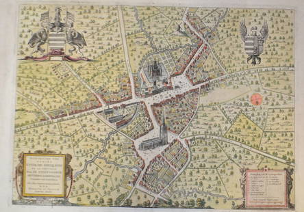
Sold201818th Map of French Region PicardieTopographical map of government of Castelet, dated 17th C, printed within an acanthuis border. S:17.5"H x 21.5"W F: 28"H x 31.5"WSee Sold Price
Sold201518th c. French verdure aubusson tapestryEarly 18th century French verdure aubusson tapestry, depicting a pond in a woodland setting with a village in the background, 114"h x 164"w.See Sold Price
Sold2017Period 18th Century French Walnut Commode,from south of France, nice polish, c. 1770, 32 h x 49 w x 24 d From Gary Elam Collection, acquired from Antonio's Antiques, San Francisco, personal collection.See Sold Price
Sold2022Monumental 18th C French Tooled Leather ChinoiserieA monumental 18th century gold gilt painted, tooled leather chinoiserie palace panel after Jean-Baptiste Pillement constructed of tooled leather applied to a wood board backer with green painted grounSee Sold Price
Sold2022Monumental 18th C French Tooled Leather ChinoiserieA monumental 18th century gold gilt painted, tooled leather chinoiserie palace panel after Jean-Baptiste Pillement constructed of tooled leather applied to a wood board backer with green painted grounSee Sold Price
Sold2021RARE PAINTED 18TH C. FRENCH LOUIS XVI PERIOD BANQUETTESThe outstanding pair of late 18th century banquettes or benches, early iterations Louis XVI motifs in simple renderings of grooved horizontal rails mortised into legs topped by simple unadorned blockSee Sold Price
Sold20213 Antique 18th c. French Chinoiserie Wall Paper PlaquesGroup of three plaques (France, ca. mid-18th century) depict Westernized Chinese social scenes, accented by motifs of fancy foliage, birds and architectural imagery. Formally fashioned in the early waSee Sold Price
Sold2023Set of late 18th C. French playing cardsANONYMOUS. FRENCH, 18th Century. A complete set of 36 Etteilla(marked "Eteila") playing cards for cartomancy, with etched illustrations. Cards 2 7/8in x 1 7/8in, on plain paper card backs. The face vaSee Sold Price
5 days LeftJasper521758 MAP PARTIE DE LA MER GLACIALE contenants La Nouvelle Zemble RUSSIA antique$55
5 days LeftJasper521770 French engraving map of Bonne,Rigobert Arabie. Mer Rouge et Golfe Persique$60
6 days LeftJasper52A New and Correct Chart of England, Scotland and Ireland. MOUNT & PAGE 1758 map$260
May 14Fleischer's Auctions1755 Map Partie de l'Amerique Septentrionale, qui comprend Le Cours de L'Ohio...$300(3 bids)
2 days LeftTrillium Antique Prints & Rare BooksBonne & Desmarest - Map of the Louisiana Territory from Great Lakes to Florida (Middle America)$50
2 days LeftTrillium Antique Prints & Rare BooksBonne & Desmarest - 5 Maps of the West Indies or Antilles Islands$50
2 days LeftTrillium Antique Prints & Rare BooksBonne & Desmarest - 4 Maps of Italy or surrounding Islands$50
Apr 30Plakas AuctionsA PAHARI/BASHOLI BIRD WITH AN INSECT PREY IN HIS BEAK, 18TH CENTURY, INDIA£1,600


![The Sea Coast of France from Ushent to Olone [Olonne]. MOUNT & PAGE 1758 map (1 of 1)](https://p1.liveauctioneers.com/5584/326140/175576897_1_x.jpg?height=282&quality=70&version=1713288521)


