Sold20221910 Railroad Map of Pennsylvania by Wall -- RailroadTitle: 1910 Railroad Map of Pennsylvania by Wall -- Railroad Map of Pennsylvania Published by the Department of Internal Affairs of Pennsylvania Cartographer: J S Wall / PA Dept. of Internal Affairs YSee Sold Price
Sold2024Pennsylvania Railroad July 8, 1885 Public TimetableThis is a Pennsylvania Railroad July 8, 1885 public timetable. Has 36 paneled pages (18 to a side) and is printed on one large piece of paper. An amazing route map is on the inside, featuring the PRRSee Sold Price
Sold2024Ohio and Pennsylvania RR 1st Annual Report-1849This is an Ohio and Pennsylvania Railroad first annual report dated 1849. The front cover has separated from the rest of this 24 page booklet, and the route map inside the cover has also separated. ThSee Sold Price
Sold2024Ohio and Pennsylvania RR 2nd Annual Report-1850This is an Ohio and Pennsylvania Railroad 2nd annual report dated 1850. Fine original condition, with 16 pages, and a complete route map inside the front cover. Later absorbed by the Pennsylvania RailSee Sold Price
Sold2020Antique Wall MapAntique Wall Map 1890s Rand McNally Master Map of USA Railroad and Land 9' X 10' 114" W 9"D Two MapsSee Sold Price
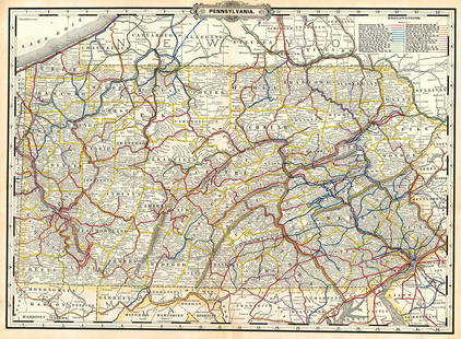
Sold2023Pennsylvania.Publication Date: 1889 Title: Pennsylvania. Cartographer: CRAM, GEORGE F. Publisher: GEO. F. CRAM Height: 16 Width: 22.30 Detailed map with railroad routes in colors. Letterpress on reverse. OrnamentaSee Sold Price
Sold2021A WABASH RAILWAY WALL MAP DATED 1928The full-color map for Wabash Railroad reads THE BANNER ROUTE OF THE CENTRAL STATES, copyright 1928, signed Poole Bros. Chicago. Measures 45.5 x 61 inches. We happily provide seamless in-house packingSee Sold Price
Sold2021A WABASH RAILWAY WALL MAP DATED 1928The full-color map for Wabash Railroad reads THE BANNER ROUTE OF THE CENTRAL STATES, copyright 1928, signed Poole Bros. Chicago. Measures 45.5 x 61 inches. Please be aware that this lot is too large tSee Sold Price
Sold20231902 Map of Vermont Highways, Natural Features, Railroad Stations, etc...This is a large, wall hanging 1902 Complete Map of Vermont Showing Highways and Natural Features, with an Index of All Cities, Villages, Post Offices, and Railroad Stations. Railroad routes are also sSee Sold Price
Sold20231855 Guide for the Pennsylvania Railroad with an Extensive Map from the Pennsylvania RailroadA 40 page Guide for the Pennsylvania Railroad with an Extensive Map; Including the Entire Route, with all its Windings, Objects of Interest, and Information Useful to the Traveler. Philadelphia: T.K.See Sold Price
Sold20231889 Chicago and Alton Railroad Map This is a large, wall hanging 1889 map of the Chicago and Alton Railroad, as well as a railroad map of the USA and Canada. The Chicago and Alton Railroad is highlighted, and the name of the railroad iSee Sold Price
Sold2024Great Western RY November 1, 1880 Public TimetableThis is a Great Western Railway November 1, 1880 public timetable. Has 32 paneled pages (16 per side) printed on one large piece of paper. Complete USA map with the Great Western route and all other USee Sold Price
Sold2023Chicago Rock Island and Pacific RR Autumn 1889 Public TimetableThis is a Chicago, Rock Island and Pacific Railroad Autumn 1889 public timetable. Has 40 total panels (20 to a side). Wonderful full color USA map on one side, showing the CRI&P routes, as well as mosSee Sold Price
Sold2021Pennsylvania Railroad Map of the Center and NortheastPaper map has good color, cant find a dated, framed, shows light wear, 20"x42"See Sold Price
Sold2021Map Postcard Collection [137947]About 60 postcards with maps. Many state maps, but also international, Map of the British Empire, railroad routes and others. Get one for every state!Date: Country (if not USA): State: City: ProvenancSee Sold Price
Sold20216 Railroad Publications incl. MapIncludes "The Future of Our Railways" (1920), "The Northern Pacific Railroad; Its Route, Resources, Progress, and Business" (1871) Pennsylvania Railroad Co. Steamer Richard Stockton Excursions (1879),See Sold Price
Sold20171936 Japanese Showa Period Map of ChinaItem: 1936 Japanese Showa Period Map of China Description: An interesting map of China, showing topographical features, the Great Wall, cities, railroads and sea routes. Insets are the regions of ChinSee Sold Price
Sold20241875 Rand Avery and Co. Map of Express Companies and Railroads of the USA and CanadaThis is an 1875 Rand Avery and Company Map of Express Companies of the USA and Canada. This map is paper on linen, and express routes are show in different colors, while all railroad lines are labeledSee Sold Price
Sold2015Railroad Maps and Trade CertificateRailroad Maps including; framed PRR map of Chesapeake Region, 1956, 20" x 28 1/2", 1893 railroad lines of the Pennsylvania System (folded), PRR Summer Excursion route (folded) and 1975 Conrail ServiceSee Sold Price
Sold2022The New Jersey Ocean Resorts on the Pennsylvania Railroad Map1908. 18 x 13 1/2 inches.See Sold Price
Sold2022Visit Washington / Go via Pennsylvania Railroad. USA, ca. 1...Visit Washington / Go via Pennsylvania Railroad. USA, ca. 1950s. Railroad travel poster with a porthole illustration of the Hall of the House of Representatives; yellow and blue lettering against crimSee Sold Price
Sold2022Hardcover 1908 State of Pennsylvania Railroad Map1908 State of Pennsylvania folding map of all railroads. Hardcover with lots of color. 58" by 38" unfolded.See Sold Price
Sold20231904 Pennsylvania Railroad Map of CitiesA book from the Pennsylvania Railroad Library for the Pennsylvania Railroad Map of Cities. The cover has gold lettering, a call number sticker on the spine, and shows discoloration along the edge. TheSee Sold Price
May 09Rail & Road Auctions1951 Chicago, Milwaukee, St. Paul & Pacific Railroad Wall Map - Route of the Hiawathas$50
May 09Rail & Road Auctions1961 Chicago, Milwaukee, St. Paul & Pacific Railroad Polychrome Wall Map$50
6 days LeftJasper52Great example of Johnson’s 1861 RR map of Illinois – Johnson/Browning$10
May 01Adam's AuctioneersPLOWDEN, Francis: An Historical Review of The State of Ireland [5 vols.] Philadelphia (William Mc€240
3 days LeftSchilb Antiquarian Rare Books1848 HUGE MAP Illustrated Guide for Travelers AMERICA Cities Travel Guide RARE$155(4 bids)
May 09Rail & Road Auctions1882 New York, Ontario and Western / New York West Shore and Buffalo Railroad Map$40
7 days LeftAntiques Online AuctionsPan American On The Routes of the Flying Clipper Ships Map$35(2 bids)
May 01Adam's AuctioneersCAREY'S General Atlas Improved and Enlarged, being a Collection of Maps of the World and Quarters,€2,200(2 bids)
May 09Rail & Road AuctionsPennsylvania Railroad "The General" Double Sided Gate Sign, Chicago - New York$150
May 01Adam's AuctioneersH.C CAREY AND I.LEA (publishers) A Complete Historical, Chronological and Geographical AMERICAN€1,500


![Map Postcard Collection [137947]: About 60 postcards with maps. Many state maps, but also international, Map of the British Empire, railroad routes and others. Get one for every state!Date: Country (if not USA): State: City: Provenanc](https://p1.liveauctioneers.com/2699/211819/108068744_1_x.jpg?height=310&quality=70&version=1626723835)


![PLOWDEN, Francis: An Historical Review of The State of Ireland [5 vols.] Philadelphia (William Mc (1 of 4)](https://p1.liveauctioneers.com/533/325941/175488528_1_x.jpg?height=282&quality=70&version=1712845571)


