Sold2016Nicolaes Visscher I (Dutch, 1618-1679) LeodiensisNicolaes Visscher I (Dutch, 1618-1679) Leodiensis Episcopatus. Hand-colored engraved map, 1677, together with two topographical prints: hand-colored etchings Sight: 18" x 22.75" Frame: 23" x 26.5"See Sold Price
Sold2020Map, Nicolas VisscherNicolas Visscher (Dutch, 1618-1709), "Insulae Americanae in Oceano Septentrionali ac Regiones Adjacentes," circa 1682, hand-colored engraving, sight (image): 18.25"h x 22"w, overall (with frame): 27.2See Sold Price
Sold2024Six Maps including Visscher's Map of America[SIX MAPS] 1. VISSCHER, Nicolas (1618-1679). Novissima et Accuratissima Totius Americae descriptio. Engraved map with original hand color. Amsterdam, c. 1677. 20" x 24" visible, 29 1/2" x 33 1/2" framSee Sold Price
Sold2023Visscher Map of South East AsiaVISSCHER, Nicolas (1618-1679). Indiae Orientalis, nec non Insularum Adiacentium Nova Descriptio. Engraved map with great original hand color in full. Amsterdam, c. 1698. 20 1/2" x 24 1/8" sheet. ThisSee Sold Price
Sold2022Early 18th cent Holy Land Map of JerusalemVisscher, after Nicolaum (Nicolaes) (Dutch, 1618-1679), Die Heylige und Weitberuhmte Stadt Jerusalem Erstlich Genant Salem, antique map, c. 1710s, published in a German bible by Johann Detleffsen, a sSee Sold Price
Sold2019Nicolao Visscher. Orbis Terrum Nova MapNicolao Visscher (Dutch, 1618-1709). A hand-colored engraved map, circa 1658. Orbis Terrum Nova et Accuratussna Tabula. Showing partial coastlines of New Zealand and Australia. Unframed. 23-1/2 in x 2See Sold Price
Sold2020Map, Nicolaes VisscherNicolaes Visscher (Dutch, 1618-1709), "Exactissima Platinatus Rheni ac Ducatus Bipontini Tabula," circa 1688, hand colored engraving, image (sight): 18"h x 22.25"w, overall (with frame): 25.25"h x 29.See Sold Price
Sold2023After Claes Jansz Visscher, Map of ParisAfter Claes Jansz Visscher (Dutch, 1586-1652), engraving on paper depicting a 1618 map of Paris, flanked on either side by illustrations of Parisian citizens from the King and Queen, to the common vilSee Sold Price
Sold2024Rare Antique Map - Hudson Bay Chart - Old Map of North America - Bellin - Jacques"Carte de la Baye de Hudson". Its finely engraved, hand-coloring engraved map from the Dutch edition of acques Nicolas Bellin Histoire "General of Travel". Published in Amsterdam. A handsome chart ofSee Sold Price
Sold2024Claes Visscher Reproduction 1618 Map of ParisClaes Janszoon Visscher II reproduction map of the city of Paris, Lutetia Parisorum urbs, toto orbe celeberrima notissimaque, caput regni Franciae, 1618. 24 1/4" x 35 1/4" (with frame 27 1/4" x 38 3/8See Sold Price
Sold2018Nicolaes Visscher I. Christ Before Pilatus. 1652.Nicolaes Visscher I (Dutch, 1618-1709). After Jacob Jordaens (Flemish, 1593-1678). "Christ Before Pilatus." From "Royal-Size Bible / Historiae Sacrae Veteris et Novi Testamenti..." 1652. "I. IordaensSee Sold Price
Sold2022NOVISSIMA ET ACCURATISSIMA TOTIUS AMERICAE FRAMED MAPNOVISSIMA ET ACCURATISSIMA TOTIUS AMERICAE FRAMED MAP Novissima et Accuratissima Totius Americae Descriptio map, circa 19th century, by Nicholas Visscher. Double-page map of North and South AmeriSee Sold Price
Sold2018AFTER NICOLAS SANSON (FRENCH, 1600-1667) MAP OF NORTHAFTER NICOLAS SANSON (FRENCH, 1600-1667) MAP OF NORTH AMERICA, hand-colored, on laid paper, title in cartouche to upper left corner lettered "NORTH AMERICA / Divided into it's Principall Parts / whereSee Sold Price
Sold2016CORNELIS DE VISSCHER AFTER ADRIAEN VAN OSTADECORNELIS DE VISSCHER AFTER ADRIAEN VAN OSTADE (DUTCH, 1618-1709), ENGRAVING, H 17 1/4", W 13 1/2":An etching and engraving after a painting by Van Ostade, (Dutch, 1618 - 1709). Titled 'Interior with aSee Sold Price
Sold2021Dutch Nicolaes Visscher I Map of New Amsterdam, ca 1690Nicolaes Visscher I. Map of Northeast with Early View of New York City. Ca. 1690 to 1729. A finely hand-colored example of Nicolaes Visscher I's illustrated map of the Northeast of America with an insSee Sold Price
Sold2018Visscher: Antique Map of Africa, 1670Title: Africæ Accurata Tabula. 17th century Visscher map of Africa Map maker: Nicolas Visscher Place and Year: Amsterdam, c. 1670 Dimensions: 43.5 x 54 cm (17¼ x 21¼ in) Technique: Copperplate engrSee Sold Price
Sold2022Scarce 1705 map of North America by Nicolas de Fer (Calif. as island)Nice example of de Fer's scarce map of North America, first published in Paris in 1693. This specimen with a 1705 date is from the 1723 edition of de Fer’s Petit et Nouveau Atlas and features laterSee Sold Price
Sold2022(PELOPONNESUS.) Nicolas Visscher. Peloponnesus Hodie Morea.(PELOPONNESUS.) Nicolas Visscher. Peloponnesus Hodie Morea. Double-page engraved map of the kingdom of Morea with the title cartouche symbolizing the contemporary Venetian conquest over the Ottoman TuSee Sold Price
Sold2023c 1706 Pieter Van Der Aa North + South America Map as 1st Discovered by ColumbusHistoric Maps 1706 North & South America Map Discovered by Columbus First Voyage Published by Dutch Map Pieter Van Der Aa (1659-1733) c. 1706-1708, Original Map of North & South America (translated) tSee Sold Price
Sold2023Visscher Map of Middleburgh, HollandVISSCHER, Nicolas II (1649-1702). Untitled [Middelburgh] Engraved map with original hand color. Amsterdam, c.1690 21 1/2" x 24 3/8" sheet. Antique Map showing the then Island of Middleburgh in HollandSee Sold Price
Sold2024Framed Vintage Style Visscher Commander Repro Map"Among the many great Dutch map publishers active in the seventeenth century were the Visscher family, begun by Claes Jansz Visscher (1587-1652) and continued by his son Nicolaas (Piscator jun. 16See Sold Price
Sold2021Map of the NetherlandsFramed map of Novi Belgii, printed in USA, reproduced form an engraving by Nicolas Visscher. [Frame: 18" H x 21 3/4" W]. In good condition.See Sold Price
Sold2015Scarce Hudson-Fulton Celebration TapestryA woven tapestry with the Roman numerals for 1626 at center top for the year Manhatten was purchased from the Native Americans by the Dutch, and showing map of the Dutch colony in North America entitlSee Sold Price
Sold2024Original Antique Map of China, Macau and Canton - Asia - Jacques Nicolas BellinIts finely engraved, hand-coloring engraved map from the Dutch edition of acques Nicolas Bellin Histoire General des Voyages. Published in Amsterdam, 1770 year. This fine copperplate map from that ediSee Sold Price
5 days LeftJasper52Le Comté d'Artois et des environs'. N France & W Belgium. VISSCHER c1680 map$300
BonhamsSEUTTER, MATTHÄUS. 1678-1757. And TOBIAS CONRAD LOTTER. 1717-1777. Recens edita totius Novi...$900(1 bid)
Apr 28South Jersey Auction by Babington Auction IncFramed map of North America and Central America$25
May 09Hunt and Peck Estate Services, Inc.Jacques Nicolas Bellin Map Of Western Part Of New France Or Canada$200
15 hrs LeftNorth American Artifact Auctions10 Book Set The Book of Art A Pictorial Encyclopedia of Painting, Drawing, and Sculpture Copyright$35(2 bids)
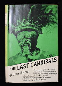
15 hrs LeftNorth American Artifact AuctionsTHE LAST CANNIBALS by JENS BJERRE 1957 Fine or Near Fine$10(1 bid)
15 hrs LeftNorth American Artifact AuctionsWar Diary of 354th Infantry - 89th Division 1919$10(1 bid)
15 hrs LeftNorth American Artifact AuctionsRand McNally & Co's New Ideal State and County Survey and Atlas 1911$10(1 bid)


![Six Maps including Visscher's Map of America: [SIX MAPS] 1. VISSCHER, Nicolas (1618-1679). Novissima et Accuratissima Totius Americae descriptio. Engraved map with original hand color. Amsterdam, c. 1677. 20" x 24" visible, 29 1/2" x 33 1/2" fram](https://p1.liveauctioneers.com/1968/314554/168606424_1_x.jpg?height=310&quality=70&version=1704142666)


![Visscher Map of Middleburgh, Holland: VISSCHER, Nicolas II (1649-1702). Untitled [Middelburgh] Engraved map with original hand color. Amsterdam, c.1690 21 1/2" x 24 3/8" sheet. Antique Map showing the then Island of Middleburgh in Holland](https://p1.liveauctioneers.com/1968/297676/158406682_1_x.jpg?height=310&quality=70&version=1690906360)

![Map of the Netherlands: Framed map of Novi Belgii, printed in USA, reproduced form an engraving by Nicolas Visscher. [Frame: 18" H x 21 3/4" W]. In good condition.](https://p1.liveauctioneers.com/1221/193827/98401041_1_x.jpg?height=310&quality=70&version=1613857875)


![CHATELAIN, HENRI. 1684-1743. Carte De La Nouvelle France.... [Amsterdam: 1719.] (1 of 3)](https://p1.liveauctioneers.com/1043/324005/175444939_1_x.jpg?height=282&quality=70&version=1713537622)