Sold2023Collection: Maps, Atlases and CalligraphyMaps, Atlases and Calligraphy. - a collection of 25 volumes (including: D.W. Marshall & H.H. Peckham. Campaigns of the American Revolution. [Ann Arbor, Mich.: 1976], folio. Original cloth, dust-jacketSee Sold Price
Sold2017Armillary Sphere by Andreas Cellarius, 1600 ArmillaryArmillary Sphere by Andreas Cellarius, 1600, reproduction from the original in the Rand McNally & Company collection, map of the globe with different Latin writing, professionally framed and matted, cSee Sold Price
Sold2022Middle East.- Saudi Arabia.- Saudi Aramco (publisher) Collection of maps and ephemera from compiledMiddle East.- Saudi Arabia.- Saudi Aramco (publisher) and others. Collection of maps and ephemera compiled by a British Engineer working in the Middle East, including 5 laminated maps of Saudi Arabia,See Sold Price
Sold2023Collection of Maps on North & South AmericasA collection of vintage maps of North and South Americas, some old, some newer, some color, hand colored, and black and white, including Manhattan, United States, South America, and some Caribbean IslSee Sold Price
Sold2023Collection of MapsCollection of maps including; 1.) Travel Map of Massachusetts, Connecticut and Rhode Island published by B. Brown & Parsons, Hartford, Connecticut, 1838. Map measures 14.5" x 20". Map exhibits some spSee Sold Price
Sold2021[MAPS] A COLLECTION OF MAPS SOLD TOGETHER[MAPS] A collection of maps sold together, including: Bell, A. A NEW CHART OF THE RIVER ST. LAWRENCEFROM THE ISLAND OF ANTICOSTI TO LAKE ONTARIO. London: R. Baldwin, [1759]. Engraved map, 18 x 25 cm.See Sold Price
Sold2020American Progression Map CollectionItems as shown. Collection of 10 Maps Framed 32x21.5 Framed VintageSee Sold Price
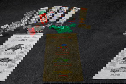
Sold2024Large Collection of Maps After Henri CHATELAINLarge collection of 20th century engravings after Henri Abraham Chatelain (French, 1684-1743) including assorted maps from "Atlas Historique," originally published between 1705 and 1720. Collection inSee Sold Price
Sold2023Book Collection, Early Maps Of The Americas (10pc)(1) "America: Early Maps of the New World" Edited by Hans Wolff (Munich: Prestel. 1992), Folio, hardcover with dj, 192pp; (1) "The Mapping of New Spain: Indigenous Cartography and the Maps of the RelaSee Sold Price
Sold2019Collection of maps depicting Essex (qty) - StockCollection of maps depicting Essex (qty) - Stock Ref:255-39See Sold Price
Sold2017COLLECTION OF MAPSPORTUGAL, OKLAHOMA INDIAN TERRITORY, AMSTERDAM, BERLIN, CUBA. SMALLEST IS 9 1/2" BY 11 1/2". LARGEST IS 13" BY 18 1/2"See Sold Price
Sold2017COLLECTION OF MAPSWORLD MAP, ASIA, NEW YORK CENTRAL, COLORADO, ALSO BROCHURES INCLUDING SHELL GAS STATION AND OTHERS.See Sold Price
Sold2022The Decline of the Roman Empire 12-Coin Collection with MapThe Decline of the Roman Empire 12-Coin Collection with Map SKU: 167344 Year: Varies Grade: Average Circulated Grade Service: Other Denomination: Varies Mint Mark: Not Shown Metal ContentSee Sold Price
Sold2022MAPS IN BOOK, Atlases, CareyCarey's Famous 1814 General Atlas. Atlases. Mathew Carey, Carey's General Atlas, Improved and Enlarged: Being a Collection of Maps of the World and Quarters, Their Principal Empires, Kingdoms, &c., 18See Sold Price
Sold20201855 Smith’s ATLAS Geography 36 BEAUTIFUL Colored MAPS1855 Smith’s ATLAS Geography 36 BEAUTIFUL Colored MAPS World ‘Smith’s Atlas of Modern and Ancient Geography’ is a collection of maps focusing on the United States, but includes maps of the worSee Sold Price
Sold2023[DAKOTA]. The Mercantile Agency Reference Book (And Key) with A List of Banks and Bankers, State[DAKOTA]. The Mercantile Agency Reference Book (And Key) with A List of Banks and Bankers, State Collection Laws, Maps, Etc. New York: R. G. Dun & Co., 1908. Square 8vo. Two maps of North Dakota printSee Sold Price
Sold2024Carey, pub. 1814 - Map of Mexico or New SpainThis engraved map is from Mathew Carey's General Atlas, improved and enlarged: being a collection of maps of the world and quarters, their principal empires, kingdoms, &c. The work was published in PhSee Sold Price
Sold2024Carey, pub. 1814 - A Chart of the WorldThis engraved map is from Mathew Carey's General Atlas, improved and enlarged: being a collection of maps of the world and quarters, their principal empires, kingdoms, &c. The work was published in PhSee Sold Price
Sold2021Miscellaneous United States Railroad Ephemera (38)Lot of 38. Collection of maps, time schedules, pamphlets, flyers, and magazine articles for railroads throughout the country including Texas Electric Railway, McKinney Avenue Transit Authority (DallasSee Sold Price
Sold2016Hindoostan, India, Nepal, Pakistan, Ceylon, 1839Original engraving from "New General Atlas, being a Collection of Maps of the World & Various Quarters" published by Allan Bell & Co., in London, 1839. Dimensions: 14.25 x 20 inches.See Sold Price
Sold2021THE WEST POINT ATLAS OF AMERICAN WARS, V. ESPOSITO:THE WEST POINT ATLAS OF AMERICAN WARS, V. ESPOSITO: 1st Edition of 1959, Two Volumes by Frederick Praeger Publisher. Best Collection of Maps of American Wars from the French and Indian to Korean War.See Sold Price
Sold20241816 MAP SOUTHERN PART OF RUSSIA or MUSCOVY in EUROPE copper engraving ANTIQUEAntique engraved map of Southern part of Russia from A General Atlas, Being A Collection Of Maps Of The World And Quarters, Their Principal Empires, Kingdoms, &c. Containing Fifty Eight Maps And ChartSee Sold Price
5 days LeftAdam's AuctioneersCAREY'S General Atlas Improved and Enlarged, being a Collection of Maps of the World and Quarters,€2,200(2 bids)
2 days LeftTrillium Antique Prints & Rare BooksCarey, pub. 1814 - Map of the State of Tennessee$50(1 bid)
2 days LeftTrillium Antique Prints & Rare BooksCarey, pub. 1814 - Map of the Mississippi Territory$60(2 bids)
May 09Hunt and Peck Estate Services, Inc.Abraham Ortelius map of Bitiurigum from Theatrum Orbis Terrarum$50
2 days LeftTrillium Antique Prints & Rare BooksCarey, pub. 1814 - Map of Scotland with the Principal Roads$50
11 hrs LeftHannam's Auctioneers LtdA rare collection of WW2 Maps of the Tobruk together with canvas map case£170(1 bid)
1 day LeftJeschke Jadi Auctions Berlin GmbHSammlung von zwei altkolorierten Kupferstichkarten. 18. Jh. Maße je ca. 53 x 65 cm.€200
May 04Private NY Collection1797 Universal Magazine BOTANY PLATES Flowers FRUIT 12 Copper Engraved Plates$100
6 days LeftDoyle New YorkA collection of Edward Gorey books and ephemera, most signed to Michael Feingold$1,000


![Collection: Maps, Atlases and Calligraphy: Maps, Atlases and Calligraphy. - a collection of 25 volumes (including: D.W. Marshall & H.H. Peckham. Campaigns of the American Revolution. [Ann Arbor, Mich.: 1976], folio. Original cloth, dust-jacket](https://p1.liveauctioneers.com/3975/301526/160693994_1_x.jpg?height=310&quality=70&version=1694182765)


![[MAPS] A COLLECTION OF MAPS SOLD TOGETHER: [MAPS] A collection of maps sold together, including: Bell, A. A NEW CHART OF THE RIVER ST. LAWRENCEFROM THE ISLAND OF ANTICOSTI TO LAKE ONTARIO. London: R. Baldwin, [1759]. Engraved map, 18 x 25 cm.](https://p1.liveauctioneers.com/1124/208511/106199202_1_x.jpg?height=310&quality=70&version=1624388585)


![[DAKOTA]. The Mercantile Agency Reference Book (And Key) with A List of Banks and Bankers, State: [DAKOTA]. The Mercantile Agency Reference Book (And Key) with A List of Banks and Bankers, State Collection Laws, Maps, Etc. New York: R. G. Dun & Co., 1908. Square 8vo. Two maps of North Dakota print](https://p1.liveauctioneers.com/197/290824/154051809_1_x.jpg?height=310&quality=70&version=1685134375)