Sold2023Underground Water Map New Mexico Carlsbad SheetPublication Date: 1899 Title: Underground Water Map New Mexico Carlsbad Sheet Cartographer: GARDNER, FRANK D./JOHN STEWART Publisher: U.S. DEPT. AGRICULTURE Height: 21 Width: 15.75 Area geologic map.See Sold Price
Sold20201854 Black's Map of Mexico, Texas and California --Title/Content of Map: 1854 Black's Map of Mexico, Texas and California -- Mexico, California, Texas Date: 1854, Edinburgh Cartographer: A & C Black Size: 10 X 14.5 in. This is a very nice map of MexicSee Sold Price
Sold2018LONDON. Vintage Underground / Tube map 1933 old vintageTITLE/CONTENT OF MAP: 'Map of the Underground Railways of London' DATE: 1933 IMAGE SIZE: Approx 18.5 x 30.5cm, 7.25 x 12 inches (Medium) TYPE: Colour vintage street atlas map CONDITION: Good; suitableSee Sold Price
Sold20181720 Homann Map of Black Sea, Southern Russia andTitle/Content of Map: 1720 Homann Map of Black Sea, Southern Russia and Ukraine -- Tabula Geographica qua pars Russiae Magnae Pontus Euxinus seu Mare Nigrum et Tartaria Minor cum finitimis Bulgariae,See Sold Price
Sold2019Map of a Reconnaissance of the Black Hills. ...Title/Content of Map: Map of a Reconnaissance of the Black Hills. ... Date: 1874 Cartographer: LUDLOW, WILLIAM (1843-1901) Publisher: WAR DEPARTMENT Size: 25Height - 21Width D. Martin Sculpt. Shows FlSee Sold Price
Sold2022LONDON UNDERGROUND tube map diagram plan. First STINGEMORE edition 1925TITLE/CONTENT OF MAP: Underground Railways of London [694 11.5.25] This is the first edition of an Underground geographic map designed by F H Stingemore. It is one of the first designs not to show anySee Sold Price
SoldBOSTON MAPS. Map of the City of Boston, Massachusetts, Published by the City Planning Board.BOSTON MAPS. Map of the City of Boston, Massachusetts, Published by the City Planning Board. Engraved map on paper backed with linen, in black and white with blue, in folding sections with black cardSee Sold Price
Sold2016Scheffer (John) - The History of Lapland,first English edition , additional engraved title with small repair to lower margin, engraved map water-stained, woodcut illustrations including title vignette, some short tears to lower margins, someSee Sold Price
Sold2022Britain.- Cary (John) Cary's New Itinerary..., first edition, 1798 & others, British topography (7)NO RESERVE Britain.- Cary (John) Cary's New Itinerary; or, an Accurate Delineation of the Great Roads..., first edition, engraved title and dedication, folding engraved map (water-stained, torn and reSee Sold Price
Sold20201850 Tallis Map of the Black Sea Region -- Black SeaTitle/Content of Map: 1850 Tallis Map of the Black Sea Region -- Black Sea Cartographer: J Tallis Year/Place: 1850, London Size: 9.8 X 12.3 in. This is an excellent map of the Balck Sea area, technicaSee Sold Price
Sold2017Map of Principal Countries of the Ancient World, 1885Map: Map of the Principal Countries of the Ancient World From Black's General Atlas of the World New and Revised Edition. Edinburgh 1885 Size: 23.5 x 17.75 inches No Reserve: This lot starts at $1 andSee Sold Price
Sold2020Mediterranean & Black Seas [East sheet]. Greece TurkeyTITLE/CONTENT OF MAP: [A map of the Mediterranean Sea with the adjacent regions and seas in Europe, Asia and Africa - east sheet] The top image on the right hand side shows the entire map. To view a cSee Sold Price
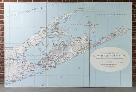
Sold2022Three Panel Water Current Map of Eastern Long Island on Canvas with FrameOver scaled Eastern Long Island water current map on three panel canvas, strengthened on frame. Please note of wear consistent with age. Each panel measures 48"W x 2"D x 96"H.See Sold Price
Sold2022Oil, Gas, Petrolina Rare 1960s Texaco water ways mapsOil, Gas, Petrolina Rare 1960s Texaco water ways mapsSee Sold Price
Sold2022Water distribution in San Francisco 1894Heading: -1894 Author: Spring Valley Water Company Title: Map of San Francisco showing the Water Service of Spring Valley Water Works... Place Published: San Francisco Publisher:Britton & Rey DatSee Sold Price
Sold2024Penn State Mental Hospital & Advertising Ephemera1951 Harrisburg Pennsylvania State Hospital underground passageway maps, book about mental health care in Pennsylvania, "The City on the Hill" book by Ernest Morrison, Bear Brand Baby Book, Noah's ArkSee Sold Price
Sold2018Modernist Map Drawing. Large scale urban map on bModernist Map Drawing. Large scale urban map on black ground. -- Dimensions: Image Size: H: 48 inches: W: 68 inches ---See Sold Price
2017Gray: Map of Countries Surrounding the Black Sea, 1883Map: Gray's New Map of the Countries Surrounding the Black Sea: Comprising Turkey in Europe, and Part of Turkey in Asia, Greece (Hellas) Southern Russia, Etc... Publication Date: 1883 Authors: STEDMANSee Sold Price
Sold2017Gray's Antique Map of Countries Surrounding Black SeaMap: Gray's New Map of the Countries Surrounding the Black Sea Comprising European Turkey Southern Russia Asia Minor Etc. Publication Date: 1877 Authors: O.W. GRAY & SON, GRAY, FRANK A. Publisher: O.WSee Sold Price
Sold2018Gray's New Map of the Countries Surrounding the BlackTitle/Content of Map: Gray's New Map of the Countries Surrounding the Black Sea: Date: 1883 Cartographer: GRAY, FRANK A. Size: 16.3X26.8 "...comprising Turkey in Europe, and part of Turkey in Asia, GrSee Sold Price
Sold2022COMIC MAP ROSE (FREDERICK W.) Angling in Troubled Waters - A Serio-Comic Map of Europe, G.W. Bac...COMIC MAP ROSE (FREDERICK W.) Angling in Troubled Waters - A Serio-Comic Map of Europe, chromolithographed pictorial map, tears to folds some folds split, 3 small areas of loss to image (in body of TSee Sold Price
Sold2023'MAP', Sterling Silver Water PitcherSterling silver water pitcher, with spherical body, wide spout, scrolled handle, marked "MAP" total weight: 31.16 ozt. height 9 in. x width 9.5 in. x depth 7 in. Provenance: The Estate of cardiologSee Sold Price
Sold2022Waterfront map of San Francisco, 1918Heading: -1918 Author: Hosmer, A. B. Title: Map of the Water Front of San Francisco from Twenty Fourth St. to Laguna St. Scale 600 ft.=1 inch Place Published: [San Francisco?] Publisher:[Board of StatSee Sold Price
7 days LeftJasper52LONDON UNDERGROUND tube map diagram of lines. Middle Circle. HARRY BECK #2 1936$300
7 days LeftJasper52Underground Map of London. Tube network. No print code. June-August/mid 1924$1,100
7 days LeftJasper52Metropolitan Railway and Connections. London Underground. SELBIE c1930 old map$440
7 days LeftJasper52LONDON UNDERGROUND tube map diagram plan. Northern Heights SCHLEGER/ZERO #2 1939$260
7 days LeftJasper52LONDON UNDERGROUND tube map plan diagram. Northern Heights SCHLEGER/ZERO #3 1939$260
7 days LeftJasper52LONDON UNDERGROUND tube map plan diagram. Northern Heights SCHLEGER/ZERO #1 1940$280
7 days LeftJasper52LONDON UNDERGROUND tube map diagram plan. Piccadilly extension. STINGEMORE 1931$280
7 days LeftJasper52LONDON UNDERGROUND tube map plan diagram. Northern Heights SCHLEGER/ZERO #1 1940$280
7 days LeftJasper52London's Underground. What to See/How to Travel. Macdonald Gill. March 1922 map$700


![LONDON UNDERGROUND tube map diagram plan. First STINGEMORE edition 1925: TITLE/CONTENT OF MAP: Underground Railways of London [694 11.5.25] This is the first edition of an Underground geographic map designed by F H Stingemore. It is one of the first designs not to show any](https://p1.liveauctioneers.com/5584/263211/137236971_1_x.jpg?height=310&quality=70&version=1664917902)


![Mediterranean & Black Seas [East sheet]. Greece Turkey: TITLE/CONTENT OF MAP: [A map of the Mediterranean Sea with the adjacent regions and seas in Europe, Asia and Africa - east sheet] The top image on the right hand side shows the entire map. To view a c](https://p1.liveauctioneers.com/5584/167533/84481141_1_x.jpg?height=310&quality=70&version=1588715327)


![Waterfront map of San Francisco, 1918: Heading: -1918 Author: Hosmer, A. B. Title: Map of the Water Front of San Francisco from Twenty Fourth St. to Laguna St. Scale 600 ft.=1 inch Place Published: [San Francisco?] Publisher:[Board of Stat](https://p1.liveauctioneers.com/642/242590/125758454_1_x.jpg?height=310&quality=70&version=1648613138)


