Sold2017Allard Map of America with California as Island, 1697Map: Allard Map of America with California as Island - Recentissima Novi Orbis sive Americae Septentrionalis et Meridionalis Tabula Cartographer: C. Allard Date: ca. 1697 Size: 19 x 22.5 inches Nice lSee Sold Price
Sold2020WIT, FREDERICK de. Novissima et Accuratissima TotiusWIT, FREDERICK de. Novissima et Accuratissima Totius Americae Descriptio. Double-page engraved map of the Americas showing California as an island. 20x23½ inches sheet size, ample margins; originSee Sold Price
Sold2017Bertius: Descriptio Americae Map, 1616Map: Descriptio Americae Maker: Petrus Bertius Date: 1616 Medium: Original handcolored copper plate engraving Size: 3.75 x 5.25 inches A remarkably accurate map of the Americas showing California attaSee Sold Price
Sold20221692 Peeters Map of the Americas -- AmericaeTitle: 1692 Peeters Map of the Americas -- Americae Cartographer: J Peeters Year / Place: 1692, Antwerp Map Dimension (in.): 5.9 X 7.3 in. This superb map of the Americas features California as an islSee Sold Price
Sold2017Sanson: Antique Map of Americas with Atlantis, 1699Map: 1699 Sanson Map of Americas with Mythical Atlantis and California as Island -- Atlantis Insula, a Nicolao Sanson Antiquitati Restituta; nunc demum Majori Forma Delineata, et in Decem Regna, iuxtaSee Sold Price
Sold2020Covens & Mortier Map of the World ca. 1700 CalifoJohannes Covens (1697-1774) and Cornelius Mortier (1699-1783), "Carte Generale du Monde, ou Description du Monde Terrestre & Aquatique," Amsterdam, ca. 1700. This map of the world shows California asSee Sold Price
Sold2022Wells' world map with California an Island 1700Heading: Author: Wells, Edward Title: A New Map of the Terraqueous Globe according to the Ancient Discoveries and most general Divisions of it into Continents and Oceans Place Published: London PubliSee Sold Price
Sold2023America. North/South Americas. California Missions. THOMSON 1830 old mapTITLE/CONTENT OF MAP: 'America' DATE PRINTED: 1830 IMAGE SIZE: Approx 53.0 x 64.0cm, 20.75 x 25.25 inches (Large); Please note that this is a folding map. TYPE: Antique early 19th century atlas map wiSee Sold Price
Sold2023AMERICA H. Moll Geographer 1732 MapHerman Moll 1732 Map of the Americas, North and South America with California depicted as an island. Hand Colored engraving 8 1/2 x 11 in Matt.See Sold Price
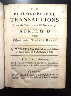
Sold20221721 Philosophical Transactions Map of CaliforniaTitle: 1721 Philosophical Transactions Map of California Description: "The Philosophical Transactions (From the Year 1700 to the Year 1720) Abridg'd and Dispos'd under General Heads", by Henry Jones,See Sold Price
Sold2019AMERICAS. Shows California as an Island. 'NouveauTITLE OF THE MAP: 'Nouveau Continent ou Amerique' DATE PRINTED: 1683 IMAGE SIZE: Approx Overall page size 13 x 21cm approximately (5 x 8 inches); image size 10.5 x 14.5cm approximately (4 x 5.5 inchesSee Sold Price
Sold2020AMERICAS SHOWING CALIFORNIA AS AN ISLAND. 'NouveauTITLE OF THE MAP: 'Nouveau Continent avec plusieurs Isles' Australia appears partly outlined. The top image on the right hand side shows the entire map. To view a close up of the map showing the levelSee Sold Price
Sold2017Mallet: Antique Map of the Americas, 1683Map Title: 'Nouveau Continent avec plusieurs Isles' Australia appears partly outlined. AMERICAS SHOWING CALIFORNIA AS AN ISLAND. 'Nouveau Continent'. Date Printed: 1683 Image Size: Approx Overall pageSee Sold Price
Sold20221685 Map of the Americas, w/California an IslandHistoric Maps Hand-Colored Map titled, "L'AMERIQUE SUIVANT LES DERNIERES OBSERVATIONS," of North and South America with California shown as a Separate Island c. 1685, Copper Plate Engraved, Hand-ColorSee Sold Price
Sold2017Meullers: Antique Map of the Americas, 1758Title: 1758 German map of America with peculiar (and late) Island of California. America oder Neu Europa Map maker: Johann Bernhard Meullers, Leben un gewohnheiten der Ostjacken Place and Year: [BerliSee Sold Price
Sold2018De L'Isle Engraved Map of the AmericasCarte d'Amerique dressée pour l'usage du Roy. Guillaume De L'Isle (1675-1726) & Philippe Buache (1700-1773). Engraved map with hand color in part. Paris, 1722 (1763). 21 1/2 x 27 3/4 inches sheetSee Sold Price
Sold2022(AMERICAS.) Herman Moll. A Map of America According to ye Newest and Most Exact Observations.(AMERICAS.) Herman Moll. A Map of America According to ye Newest and Most Exact Observations. Engraved map of North and South America showing California as an island. 11½x7¾ inches sheet sizSee Sold Price
Sold2016101 MapsVarious Ages, Conozca Sus Raices, 20th Century Map of the Indigenous Peoples of Mexico and Centro America,1995, 24" x 19", folds; 35 Topographical Map of the Mineral Districts of California, 1853, copSee Sold Price
Sold2015Two Hand-Colored Old World MapsTwo Hand-Colored Old World Maps of England/Wales and the Americas, consisting of "Accuratissima Angliae Regni et Walliae Principatus...", engraved by Cornelis Danckerts, ca. 1690-1700, plate 20-1/2" xSee Sold Price
Sold20181700 Pacific sea chart with Island of California andTitle: Mer de Sud ou Pacifique contenant l'Isle de Californe. Map maker: Pierre Mortier Place and Year: Amsterdam, 1700 Dimensions: 60 x 74.5 cm (23.6 x 29.3 in) Technique: Copperplate engraving ColorSee Sold Price
Sold20241717 MAP of AMERICA antique authentic CALIFORNIA AS AN ISLAND L'AmeriqueAmericas. L'Amerique, Meridionale et Septentrionale Dressee Selon les Dernieres Relations et Suivant les Nouvelles Decouverte... by Fer (Nicholas de) (1646-1720) engraver Inselin, C. A Paris :b Chez lSee Sold Price
Sold2023America Aurea Pars Altera Mundi MapCirca 1700, North And South America With California As An Island, Hand Colored Engraving, Sight 20 X 23 Inches, Matted And Framed 29 X 32 X 0.5 Inches. See Photos For Additional Condition Information.See Sold Price
Sold2022(AMERICAS.) Christoph Weigel. Novi Orbis Sive Totius Americae cum Adiacentibus Insulis.(AMERICAS.) Christoph Weigel. Novi Orbis Sive Totius Americae cum Adiacentibus Insulis. Engraved map of the western hemisphere showing California as an island and a decorative figural title cartouche.See Sold Price
Sold20171703 Scherer - World Map [California as an Island]Title: World Map [without title] "Map maker: Heinrich Scherer, Atlas Marianus" "Place and Year: Munich, 1703" "Dimensions: 23.6 x 35.5 cm (9.3 x 14 in)" "Technique: Copperplate engraving" "Coloring: USee Sold Price
7 days LeftJasper521865 Colton Map of US Southwest -- Colton's Map of California, Nevada, Utah, Colorado, Arizona & New$160
7 days LeftJasper521700 Schenk Map of Russian Empire -- La Russie Blanche ou Moscovie Divisee Suivant l'Estendue des$240
Featured20 hrs LeftJasper521st ed. of Moll’s fascinating 1701 map of Isle of California$160(3 bids)
May 16Potter & Potter AuctionsPictorial Map of Hollywood and Vicinity / Hollywood Film Ca...$125(1 bid)
7 days LeftJasper521699 Moll World Map with Cowley's Voyages -- Nouvelle Carte du Monde Suivant l'idee de Mercator ou$240
7 days LeftJasper521719 Chatelain World Map -- Mappe-Monde pour Connoitre les Progres & les Conquestes les Plus$280
7 days LeftJasper521930 Map of Hollywood, California -- Security-First National Bank Map of Hollywood and Vicinity$280


![1703 Scherer - World Map [California as an Island]: Title: World Map [without title] "Map maker: Heinrich Scherer, Atlas Marianus" "Place and Year: Munich, 1703" "Dimensions: 23.6 x 35.5 cm (9.3 x 14 in)" "Technique: Copperplate engraving" "Coloring: U](https://p1.liveauctioneers.com/5584/112867/57947644_1_x.jpg?height=310&quality=70&version=1511920104)


