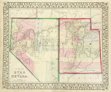
Sold2018Mitchell: Antique Map of Utah and Nevada,1870Title/Content of Map: 1870 Mitchell Map of Utah and Nevada -- County Map of Utah and Nevada Date Printed: 1870 Philadelphia Cartographer: S Mitchell Size: 10.6 X 13.5 in. Handsome county map of Utah aSee Sold Price
Sold2021Large map of San Mateo County Cal. 1913Heading: (California - San Mateo County) Author: Denny, Edward, & Co. Title: Denny's Pocket Map of San Mateo County, California. Compiled from latest official and private data Place Published: San FraSee Sold Price
Sold20231877 Mitchell Map of Utah and Nevada [verso] Arizona and New Mexico -- County Map of of Utah andTitle: 1877 Mitchell Map of Utah and Nevada [verso] Arizona and New Mexico -- County Map of of Utah and Nevada [verso] County Map Arizona and New Mexico Cartographer: S Mitchell Year / Place: 1877 PhiSee Sold Price
Sold20191876 Mitchell Map of Utah and Nevada [verso] ArizonaTitle/Content of Map: 1876 Mitchell Map of Utah and Nevada [verso] Arizona and New Mexico -- County Map of of Utah and Nevada [verso] County Map Arizona and New Mexico Date: 1876 Philadelphia CartograSee Sold Price
Sold2017Mitchell: Antique County Map of Utah & Nevada, 1870[Utah, Nevada]. N. p: S. Augustus Mitchell, 1870s. The map was drawn and engraved by W. H. Gamble of Philadelphia. Coloured map. Approximately 11-3/4 x 14-/4 inches image area, one sheet, matted. FineSee Sold Price
Sold2019Mitchell: County Map of Utah & NevadaMap Title: County Map of Utah and NevadaCartographer: S. A. Mitchell Place/Date: Philadelphia / 1870 Size: 14" x 11 5/8" Condition: full color; light overall age toning The beautifully detailed and coSee Sold Price
Sold2020Real estate map of Berkeley Woods with ms. noted, 1917Heading: (California - Contra Costa County) Author: Title: Map of Berkeley Woods Contra Costa County, Cal. Scale 1 in. = 100 feet Place Published: [Berkeley, CA] Publisher: Date Published:See Sold Price
Sold2023Post 1893 Nevada County & Grass Valley Mining Stock Collection [143617]Lot of 22. Duplication. Included: South Idaho Cons. Mining & Milling Co. (1893); Union Hill Mines (8 issued in 1915); Mount George MC (1895); Golden Center of Grass Valley MC (1913 and 1917); Belle UnSee Sold Price
Sold2022Nevada & Utah 1880Title/Content of Map: Nevada & Utah 1880 Date Printed: 1880 Material/Medium: paper Size: folio, 23x 15 inches Additional Info: Hand colored county & township map of Utah & Nevada by Mitchell. Map measSee Sold Price
Sold2020Rare map of Eureka Mining District, NevadaHeading: (Nevada) Author: Hall, Leon M. Title: Compiled Map Showing Properties of the Eureka Mining District, Eureka County, Nevada Place Published: Eureka County, Nevada Publisher: Date PublisheSee Sold Price
Sold2022Topo Map of Blue River Gold Fields, Colorado [155248]Framed map of the Blue River Gold Fields and Metal Mines, Summit County, Colorado. Slight center fold separation. 14.5x13".Date: Country (if not USA): State: ColoradoCity: Summit CountyProvenance: GarSee Sold Price
Sold2017McNally: Map of Nevada, 1898Detached leaf from the Indexed Atlas of the World. Colored print, each county a different color, with lots of detail regarding mountains, rivers, etc. Written information about Alaska on the verso[NevSee Sold Price
Sold2016Map of Nevada, 1895Original engraving from Atlas of the World by Rand McNally, 1895. Map includes counties, geographical landmarks, streets and population data. Dimensions: 21 1/4" x 14" No Reserve Buyer pays shipping.See Sold Price
Sold20211887 Map of NevadaAuthor: Watson Title: 1887 Map of Nevada Medium: Ink on Paper Dimensions: 11.5"X16.5" Map of Nevada, dated 1887 engraved for Watson's General Atlas. Color coded for counties. Insets of mining territorSee Sold Price
Sold2021Bancroft's Map of California, Nevada, 1873Heading: Author: Bancroft, Albert Little Title: Bancroft's Map of California, Nevada, Utah and Arizona, Published by A. L. Bancroft & Compy. Booksellers & Stationers San Francisco Cal. 1873 Place PubSee Sold Price
Sold2021Reorganized Carrie Silver-Lead Mines Corporation6 Issued 1935-1938. Incorporated in Nevada. The mine originally worked the Carrie mine in Gilbert, Nevada. Later it would work a gold min in Amador County, California. Abraham Lincoln vignette. SignedSee Sold Price
Sold2020Real estate for sale in Portola Valley, Cal.Heading: (California - San Mateo County) Author: Title: Map of Brookside Park near Stanford, San Mateo County, California Place Published: Palo Alto, CA Publisher:Aust Realty Co. Date Published:See Sold Price
Sold2021Rare map of lands beneath Lake Berryessa, Cal.Heading: (California - Napa County) Author: Title: Map of land along the Putah Creek, most of which is now under Lake Berryessa Place Published: No place Publisher: Date Published: Late 19tSee Sold Price
Sold2023Bancroft's Map of California and Nevada, Dated 1868Framed Bancroft's Map of California and Nevada, Dated 1868. 'BANCROFT'S MAP OF CALIFORNIA AND NEVADA Published by H.H. Bancroft & Co. Booksellers & Stationers SAN FRANCISCO, CAL. 1868', lower left corSee Sold Price
Sold2021Early 2-pg map of California w/Nevada, 1883Nice early double-page map of California from one of the earliest Cram atlases. Also shows most of Nevada. Shows only seven counties in southern part of the state below the 36th parallel (there are noSee Sold Price
Sold2020Map of California, Oregon Utah Nevada +Map of California, Oregon, Idaho, Utah, Nevada, Arizona and Washington PLUS Mexico and Central America on verso Two maps on one sheet. (back to back). Hand colored.See Sold Price
Sold2022Map of the State California and NevadaMap of the State California and Nevada Dimensions: 10 x 13" Condition Report Good. Center fold as issued. Text on verso. Subject References: BL1830See Sold Price
Sold2022California Mines and Minerals, 1899 [154525]California Mines and Minerals, 1899. Souvenir Edition. Calaveras County and Motherlode foldout map. 450pp with index plus ads.Date: Country (if not USA): State: CaliforniaCity: Calaveras CountyProvenaSee Sold Price
Sold2022San Mateo Co., Cal., Tide Lands at auction 1871Heading: (California - San Mateo County) Author: Allardt, Geo. F., Surveyor Title: Sale Map No. 9. Salt Marsh and Tide Lands situate in the County of San Mateo, State of California. To be sold at publSee Sold Price
5 days LeftJasper521865 Colton Map of US Southwest -- Colton's Map of California, Nevada, Utah, Colorado, Arizona & New$160
5 days LeftJasper52New Map of That Portion of North America Exhibiting the United States and Territories...Mexico...$360
May 19Heartland Artifact Auctions IncStunning Agate Elko Eared, 2x COA, Rogers / Michael, found in Churchill County Nevada, 1920s-1960'$190(5 bids)
May 16Potter & Potter AuctionsMcCARTY, Lea (1905 – 1960). Sonoma County / Its Highlights ...$100(1 bid)
5 days LeftChristie'sPIAGET, REF. 9795 A 6, AN 18K GOLD AND DIAMOND-SET WRISTWATCH WITH LAPIS LAZULI DIAL MADE FOR THEPreview Only
May 16Potter & Potter AuctionsLINDGREN, Hjalmer “Jolly” (1895–1952). A Hysterical Map of ...$150(1 bid)


![1877 Mitchell Map of Utah and Nevada [verso] Arizona and New Mexico -- County Map of of Utah and: Title: 1877 Mitchell Map of Utah and Nevada [verso] Arizona and New Mexico -- County Map of of Utah and Nevada [verso] County Map Arizona and New Mexico Cartographer: S Mitchell Year / Place: 1877 Phi](https://p1.liveauctioneers.com/5584/293457/155766077_1_x.jpg?height=310&quality=70&version=1687903812)
![1876 Mitchell Map of Utah and Nevada [verso] Arizona: Title/Content of Map: 1876 Mitchell Map of Utah and Nevada [verso] Arizona and New Mexico -- County Map of of Utah and Nevada [verso] County Map Arizona and New Mexico Date: 1876 Philadelphia Cartogra](https://p1.liveauctioneers.com/5584/137769/69881187_1_x.jpg?height=310&quality=70&version=1552435690)
![Mitchell: Antique County Map of Utah & Nevada, 1870: [Utah, Nevada]. N. p: S. Augustus Mitchell, 1870s. The map was drawn and engraved by W. H. Gamble of Philadelphia. Coloured map. Approximately 11-3/4 x 14-/4 inches image area, one sheet, matted. Fine](https://p1.liveauctioneers.com/5584/107399/55057774_1_x.jpg?height=310&quality=70&version=1501794677)
![Real estate map of Berkeley Woods with ms. noted, 1917: Heading: (California - Contra Costa County) Author: Title: Map of Berkeley Woods Contra Costa County, Cal. Scale 1 in. = 100 feet Place Published: [Berkeley, CA] Publisher: Date Published:](https://p1.liveauctioneers.com/642/174090/87617742_1_x.jpg?height=310&quality=70&version=1595023143)
![Post 1893 Nevada County & Grass Valley Mining Stock Collection [143617]: Lot of 22. Duplication. Included: South Idaho Cons. Mining & Milling Co. (1893); Union Hill Mines (8 issued in 1915); Mount George MC (1895); Golden Center of Grass Valley MC (1913 and 1917); Belle Un](https://p1.liveauctioneers.com/2699/299057/159193250_1_x.jpg?height=310&quality=70&version=1692045004)


![Topo Map of Blue River Gold Fields, Colorado [155248]: Framed map of the Blue River Gold Fields and Metal Mines, Summit County, Colorado. Slight center fold separation. 14.5x13".Date: Country (if not USA): State: ColoradoCity: Summit CountyProvenance: Gar](https://p1.liveauctioneers.com/2699/258191/134290999_1_x.jpg?height=310&quality=70&version=1660351799)


![California Mines and Minerals, 1899 [154525]: California Mines and Minerals, 1899. Souvenir Edition. Calaveras County and Motherlode foldout map. 450pp with index plus ads.Date: Country (if not USA): State: CaliforniaCity: Calaveras CountyProvena](https://p1.liveauctioneers.com/2699/258191/134290967_1_x.jpg?height=310&quality=70&version=1660351799)


