Sold2020[Maps & Atlases] [London] Stow, John, Group of 5 maps[Maps & Atlases] [London] Stow, John Group of 5 maps of London London, 1754-55. Approximately 18 1/2 x 15 7/8 inches. Five matted maps from Stow's "A Survey of Cities of London and Westminster and theSee Sold Price
Sold2018[ATLASES AND MAPS]. A group of 5 atlases and maps,[ATLASES AND MAPS]. A group of 5 atlases and maps, comprising: [MARSHALL, John]. Atlas to Marshall's Life of Washington. Philadelphia: J. Crissy, n.d. 8vo. Numerous hand-colored engraved maps. OriginaSee Sold Price
Sold2019Engraved Map of the Holy Land, 1613Detailed map of the lands of the Tribe of Zabulun, Issachar and Manasseh in the Holy Land, from Christian van Adrichom's Theatrum Terrae Sanctae, first published in 1590 with subsequent edition in 159See Sold Price
202316th c. Map, Israel, Middle East - TRIBUS ASER by Christian van AdrichomDescription16th c. Engraved Map of Israel, Middle East - TRIBUS ASER [Territory of the Tribe of Asher in the Holy Land] by Christiaan van Adrichem, (1533-1585) and Arnold Mylius (1540-1604) | PublisheSee Sold Price
Sold2021(lot of 11) Perfume advertising group(lot of 11) Perfume advertising group, consisting of Van Cleef and Arpels, Christian Dior, Perry Ellis, Samsara Guerlain, etc., largest 13.5"hSee Sold Price
Sold2024Polynesia. Fiji, Hawaiian & Samoan islands. Vanua/Viti-Levu. THE TIMES 1900 mapTITLE/CONTENT OF MAP: 'Polynesian groups' DATE PRINTED: 1900 IMAGE SIZE: Approx 19.5 x 25.0cm, 7.75 x 9.75 inches (Medium) TYPE: Antique colour atlas map CONDITION: Good; suitable for framing. PleaseSee Sold Price
Sold2021(5) Circa 1930s Pull Down School MapsGroup Lot of Five (5) Circa 1930s Pull Down School Maps. (4) are drawn by R. Baxter Blair. Editors: S. Van Valkenburg, D. Sc.,Charles C. Colby Ph. D., Clarence F. Jones, Ellworth Huntington Ph. D. andSee Sold Price
Sold2019Cortambert, Eugene 1874 Group of 3 HC French MapsHand Coloured Lithograph Maps Published 1874, Paris for "Atlas de la Geographie de L'Europe" by Eugene Cortambert. Paper Size: 13.5 x 10 inch (34 x 26cm) Good ConditionSee Sold Price
Sold2018Levasseur, Victor 1869 Group of 3 Maps of France"Loir et Cher" "Bas Rhin" and "Loire" Steel Engraved Maps Published 1869, Paris for "Atlas National Illustre" by Victor Levasseur. Paper Size: 20.5 x 14.5 inch (52 x 37cm) Good ConditionSee Sold Price
Sold2019Bryce, James 1881 Group of 3 Maps. Roman EmpireLithographs Map Published 1881, London for ""The International Atlas and Geography..." by James Bryce. Maps by Edward Weller & John Bartholomew. Uncommon. Paper Size: 13.5 x 10 inch (34 x 25cm) and 18See Sold Price
Sold2022[MAPS]. A group of 5 maps from an early American edition of...[MAPS]. A group of 5 maps from an early American edition of the Encyclopedia Britannica. [Philadelphia: Thomas Dobson, ca. 1790s to 1810s]. Copperplate engraved maps. 8vos to an oblong 4to (visible arSee Sold Price
Sold2020[Maps & Atlases] [Africa] Ortelius, Abraham, Group of 2[Maps & Atlases] [Africa] Ortelius, AbrahamGroup of 2 MapsBarbariae et Biledulgerid, nova descriptio(Antwerp, ca. 1570-1612). Hand-colored engraving. Coastal map of North Africa and the Mediterranean,See Sold Price
Sold2020(BOTANICAL – RHODODENDRONS.) Van Houtte, Louis.(BOTANICAL – RHODODENDRONS.) Van Houtte, Louis. Group of 5 color-printed plates of rhododendron blossoms from Horto van Houtteano. 3 double-page (12½x9¾ inches), 2 full-page (9¾x6See Sold Price
Sold2022BUDDY L ATLAS VAN LINES TRUCK572. BUDDY L ATLAS VAN LINES TRUCK | 28.5" l. | (Excellent Condition) | $600 - $900See Sold Price
Sold2018United States North America... the South Eastern StatesTitle/Content of Map: United States North America... the South Eastern States Comprising... Date Printed: 1854 Cartographer: SWANSTON, G.H. Size: 15.3X19.5 Best atlas map of period for placenames.PastSee Sold Price
Sold2023Colton's Central America. Decorative antique map. Honduras Guatemala 1869Title: Colton's Central America. Decorative antique map. Honduras Guatemala 1869 Description: Colton's Central America' by Joseph Hutchins Colton (1869). Antique engraved hand coloured atlas map, 33.5See Sold Price
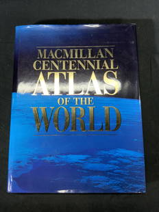
Sold2022Macmillan Centennial Atlas of the World BookMacmillan Centennial Atlas of the World. Published by Macmillan, 1997. Wear to cover and jacket consistent with exposure. Measures approx. 12 x 15.5 inches. Atlas, map, topography, photo book, referenSee Sold Price
Sold2023South America #1. Peru Ecuador Colombia Venezuela Amazonia. BARTHOLOMEW 1888 mapTitle: South America #1. Peru Ecuador Colombia Venezuela Amazonia. BARTHOLOMEW 1888 map Description: South America (Section 1)' by John Bartholomew & Co. (1888). Antique colour atlas map, 20.5 x 16.5cSee Sold Price
Sold2023South America #1. Peru Ecuador Colombia Venezuela Amazonia. BARTHOLOMEW 1893 mapTitle: South America #1. Peru Ecuador Colombia Venezuela Amazonia. BARTHOLOMEW 1893 map Description: South America (Section 1)' by John Bartholomew & Co. (1893). Antique colour atlas map, 20.5 x 16.5cSee Sold Price
Sold2021A group of 5 maps of Chicago streets, comprising:A group of 5 maps of Chicago streets, comprising: E. 1/2 of S.W 1/4 Section 8.39.14. N.P.: N.d. 31 x 40 3/4 in. -- W. 1/2 of N.W. 1/4 Section 4.39.14. Butterfields Add. N.p: N.d. 31 x 40 3/4 in. -- E.See Sold Price
Sold2024Group of 5 Atlas Windshield Washer Solvent and Doorease Tubes and Bottleslargest 5" x 2"See Sold Price
Sold2024Group of 5 Atlas Auto Bulbs and Fuses with Boxeslargest 4.5" x 2" x 1.5", all complete with productSee Sold Price
3 days LeftAmelia Jeffers, Auctioneers & Appraisers2 VOLUMES, FOLIO, THE COMPLETE ATLAS OF MODERN CLASSICAL, AND CELESTIAL MAPS, 1873$20(1 bid)
BonhamsCONNECTICUT AREA MAPS. A group of two maps of Farmington and Plainville, from Atlas of Hartford ...$50(18 bids)
May 16Potter & Potter Auctions[NEW YORK CITY – PICTORIAL MAPS]. Group of 3 pictorial maps...$200(1 bid)
1 day LeftChristie'sA GROUP OF TWO: LIMITED EDITION VAN GOGH MASTERS COLLECTION LAVENDER CANVAS & LEATHER NEVERFULL MM &Preview Only
3 days LeftTrillium Antique Prints & Rare BooksDe Jode, pub. 1593 - Map of part of Germany (Reiterata Episcopatus Monasteriensis geographica?)$100
3 days LeftTrillium Antique Prints & Rare BooksDe Jode, pub. 1593 - Map of Hesse, Germany (Hessiae Seu Cattorum Nobilissimorum?)$100
6 days LeftPlakas AuctionsL’Univers Pittoresque Turquie, Histoire et Description de Tous Les Peuples, Joseph Marie Jouannin£600


![[Maps & Atlases] [London] Stow, John, Group of 5 maps: [Maps & Atlases] [London] Stow, John Group of 5 maps of London London, 1754-55. Approximately 18 1/2 x 15 7/8 inches. Five matted maps from Stow's "A Survey of Cities of London and Westminster and the](https://p1.liveauctioneers.com/65/168030/84729856_1_x.jpg?height=310&quality=70&version=1588715715)
![[Maps & Atlases] (Adrichom, Christian van), Group of 5 First Image](https://p1.liveauctioneers.com/65/168030/84729854_1_x.jpg?height=300&quality=1&version=1588715715&width=300)
![[Maps & Atlases] (Adrichom, Christian van), Group of 5 First Image](https://p1.liveauctioneers.com/65/168030/84729854_1_x.jpg?height=300&quality=95&version=1588715715&width=300)
![[ATLASES AND MAPS]. A group of 5 atlases and maps,: [ATLASES AND MAPS]. A group of 5 atlases and maps, comprising: [MARSHALL, John]. Atlas to Marshall's Life of Washington. Philadelphia: J. Crissy, n.d. 8vo. Numerous hand-colored engraved maps. Origina](https://p1.liveauctioneers.com/197/119933/61100823_1_x.jpg?height=310&quality=70&version=1522758048)

![16th c. Map, Israel, Middle East - TRIBUS ASER by Christian van Adrichom: Description16th c. Engraved Map of Israel, Middle East - TRIBUS ASER [Territory of the Tribe of Asher in the Holy Land] by Christiaan van Adrichem, (1533-1585) and Arnold Mylius (1540-1604) | Publishe](https://p1.liveauctioneers.com/6084/291748/157234438_1_x.jpg?height=310&quality=70&version=1689539413)


![[MAPS]. A group of 5 maps from an early American edition of...: [MAPS]. A group of 5 maps from an early American edition of the Encyclopedia Britannica. [Philadelphia: Thomas Dobson, ca. 1790s to 1810s]. Copperplate engraved maps. 8vos to an oblong 4to (visible ar](https://p1.liveauctioneers.com/928/265343/138522751_1_x.jpg?height=310&quality=70&version=1666130009)
![[Maps & Atlases] [Africa] Ortelius, Abraham, Group of 2: [Maps & Atlases] [Africa] Ortelius, AbrahamGroup of 2 MapsBarbariae et Biledulgerid, nova descriptio(Antwerp, ca. 1570-1612). Hand-colored engraving. Coastal map of North Africa and the Mediterranean,](https://p1.liveauctioneers.com/65/180189/90674454_1_x.jpg?height=310&quality=70&version=1601308774)


![[NEW YORK CITY – PICTORIAL MAPS]. Group of 3 pictorial maps... (1 of 3)](https://p1.liveauctioneers.com/928/325952/175495562_1_x.jpg?height=282&quality=70&version=1712935174)


