Skip to content
Jasper52

Four corners of the world up for bid in Jasper52 map auction Oct. 9

‘Insulae Americanae in Oceano Septentrionali, cum Terris adiacentibus’ follows the coastline from Chesapeake Bay to northern South America. Published by Arnoldus Montanus in Amsterdam in 1671, this map measures 11.2 x 14.25 inches. Estimate: $700-$1,200. Jasper52 image


NEW YORK – Explore the art and science of cartography in a 61-lot auction of antique maps presented by Jasper52 on Sunday, Oct. 9. Absentee and Internet live bidding is available exclusively through LiveAuctioneers.com.

Unlike their modern counterparts, these early printed maps trace borders that shifted with each expedition into the frontier.

Discover voyagers like Capt. John Smith who plotted landmarks, raced to Caribbean islands, or proved that California was not an island. Produced by leading cartographers of their day, these maps reveal innumerable ways to view the globe.

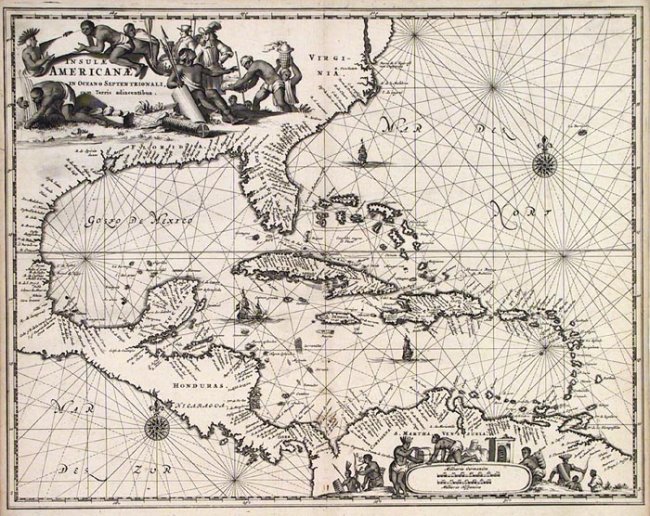
Insulae Americanae in Oceano Septentrionali, cum Terris adiacentibus (above) is an attractive map of the Caribbean based on Blaeu’s 1635 chart.

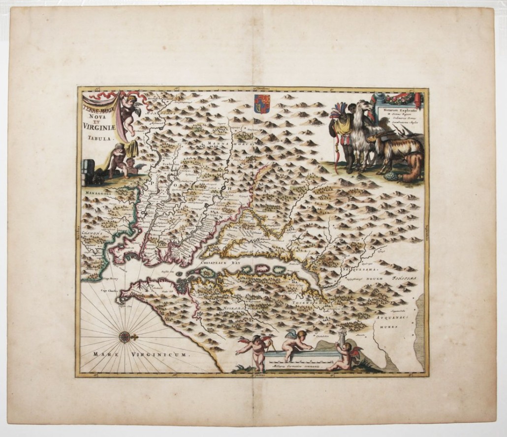
Virginia and Maryland are included in (Terrae- Mariae) Nova (et) Virginiae Tabula, which is based on Captain John Smith’s first survey of Chesapeake Bay. The map (below) was printed by J. Ogilby and A. Montanus in Amsterdam in 1671.


‘(Terrae- Mariae) Nova (et) Virginiae Tabula,’ 1671, based the Blaeu-Hondius engraving of the Capt. John Smith first survey of the Chesapeake Bay, 11.4 x 13.8 inches. Estimate: $1,000-$1,500. Jasper52 image


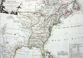
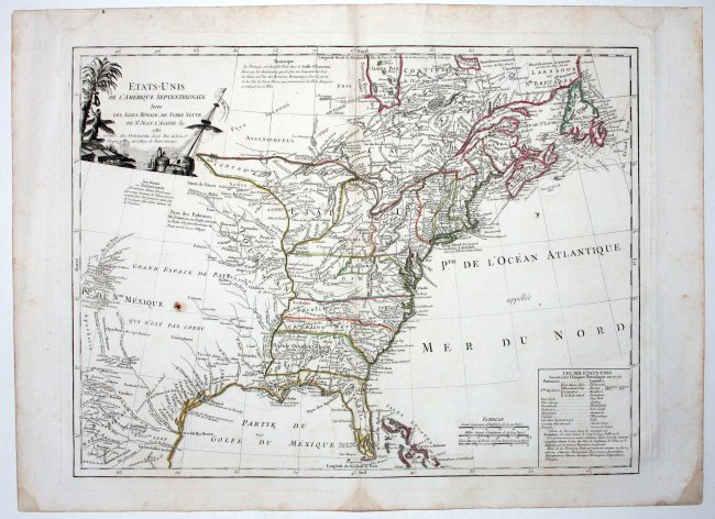
Etats-Unis De L’Amerique Septentrionale Avec Les Isles Royale, De Terre Neuve, De St. Jean, L’Acadie (below) shows the United States in 1785 immediately after the American Revolutionary War. It was printed by F. Delamarche in Paris. The Delamarche family was a dominant force in both map and globe production in France from the late 18th to the latter part of the 19th century.


Having won the American War of Independence, the United States looked to expand westward. This map published in 1785 shows early iteratons of Illinois and Indiana. It measures 18.75 x 24.75. Estimate: $1,100-$2,000. Jasper52 image
Having won the American War of Independence, the United States looked to expand westward. This map published in 1785 shows early iteratons of Illinois and Indiana. It measures 18.75 x 24.75 inches. Estimate: $1,100-$2,000. Jasper52 image


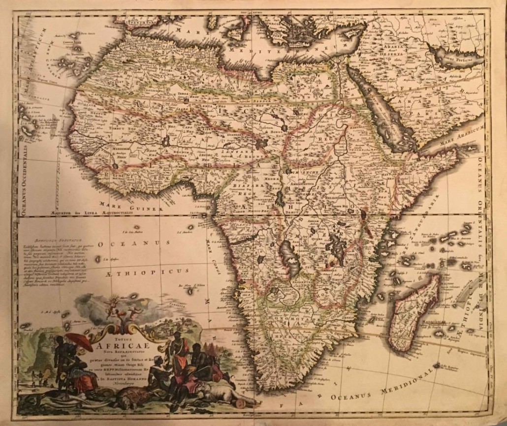
Unlike early 18th century maps of the Western Hemisphere, a 1715 map made by Joseph Homann page titled Totius Africae shows a more accurate outline of the continent (below).


‘Totius Africae’ by Joseph Homann, 1715, original color copperplate engraving, 22.5 x 19 inches. Estimate: $200-$500. Jasper52 image


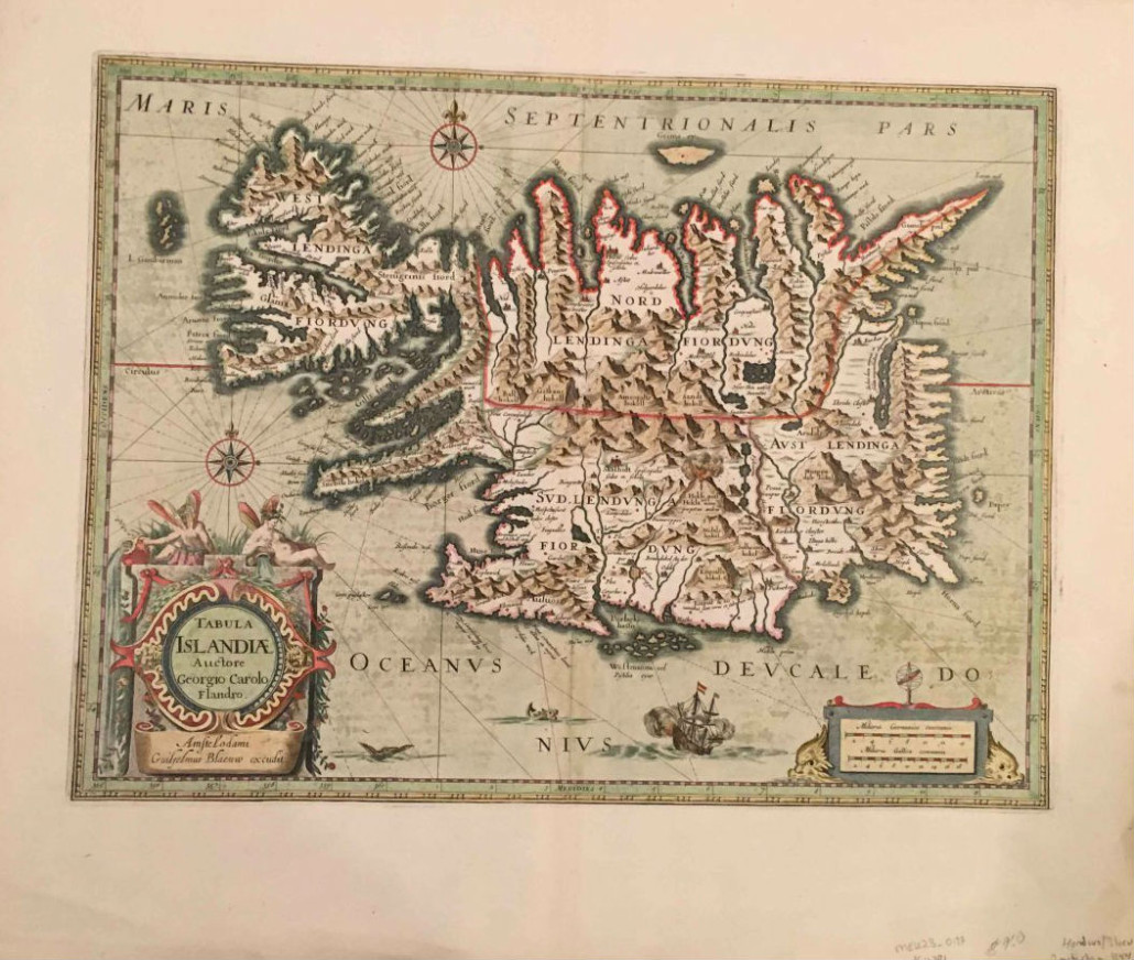
For explorers who favor fire and ice, there is a 1644 map of Tabuka Islandiae, or Iceland (below) listed in the auction.


Tabuka Islandiae,’ or Iceland, by Hondius/Blaeu, 1644, hand-colored copper plate engraving, 19.75 x 15 inches. Estimate: $250-$450. Jasper52 image
‘Tabuka Islandiae’ (Iceland), by Hondius/Blaeu, 1644, hand-colored copper plate engraving, 19.75 x 15 inches. Estimate: $250-$450. Jasper52 image


Bidding on all lots begins at $1.


View the fully illustrated catalog and register to bid absentee or live via the Internet as the sale is taking place by logging on to www.LiveAuctioneers.com.