
NEW YORK – The Grand Tour was a traditional trip to Europe undertaken by mainly young British nobility and wealthy landed gentry from the late 17th through 19th centuries. The Grand Tour served as an educational rite of passage. Collectors can travel back in time to chart such trips in a Jasper52 online auction of antique maps and atlases of Europe on Tuesday, Nov. 21. Absentee and Internet bidding is available through LiveAuctioneers.
The auction consists of 114 antique maps of the Continent and the British Isles.
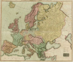
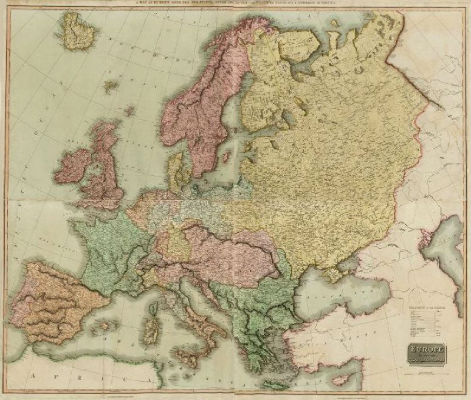
Taking in the big picture is a map of Europe in four sheets, drawn and engraved by Samuel John Neele for John Thomson & Co.’s New General Atlas, in 1817. This large hand-colored folding map (above) is in good condition, suitable for framing.
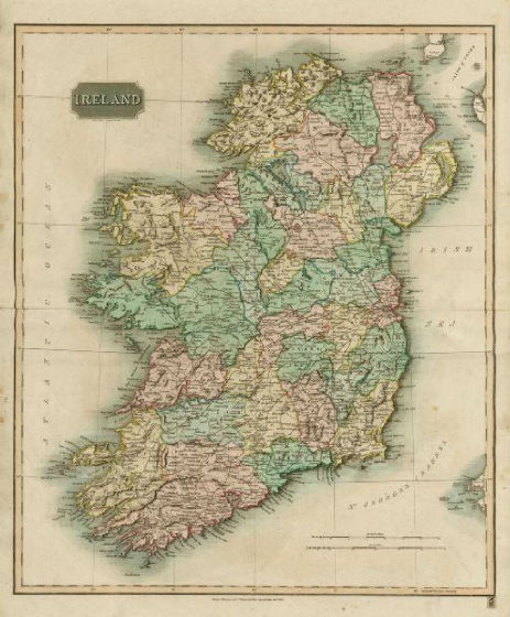
John Thomson (1777-1840) was a Scottish cartographer from Edinburgh. Another of his maps in the Jasper52 auction is an 1817 map of Ireland (below), which is also hand-colored and from his well-known New General Atlas.
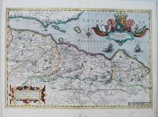
One of the maps in the Jasper52 auction shows Edinburgh and surrounding area circa 1638. While credited to the Hondius family of Amsterdam, this scarce map is believed to be the first printed version of any map by the important mapmaker and minister Timothy Pont.
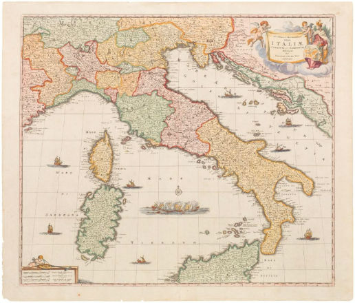
Grand Tours always took in Italy, where travelers were exposed to both the cultural legacy of classical antiquity and the Renaissance. The Jasper52 auction offers a bright example of Frederick De Wit’s decorative map of Italy, circa 1680, adorned with an elaborate pictorial cartouche, sea monsters, ships and a depiction of the naval battle of the Gulf of Naples of 1284. Frederick de Wit (1630-1706) was one of the most important engravers and publishers in Amsterdam.
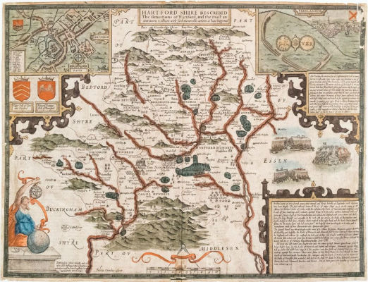
Another landmark lot in the auction is the circa 1660 map of Herfordshire by London cartographer John Speed. This is a magnificent and classic decorative county map of Hertfordshire (just north of London) is from his famous English atlas. This is a highly detailed map, with topographical features, towns and battle scenes included.
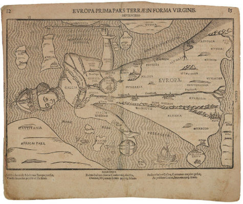
A rare 16th-century map in the sale depicts Europe in the shape of a queen. The woodblock print is by Heinrich Bunting. Representations of Europa Regina are among the most sought-after anthropomorphic maps available to collectors.
Not only will these maps serve as decorative pieces, but they also will reveal innumerable ways to view the world.
The auction will begin Tuesday at 8 p.m. Eastern time.
[av_button label=’View the fully illustrated catalog and bid on LiveAuctioneers.’ link=’manually,http://bit.ly/2ikAzsS’ link_target=’_blank’ size=’medium’ position=’center’ icon_select=’no’ icon=’ue800′ font=’entypo-fontello’ color=’theme-color’ custom_bg=’#444444′ custom_font=’#ffffff’ admin_preview_bg=” av_uid=’av-rbdbx5′]