
NEW ORLEANS – An important single-owner collection of rare, historical maps – many of them hundreds of years old and colorful, beautiful renderings of the world, the United States and portions of the United States – will be sold in a two-part online-only auction by Crescent City Auction Gallery. Bid absentee or live online through LiveAuctioneers.
Part 1 of the sale will start on Friday, June 14, with lots 1-317, at 10 a.m. Central time. Part 2 will begin a week later, on Friday, June 21, also at 10 a.m., with lots 318-693. All lots have a starting bid of $25. That modest amount is designed to spur bidding, which is expected to be brisk.
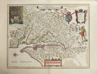
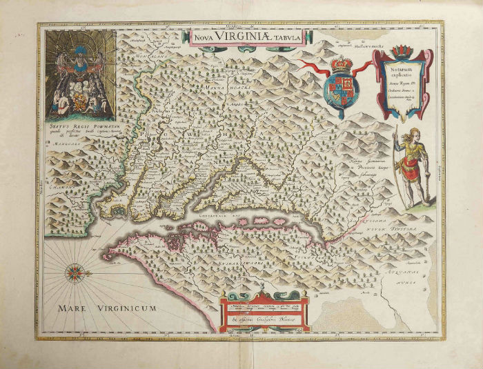
A star lot of Part 1 is expected to be a 1642 hand-colored copper engraving by Willem Janszoon Blaeu (1571-1638), titled Nova Virginia Tabula (above), a 17½-by-22½-inch depiction of Virginia, with Native American vignettes (est. $1,000-$2,000). Blaeu was a Dutch cartographer, atlas maker and publisher. He was one of the notable figures of Dutch cartography in its golden age.
Two maps by Blaeu are being sold as one lot. One is a hand-colored 1640 effort titled Virginiae partis australis et Florida partis orientalis, 15 inches by 20 inches. The other is titled India Quae Orientalis Diktur et Insulae, also from 1640, 22 inches by 18 inches. The pair has a $500-$1,000 estimate. Maps by Blaeu are highly coveted by collectors.
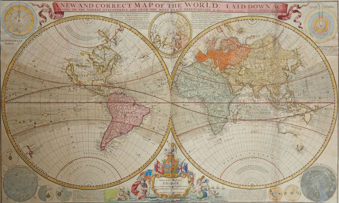
A map from 1710, titled A New and Correct Map of the World, by Herman Moll (1654-1732), hand-colored and 22 inches by 38 inches, carries an estimate of $800-$1,200. Moll was a London-based cartographer, engraver and publisher. He also associated with many writers and intellectuals and was mentioned in Jonathan Swift’s book Gulliver’s Travels.
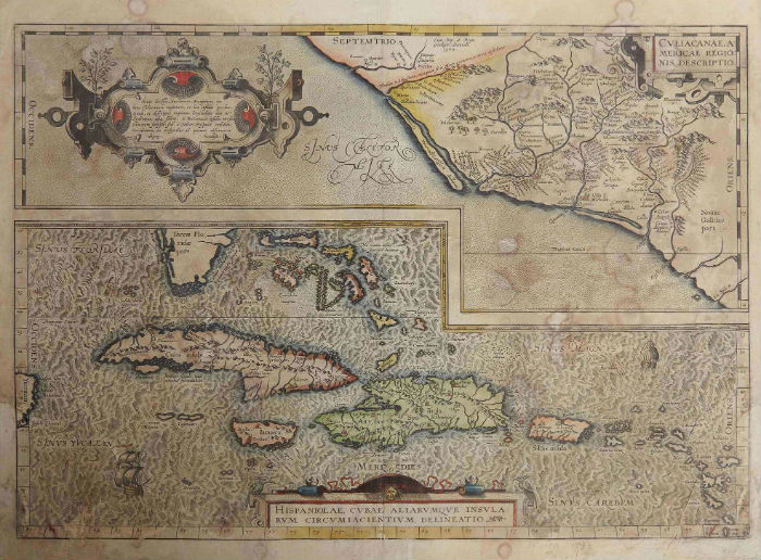
Abraham Ortelius’s (1527-1598) hand-colored 1579 map of the Caribbean and south Florida, titled Culliacanae, Americae Regionis, Description – Hispaniolae, Cubae Aliarumque lnsularum Circumiacientium Delineatio, 16 inches by 20 inches, should realize $600-$900. Ortelius created the first modern atlas, Theatrum Orbis Terrarum.
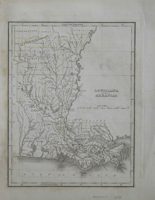
A map of Louisiana and Part of Arkansas, done in 1838 by the American cartographer Thomas Bradford (1802-1887), 12½ inches by 9¾ inches, is expected to change hands for $300-$500. Bradford lived in Boston and worked for the America Encyclopedia. His work is held in the collections of the Library of Congress and the Boston Public Library.
Johann Baptist Homann’s (1661-1774) hand-colored map of North America, titled Regni Mexicani von Novae Hispaniae Ludouicianae, N. Angliae, Carolinae, Virginae, et Pensylvaiae, circa 1725, 21½ inches by 25½ inches, has an estimate of $500-$1,000. Homann was a German cartographer-geographer who also made maps of the Americas.
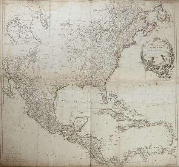
Part 2, beginning on June 21, will be highlighted by a map showing North America, Mexico and the Caribbean by Jean Baptiste D’Anville (1699-1782), titled Amerique Septentrionales (1746), 33 inches by 35½ inches (est. $800-$1,200). D’Anville was a French geographer and cartographer who greatly improved the standards of map-making.
A hand-colored map executed around 1740 and focusing mainly on Florida and Mexico by Matthias Seutter (1678-1781), titled Mappa Geographica Regionem Mexicanem et Floridam Americae Unsulas Cursus, measuring 20 inches by 23 ½ inches, should fetch $600-$900. Seutter was one of the most important and prolific German map publishers of the 18th century.
For details contact Crescent City Auction Gallery at 504-529-5057 or info@crescentcityauctiongallery.com.
[av_button label=’View the fully illustrated catalog and bid on LiveAuctioneers.’ link=’manually,https://www.liveauctioneers.com/auctioneer/328/crescent-city-auction-gallery/’ link_target=’_blank’ size=’medium’ position=’center’ label_display=” icon_select=’no’ icon=’ue800′ font=’entypo-fontello’ color=’theme-color’ custom_bg=’#444444′ custom_font=’#ffffff’ av_uid=’av-8i6844s’ admin_preview_bg=”]