

NEW YORK – Maps often provide more than a representation of an area on paper. The antique maps in a Jasper52 online auction Feb. 21 show landmarks, discoveries, shipping routes and political divisions – glimpses of the time when the cartographers sent their work to press. Absentee and Internet live bidding is available through LiveAuctioneers.
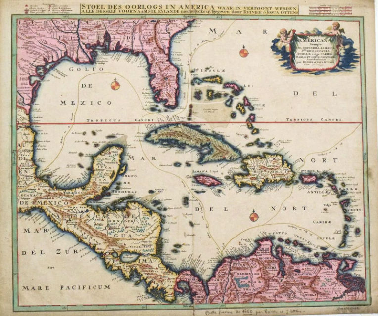
One of the many colorful maps in the auction is R. & S. Ottens’ 1730 map of the Caribbean (above), which shows the routes of the Spanish silver fleets that departed from Cartagena de Indias and Veracruz and met at Havana to set sail to Seville. The map comes from the atlases published by the Ottens brothers between 1720-50. This scarce map has a $1,200-$1,500 estimate.
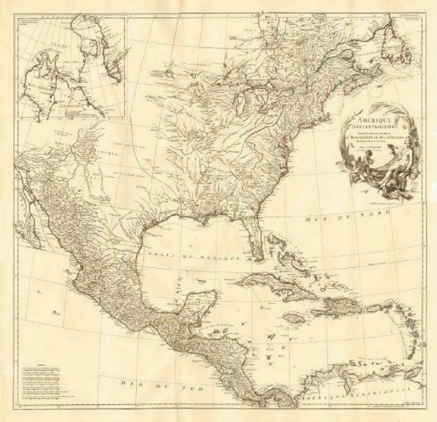
A large folding map printed in 1746 titled Amérique Septentrionale (below) shows North America divided between British (red), French (Green) and Spanish (Yellow) possessions. At this time the British colonies of New England, New York, New Jersey, Pennsylvania, Maryland, Virginia, and Carolina, “Acadie” (Nova Scotia) and Newfoundland occupied a thin sliver along the coast, with the French controlling most of the interior of the continent, including much of present-day eastern Canada. Many towns are marked on the map, including New York, Boston, Baltimore, Charles Town (Charleston), New Orleans, St. Augustine, Philadelphia, Quebec City, Montreal, Havana, Mexico City and Cartagena. This map is printed on thick, good quality paper with original outline hand coloring and a decorative title cartouche.
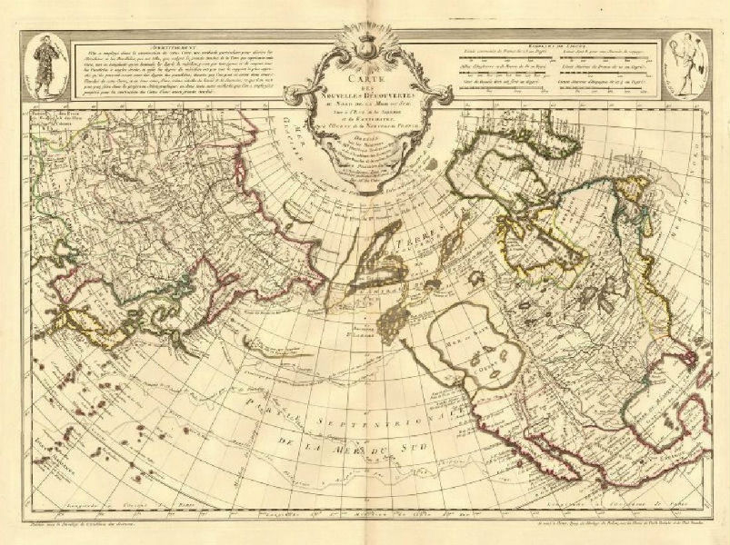
A landmark 18th-century map by Guillaume de l’Isle shows “new discoveries” in the North Pacific Ocean by explorers seeking among other objectives a northwest passage and a northeast passage.
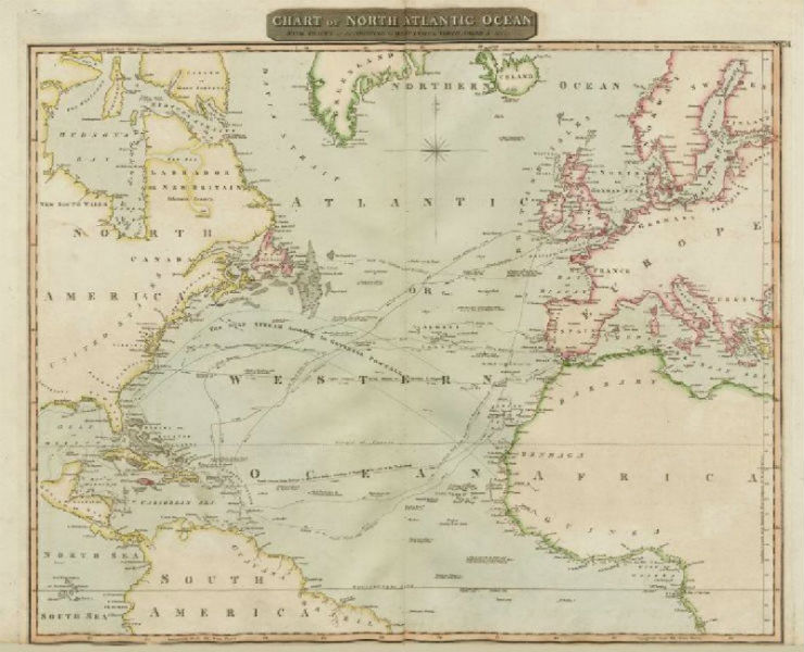
A large and fascinating 1817 chart of the North Atlantic Ocean shows the trade shipping routes according to the trade winds, and a number of other interesting features. The route of Lord Nelson to the West Indies in pursuit of the French in 1805 is shown, as is the track of the USS Insurgent (originally the French frigate Insurgente). There are numerous observations of rocks and possible shoals. The map drawn and engraved by John Moffat for John Thomson’s New General Atlas and printed by George Ramsay and Co.
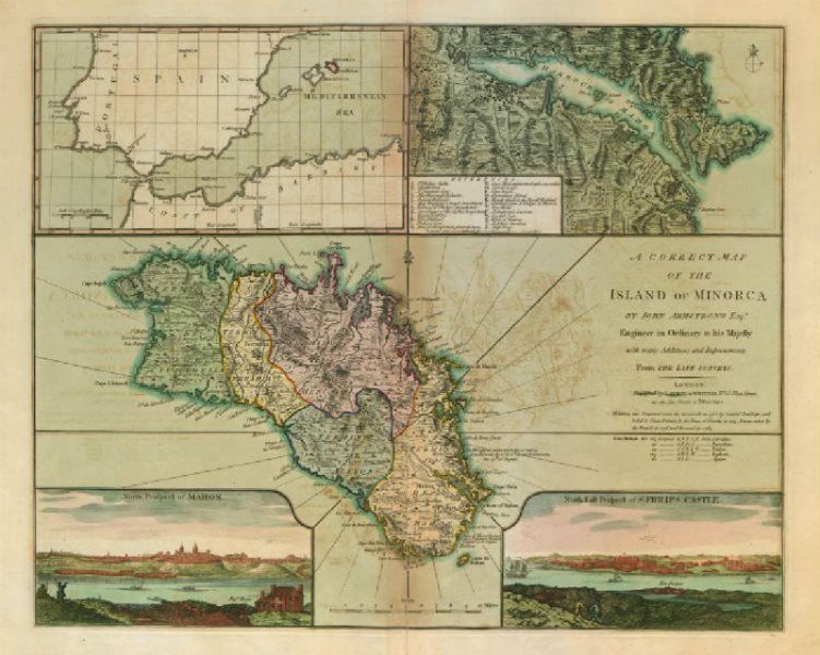
Moving to the Mediterranean, bidders will encounter “a correct map of the Island of Minorca by John Armstrong, Esqr., Engineer in Ordinary to his Majesty.” This large, decorative 1794 map of the Balearic Island of Minorca shows the major towns and includes four insets: Menorca shown relating to Iberia and the western Mediterranean, a detailed map of the city and harbor of Mahon, a view of the “North Prospect of Mahon” and a view of the “North East Prospect of St. Philips Castle” (Castillo de San Felipe).
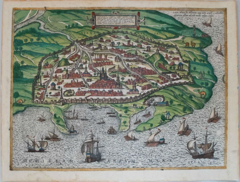
One of the oldest maps in the auction offers a bird’s-eye view of Alexandria, the ancient Egyptian center of trade, which was founded by Alexander the Great in 320 B.C. Sixteenth-century German cartographers Braun & Hogenberg shows the fortified city, centered on a mosque, being located on the Nile Delta. The impressive lighthouse (Pharus), one of the Seven Wonders of the Ancient World, reigns over the harbor. The city is surrounded by green countryside with people and camels and the sea holds a flotilla including galleys, small boats and sailing ships.
These and nearly 150 more maps will be offered in this Jasper52 online auction Wednesday, Feb. 21, at 8 p.m. Eastern.
[av_button label=’View the fully illustrated catalog and bid on LiveAuctioneers.’ link=’manually,http://bit.ly/2EJLNUg’ link_target=’_blank’ size=’medium’ position=’center’ icon_select=’no’ icon=’ue800′ font=’entypo-fontello’ color=’theme-color’ custom_bg=’#444444′ custom_font=’#ffffff’ admin_preview_bg=” av_uid=’av-mdldc2′]