
NEW YORK – Jasper52 will conduct an online auction of Premium Antiquarian Maps on Tuesday, May 26. This finely curated auction celebrates cartography at its finest. The 123 lots in the auction include antique illustrated maps and views by some of the most significant mapmakers of their times. Bid absentee or live online exclusively through LiveAuctioneers.
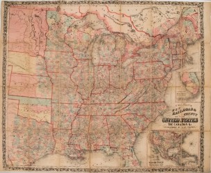
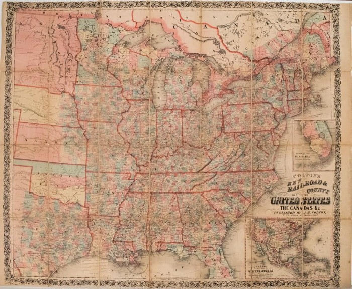
The auction opens with the 1862 Colton Map of the United States – Colton’s New Railroad & County Map of the United States and the Canadas. The rare Civil War-era map (above) by New York cartographer Joseph H. Colton is in good to fair condition. It shows an extensive network of railroads displaying both existing and proposed routes and mail routes are shown as well. Numerous other details are offered including topography, rivers, lakes, roads, steamship routes, ship routes, forts, cities and towns. The inset of North America shows the proposed Central and Union Pacific Railroads and some unusual western territorial borders, including the large New Mexico and Washington, and an early appearance of Colorado. An owner’s name is handwritten on verso (est. $800-$1,000).
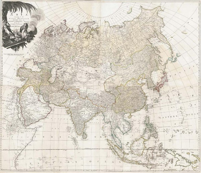
Marco Polo would have made good use of map titled Asia According to the Sieur D’anville, but it was not published until the late 18th century. The four-sheet wall-size map has been professionally joined and cleaned. It shows empires, kingdoms and states, showing the European settlements in the East Indies etc. (est. $2,500-$3,000).
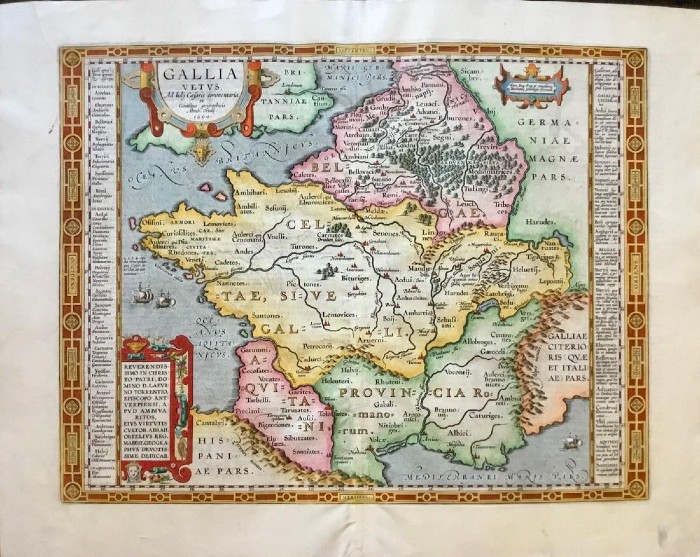
Abraham Ortelius’ Theatrum Orbis Terrarum, the world’s first true modern atlas, contained a map of ancient Gaul (France) based on Julius Caesar’s writings. Published circa 1570-1624, this hand-colored copperplate engraved map is in excellent condition (est. $500-$600).
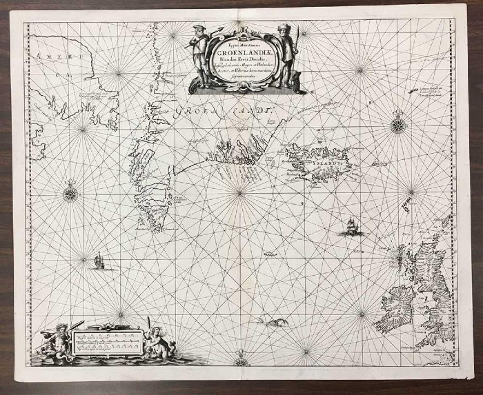
Greenland, Iceland, most of the British Isles and Newfoundland are charted on a map by Theunisz Jacobsz published circa 1649. The map contains an early sea chart of Iceland and Greenland with fur parka-clad natives (est. $1,500-$2,000).
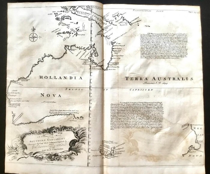
The top lot in the auction is expected to be the first English language map of Australia, which was published circa 1744-1748 by John Harris in Navigantium Alque Itinerantium Bibliotheca, or a Complete Collection of Voyages and Travels. This copperplate engraved map is in excellent condition (est. $3,500-$4,000).
The Jasper52 auction of Premium Antiquarian Maps will take place Tuesday, May 25, starting at 8 p.m. Eastern time.
[av_button label=’View the fully illustrated catalog and bid on LiveAuctioneers.’ link=’manually,https://www.liveauctioneers.com/catalog/168933_premium-antiquarian-maps/’ link_target=’_blank’ size=’medium’ position=’center’ label_display=” title_attr=” icon_select=’no’ icon=’ue800′ font=’entypo-fontello’ color=’theme-color’ custom_bg=’#444444′ custom_font=’#ffffff’ av_uid=’av-5a82bvk’ id=” custom_class=” admin_preview_bg=”]
View top auction results on LiveAuctioneers here: https://www.liveauctioneers.com/pages/recent-auction-sales/