

NEW YORK – Dreaming of exploring islands in paradise? Armchair travelers can start charting their voyage at a Jasper52 online auction of antique maps to be held Tuesday, Jan. 16. The more than 100 antique maps show travel routes and currents, and many more nautical treasures. Absentee and Internet live bidding is available through LiveAuctioneers.
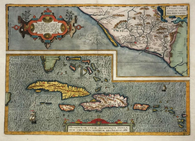
Several of the maps of the Caribbean Sea are from the 17th and 18th centuries, a period when the region’s waters were beset by warfare and piracy. Heading this category is Abraham Ortelius’ map of Culiacan, Mexico and the West Indies (above), published between 1579 and 1592. Abraham Ortelius (1527-1598) was a Flemish cartographer and geographer, celebrated as the creator of the first modern atlas, the Theatrum Orbis Terrarum (Theatre of the World). This map represents the first printed atlas map of the West Indies, from Cuba to St. Lucia. Printed on the same sheet is a map of Culiacan in western Mexico Three superb cartouches enhance the decorative appeal of this map, which has a $650-$750 estimate.
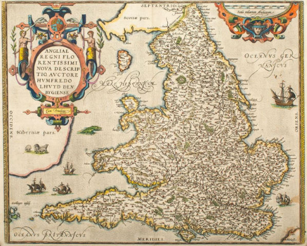
Also appearing in Ortelius’s atlas in 1573 is Welsh historian and topographer Humphrey Lloyd’s important map of England and Wales (below). This colorful map improves on the Mercator-Ortelius outline and has notable decorative features (est. $1,100-$1,200).
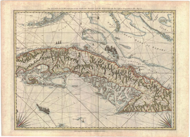
“The Island of Cuba with part of the Bahama Banks and the Martrys” by Thomas Jefferys, Robert Sayer and John Bennett is a scarce and authoritative 1775 British map and sea chart covering most of Cuba, the Cayman Islands, the Strait of Florida, and the Florida Keys. The depiction of the Florida Keys is excellent, predicated on the scientific surveys of William Gerard de Brahm, the surveyor general of British East Florida, conducted from 1765 to 1771. This is regarded to be the finest map of the region available during the era that extended from the American Revolution (1775-83) to the Napoleonic Wars (1798-1815). Thomas Jefferys (1719-1771) was the Royal Cartographer to King George III and the leading map supplier of his time.
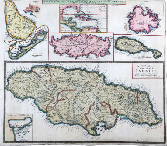
Cartographer J. Senex’s new map of the English Empire in the Ocean of America or West Indies was published in London in 1721. This scarce composite map of the British islands in the Caribbean, including seven small maps on one sheet of the West Indies, Barbados (with an inset of Bridge Town), Bermuda, St. Kitts and Antigua, and a larger map of Jamaica, with an inset of Port Royal.
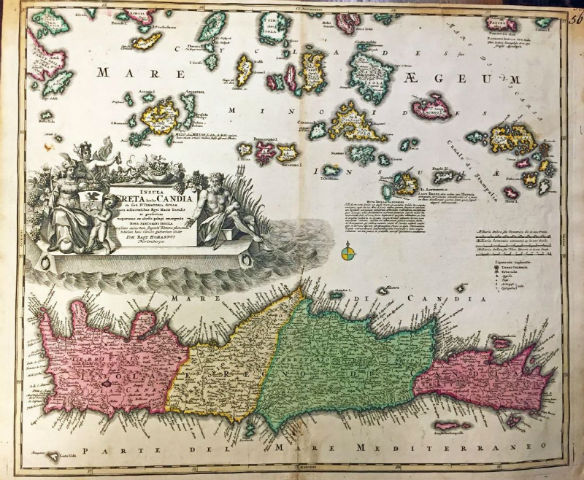
Johann Baptist Homann (1664-1724) was a German geographer and cartographer, well known for his important maps of the Americas. Although his early studies focused on religion, he soon shifted his focus to engraving and cartography and founded his own publishing house in 1702. One of the most reputable cartographers of the 18th century, he was appointed imperial geographer by Emperor Charles VI in 1715. His beautifully colored 1730 map of Crete and the islands to its north incorporates a superb cartouche featuring Mercury, Neptune, and a regal female figure holding the crested shield of Crete.
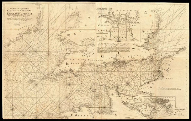
Five 18th-century sea charts by Capt. Greenvile (or Greenville) Collins, a British cartographer and engraver, are included in the auction. His 1774 chart of the English Channel shows “considerable improvements not extant in any draughts hitherto publish’d shewing the sands, shoals, depths of water and anchorage, with ye flowing of ye tydes, and setting of the current … ” This decorative copperplate nautical sea chart, printed on thick paper, consists of two sheets conjoined.
This auction will be conducted Tuesday, Jan. 16, starting at 8 p.m. Eastern time.
[av_button label=’View the fully illustrated catalog and bid on LiveAuctioneers.’ link=’manually,http://bit.ly/2CO9uXa’ link_target=’_blank’ size=’medium’ position=’center’ icon_select=’no’ icon=’ue800′ font=’entypo-fontello’ color=’theme-color’ custom_bg=’#444444′ custom_font=’#ffffff’ admin_preview_bg=” av_uid=’av-nzeizf’]