
NEW YORK – The far corners of the United States and beyond are accessible in a Jasper52 auction of antiquarian maps on Sunday, Dec. 11. Absentee and Internet live bidding is available exclusively through LiveAuctioneers.
Designed by premier cartographers, these vintage maps reveal innumerable ways to view the nation and the globe. Unlike modern charts, these maps trace borders that changed with each exploration.
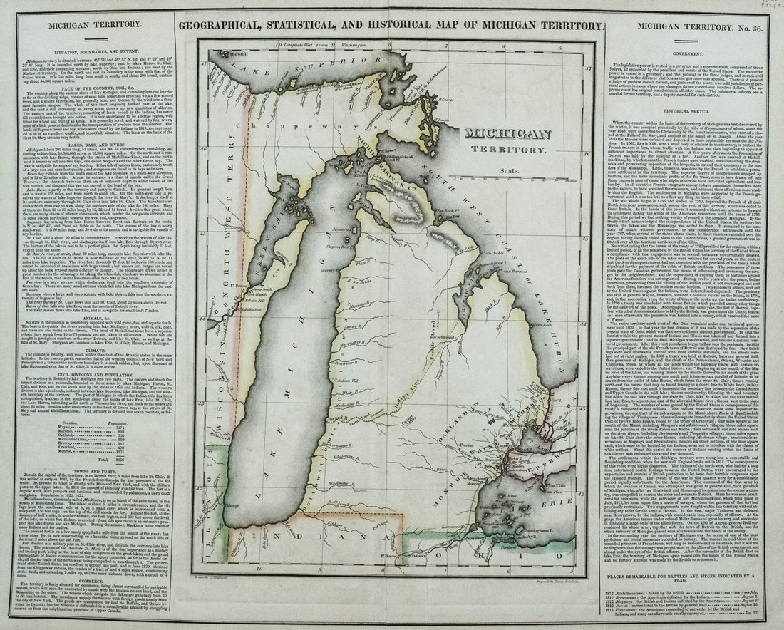
A prime example in the auction is the 1822 Geographical, Statistical and Historical Map of Michigan Territory (above), which shows a noticeably misshapen Lake Michigan shoreline. When cartographers Carey & Lea Of Philadelphia published the map, the territory was sparsely populated, mostly in the southeast corner near Detroit by Lake Erie and Lake St. Clair, with few settlements elsewhere.
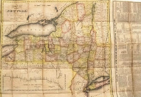
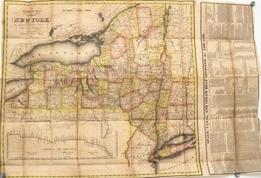
By contrast, The Tourist’s Map of the State of New York … (below), published in Utica, N.Y., in 1828 by W. Williams, shows many details such as towns, roads and canals.
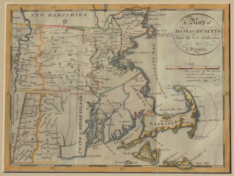
A map of Massachusetts (below) from Morse’s Universal Geography, published in 1796 by Thomas & Andrews, Boston, is offered in the 79-lot auction. Jedidiah Morse (1761-1826) was a notable geographer whose textbooks became a staple for students in the United States and earned him the title of “father of American geography.”
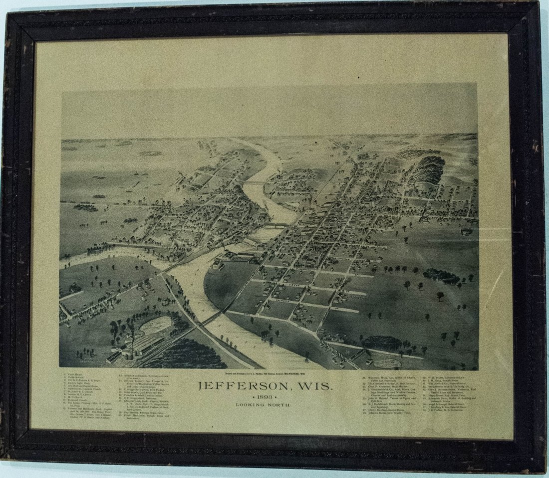
So-called bird’s-eye view maps that pictured towns were in vogue in the United States in the 1800s. One such map in the auction is Jefferson, Wisconsin 1893, Looking North. The map shows a busy county seat of about 2,200 population, with 38 locations in the city identified in the index.
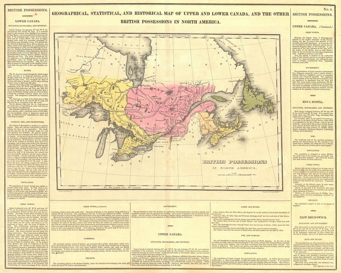
Looking north of the border, the auction includes four maps of Canada. One is the 1826 Geographical, Statistical, and Historical Map of Upper and Lower Canada, and the Other British Possessions in North America (below), published by Carey & Lea, Lucas, Fielding, Jr. / Young & Delleker, sc., Philadelphia.
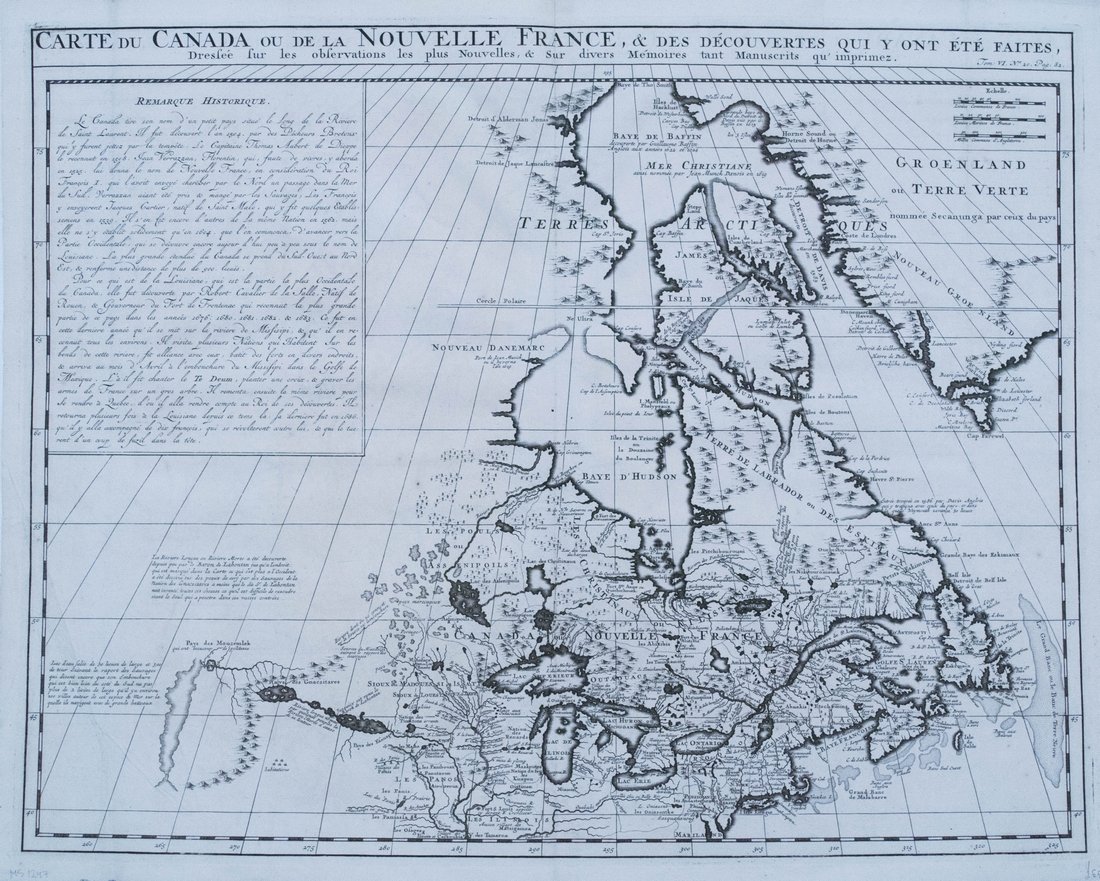
Older still is a map of French holdings in Canada (below) by cartographer H. Chatelain, which was published in Amsterdam in 1719.
Bidding starts at $1 on all Jasper52 auctions. Lots that have reserves are noted in the catalog.
[av_button label=’View the fully illustrated catalog and bid on LiveAuctioneers.’ link=’manually,http://bit.ly/2h3Ojck’ link_target=’_blank’ size=’medium’ position=’center’ icon_select=’no’ icon=’ue800′ font=’entypo-fontello’ color=’theme-color’ custom_bg=’#444444′ custom_font=’#ffffff’ av_uid=’av-wmpt88′]