
NEW YORK – On Wednesday, January 5, starting at 8 pm Eastern time, Jasper52 will conduct an auction titled Maps from a Seller’s Private Collection. All the maps in the 138-lot selection are authentic, original vintage documents, mostly featuring North America, its regions, or individual states, and mostly dating from the mid- to late 19th century.
Among the lots on offer are an 1882 hand-colored map of the New Mexico Territory; a circa-1840s United States Tables map by Ephraim Gilman; an 1864 map of the Great Western states by Johnson and Ward; a hand-colored 1872 map depicting California and Nevada; an 1864 folding pocket map by Colton, designed for use in the field during the Civil War; a Rand McNally railroad map of Manhattan and its boroughs; and an uncommon map from Colton’s General Atlas of the mid-19th century that gives size comparisons of assorted U.S. lakes and islands. Absentee and Internet live bidding will be available through LiveAuctioneers.
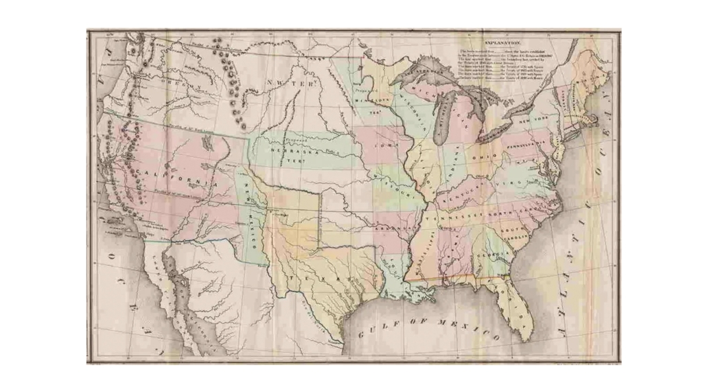
Leading the highlights is a United States map drawn on short notice in the 1840s by Ephraim Gilman, who was then the principal draftsman of the General Land Office. It is sometimes referred to as the Tables Map because a table on each side of the map offers selected statistical information including details on the so-called “Three Divisions” of Texas. Gilman’s map depicts the United States as a trans-continental power, a status it achieved with the 1846 Oregon Treaty with Great Britain and cemented in 1848 at the end of the war with Mexico, when it gained territory containing Texas and the future states of Arizona, California, Nevada and New Mexico. The Gilman map is estimated at $500-$700.
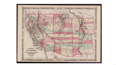
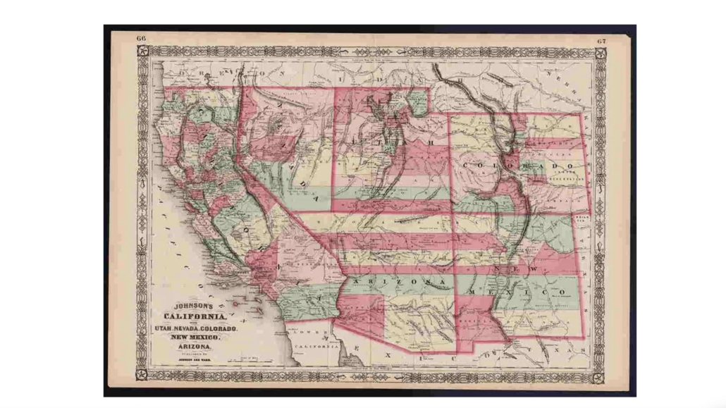
Another prize of note is a Johnson and Ward map that illustrates the states of California, Nevada, Utah, Colorado, New Mexico and Arizona. It dates to 1864, the time of the Civil War, and a time when these states had markedly elastic boundaries. This intriguing snapshot of the evolving Western U.S. includes mining districts, emigrant trails, the Santa Fe Trail, the Pony Express Route and several proposed railroads, and also the locations of many American Indian tribes, as well as geological features and political divisions. It is estimated at $285-$350.
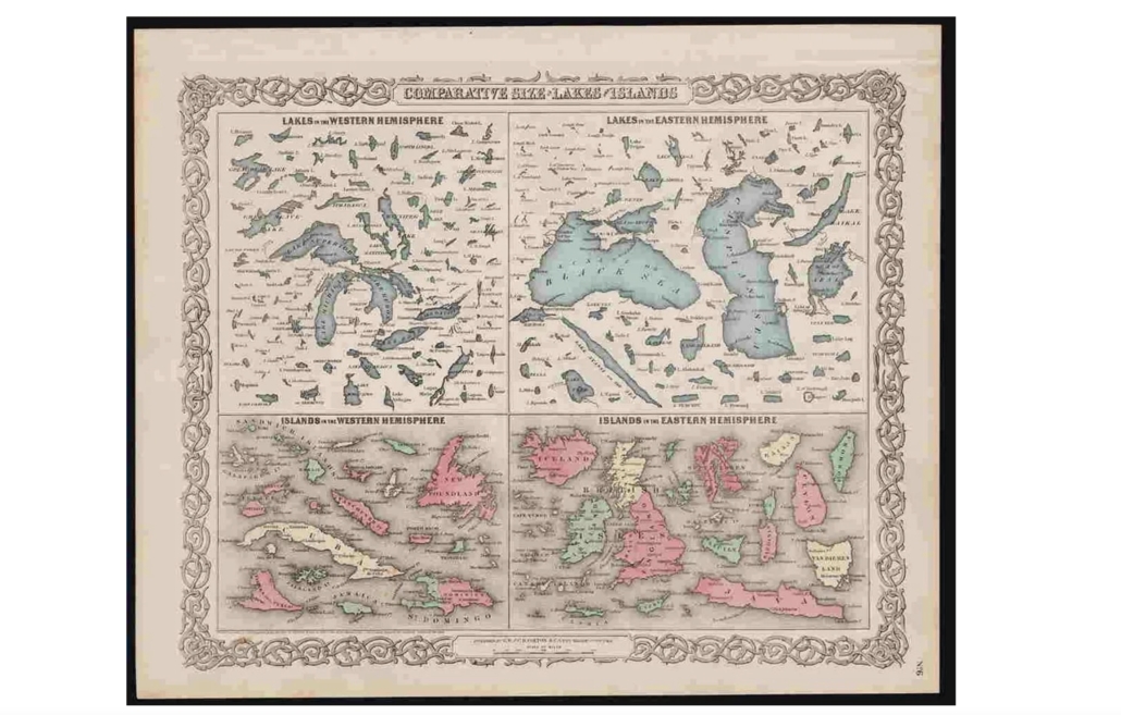
Rounding out the highlights is an unusual and curious map from the 1869 edition of Colton’s General Atlas that shows the comparative sizes of assorted U.S. lakes and islands assessed against their counterparts from both the Western and Eastern hemispheres. It is estimated at $140-$160.
[av_button label=’Click to view the auction catalog and sign up to bid’ icon_select=’no’ icon=’ue800′ font=’entypo-fontello’ link=’manually,https://www.liveauctioneers.com/catalog/231408_maps-from-a-seller-s-private-collection/?page=1&pageSize=120′ link_target=’_blank’ size=’small’ position=’center’ label_display=” title_attr=” color_options=” color=’theme-color’ custom_bg=’#444444′ custom_font=’#ffffff’ btn_color_bg=’theme-color’ btn_custom_bg=’#444444′ btn_color_bg_hover=’theme-color-highlight’ btn_custom_bg_hover=’#444444′ btn_color_font=’theme-color’ btn_custom_font=’#ffffff’ id=” custom_class=” av_uid=’av-5hin2w7′ admin_preview_bg=”]
View top auction results on LiveAuctioneers here: https://www.liveauctioneers.com/pages/recent-auction-sales/