
NEW YORK – A large map charting American aviator Charles A. Lindbergh’s historic flights is one of more than 100 collectible and antique maps offered in an online auction to be conducted by Jasper52 on Tuesday, Jan. 29. Bid absentee or live online through LiveAuctioneers.
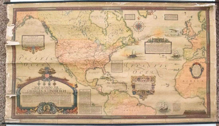
Ernest C. Clegg (1876-1954) a British-born artist, illustrator and pictorial cartographer who worked in the United States for many years, created the Lindbergh map (above) for the John Day Co. shortly after Lindbergh made the first solo nonstop transatlantic flight, from Roosevelt Field, New York, to Le Bourget Air Field, Paris in May 1927. The map, which is 28 inches high by 50 inches wide, also shows his early flights throughout the U.S., to South America via Mexico and the Caribbean. Great detail of Lindbergh’s flights is provided in cartouches. His portrait is part of the most elaborate and largest cartouche. Far from the most valuable map in the auction map, it has a $900-$1,100 estimate.
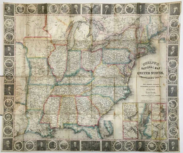
American history buffs will be interested in an 1847 folding map of the United States (below). Humphrey Phelps was an American map, broadside, and book publisher based in New York City. Phelps’s National Map of the United States, Travellers Guide was published in 1847 by Phelps, Ensigns & Thayer. The 21-by-25.4-inch map shows the principal railroads, canals, steamboat and stage routes, throughout the nation. Professionally restored and laid down on Japan paper, the handsome map folds into an ornate black roan cover stamped with cuts of a railroad train and a steamboat. It is particularly interesting for the elongated “Indian Territory” in the west with many tribes located. The eastern portion of the Republic of Texas is also shown.
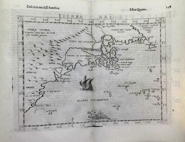
A rare 16th century view of the Eastern Seaboard is shown on a 9-by-11-inch map made by Girolamo Ruscelli in Venice, Italy (est. $1,500-$3,000)
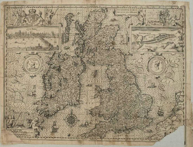
English cartographer and historian John Speed produced a rather famous map of the British Isles circa 1611 titled The Kingdome of Great Britaine and Ireland. The 14.8-by-19.8-inch map shows much topographical, river, lake and settlement detail. The upper part of the map is flanked by views of London and Edinburgh, and an inset map of the Orkneys (est. $1,500-$2,000).
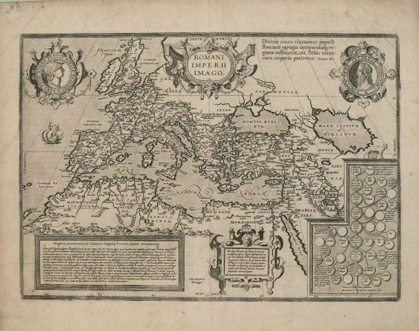
Brabantian cartographer Abraham Ortelius produced a map of the Roman Empire, Romani Imperii Imago, in 1579, which is centered on the Mediterranean and covers most of Europe, Northern Africa, and the Near and Middle East. Measuring 13.8 by 19.6 inches, the map is richly decorated with several strapwork cartouches, two containing portraits. The cartouches in the lower section of the map contain an account of Roman history including a genealogical tree of the rulers of Rome. Topographical, river, lake and settlement details are offered (est. $500-$600).
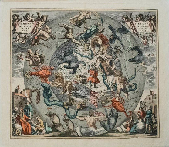
For stargazers, there’s a colorful 1708 celestial map from the Northern Hemisphere by Dutch-German cartographer Andreas Cellarius. Published in Amsterdam in 1708, his Hemisphaerii Borealis Coeli et Terrae Sphaeri Cascenographia measures 16.8 by 19.1 inches (est. $2,500-$3,000).
This carefully curated maps auction celebrates cartography at its finest. Not only will these maps serve as decorative pieces, but they also will reveal innumerable ways to view the world. The auction will begin Tuesday, Jan. 29, at 8. p.m. Eastern time.
[av_button label=’View the fully illustrated catalog and bid on LiveAuctioneers.’ link=’manually,https://www.liveauctioneers.com/catalog/134868_premium-antique-maps/’ link_target=’_blank’ size=’medium’ position=’center’ label_display=” icon_select=’no’ icon=’ue800′ font=’entypo-fontello’ color=’theme-color’ custom_bg=’#444444′ custom_font=’#ffffff’ av_uid=’av-8vo1pls’ admin_preview_bg=”]