
NEW YORK – Maps are an interesting marriage of science and art. Meant to be accurate to guide ships or travelers to their destinations with a level of detail and artistry approaching that of illuminated manuscripts, they nonetheless can be charming with whimsical decorative elements.
In this age of GPS and an increased reliance on technology, maps have mostly gone the way of cassette tapes and pay phones giving antique maps increased cachet. Those of a certain age will recall the days when gas stations gave out free folding maps, which were carefully perused until well-worn.
Collectors covet antique maps not only for nostalgia and a passion for history and geology but also the sheer pleasure of owning such a beautiful work on paper and being able to study it again and again, discovering something new each time.
Mapmaking (cartography) dates back to the Greeks during Aristotle’s time, with the earliest maps usually done on clay tablets. Anaximander is credited as being the first Greek cartographer to draw a map of the world and in his version, the earth was depicted with a cylinder shape.
Antique maps reflected cartographers’ abilities at the time; mistakes were inevitable. One of the most notorious of these mistakes was the “island of California (or Cali Fornia),” in which the state was incorrectly depicted as an island on maps in the 17th and 18th centuries. Some even claimed a map printing error contributed to Napoleon Bonaparte’s defeat in the Battle of Waterloo on June 18, 1815, when he placed his artillery at the farm of Mont-Saint-Jean, one kilometer shy of where it needed to be after consulting a map that didn’t show the farm’s location or the lie of the land correctly. Given that this distance exceeded the range of the cannons, the error likely impacted his battle tactics.
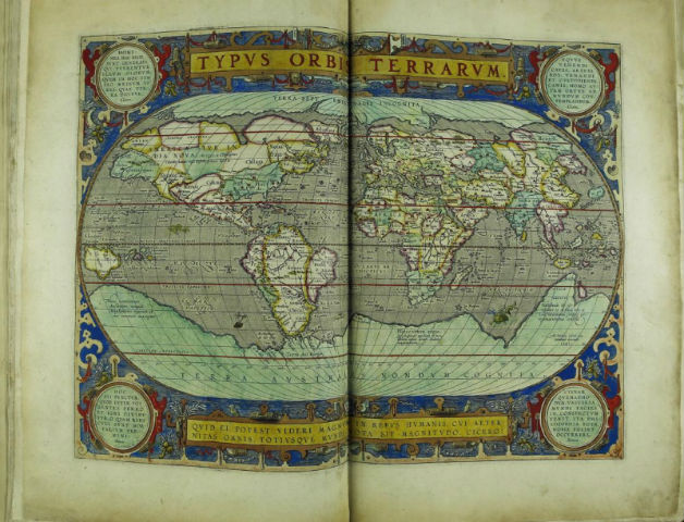
Abraham Ortelius (1527–1598) is one of the most famous cartographers, renowned for producing the first modern atlas, featuring around 160 maps, and titled the Theatrum orbis terrarum, which translates to theater of the whole world. Ortelius is recognized as a key founder of the Dutch School of Cartography. His groundbreaking atlas published in 1570 had over 40 editions in seven languages with continuous printings through 1620. In October 2017, Arader Galleries auctioned a copy from 1606 for $180,000.
The world auction record for the most expensive single map ever sold, at nearly $2.1 million, including the buyer’s premium, was a 1789 map of America by Abel Buell titled A New and Correct Map of the United States of North America that sold at Christie’s New York in 2010. It had the distinction of being the first map printed in the United States, shortly after it gained its independence from England. The map’s high price can also be attributed to its rarity as there were but eight known copies.
Collectors tend to collect maps based on places where they live or visited or maps made at a certain time in history. Astronomy buffs may collect celestial maps and militaria collectors may crossover into map collecting to acquire military maps.
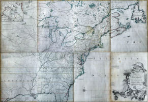
In the United States, maps of early America are very collectible. A set of three manuscript maps, 1736-1737, which claimed to be the first accurate and detailed survey of the Potomac River, show the river’s headwaters and how it ran through Westmoreland County in Virginia in 1737. The maps became source material for larger maps used to establish Sir Thomas Fairfax’ property claims to the Northern Neck area in Virginia. The three maps sold together as one lot by Arader Galleries for $675,000 in a September 2016 auction, the highest price result for a map on LiveAuctioneers.
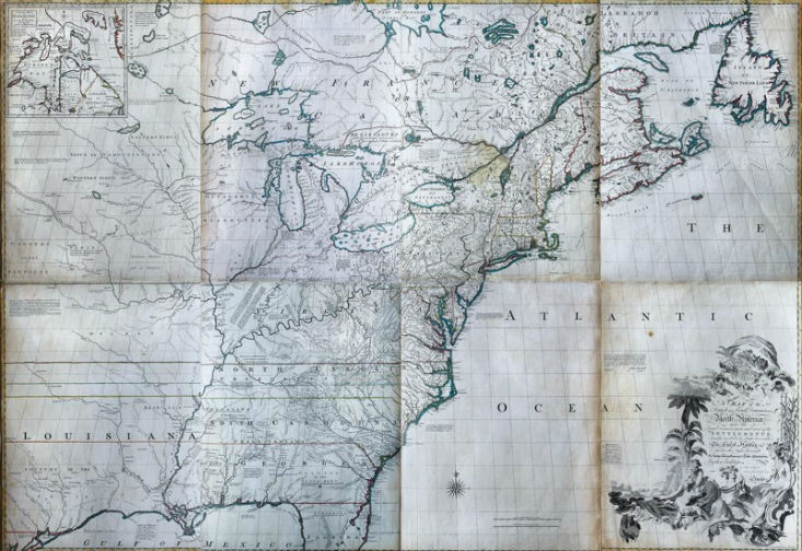
Other standouts among American maps include a 1755 map of the British and French dominions in North America by John Mitchell, which was the primary political treaty map in American history. “Regarded by many authorities as the most important map in the history of American cartography, 21 editions and impressions of the map appeared between 1755 and 1781,” according to the auction catalog description when it sold for $400,000 at Arader Galleries in June 2017.
In July 2011, North Carolina-based auctioneer Brunk Auctions sold A Compleat Map of North-Carolina… for $160,000. The map is one of 12 known copies. Published in London in 1770, the map was engraved by I. Bayly from a survey done by Captain Collet, Governor of Fort Johnson. It has detailed depictions of homes, stores, towns and geographic features, an alligator, a wildcat, and an ornate cartouche with a dedication to King George III and the English royal crest. “This map surpasses all previous examples from the region in scope and accuracy and remained the prototype for most maps of North Carolina in the 40 years following its creation,” according to the auction catalog.
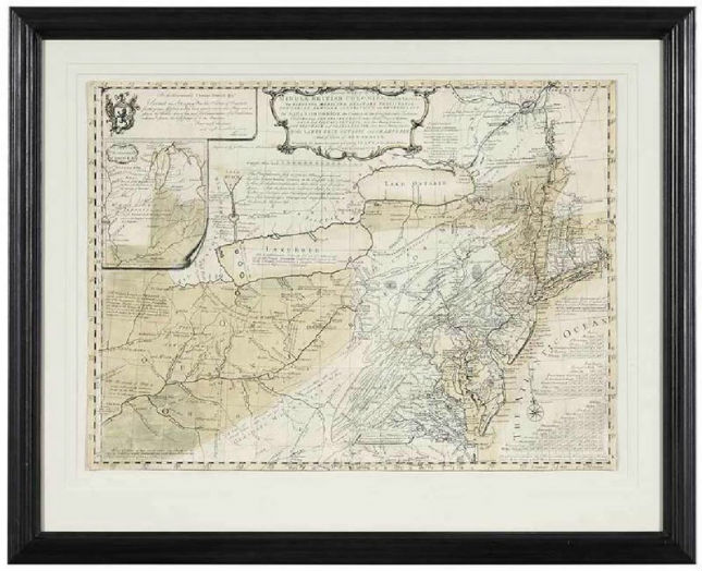
The Arrowsmith map shown below, issued in 1802, was noted for its central role in helping plan the Lewis and Clark Expedition and being taken on the trip by the famed explorers. Copies are scarce today as the map was printed for only about 18 months before another edition was published.
So, for your everyday travels, feel free to ask Siri for directions instead of pulling out a Rand McNally map but for cartography collectors, nothing beats an antique map hand-colored and fancifully decorated with mermaids or mythical creatures. Collectors of high-end maps will no doubt store or display them in climate-controlled conditions, framed or laying flat, but even beginning collectors might enjoy decorating their walls with reasonably priced examples, such as a vintage classroom map of the world.