

Maps are a snapshot from the history of the world. They record the result of battles, migrations and the birth of new nations. Enthusiasts collect maps for various reasons – the mind, the eye and the heart all play a role.
For serious scholars, they are crucial documents that present reality on the ground at that particular date. They reveal the border lines in a year of conflict or the growth of cities during a period of global exploration. Rarity is more important than condition; a single example may reveal new information.
Maps often have tremendous graphic appeal in both black and white and full color examples. Cartographers were not content with just the ground plan; artists added ornamental borders, stately personifications of a city or state, and even mythological monsters swimming in the oceans.
Display them in groups of three or four for added impact.
Finally, simple nostalgia for the past may spur on that winning bid. Maps reveal details of the place and time where ancestors were born. Honeymoon in France, gap year in New Zealand, anniversary cruise to Alaska – a map celebrating a special memory will bring a smile every time you walk by.
Cuba with Havana inset
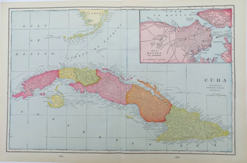
Thanks to improved diplomatic relations, a new wave of American travelers is discovering the rich cultural heritage of the nearby island of Cuba. The date of the map – 1902 – was a crucial year for the country; American occupation had ended and a free Republic of Cuba was born.
Map of North America
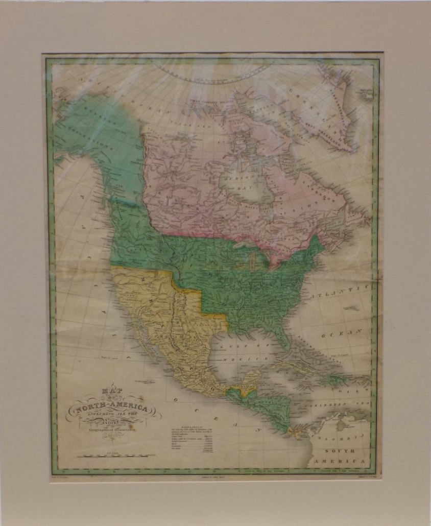
This rare 1826 Map of North America, Including All the Recent Geographical Discoveries is a colorful lesson in global spheres of influence. Canada was a British possession, while Russia would rule Alaska until Seward’s purchase of the territory in 1867. The United States, as we know it today, was still under construction; much of the Southwest from California to Texas was part of Mexico.
Bird’s-Eye View of the Holy Land
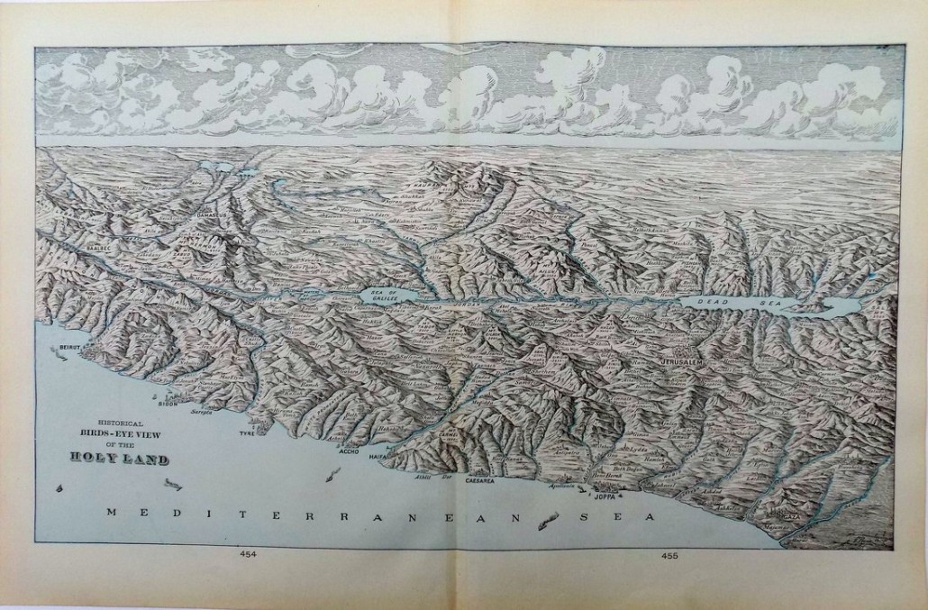
Maps approach their subject with different objectives. This Historical Bird’s-Eye View of the Holy Land lays out the topography of a region sacred to three major world religions. The map records the names of cities and holy sites along the shore of the Mediterranean and surrounding the Sea of Galilee and Dead Sea.
Straits of Magellan
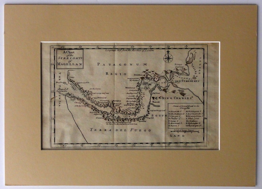
The Straits of Magellan is a navigable shortcut from the Pacific to the Atlantic Ocean between the southern edge of South America and Tierra del Fuego. Collectors of nautical maps will appreciate this early view of the channel taken from a 1716 geographical atlas published by Herman Moll in London.
England
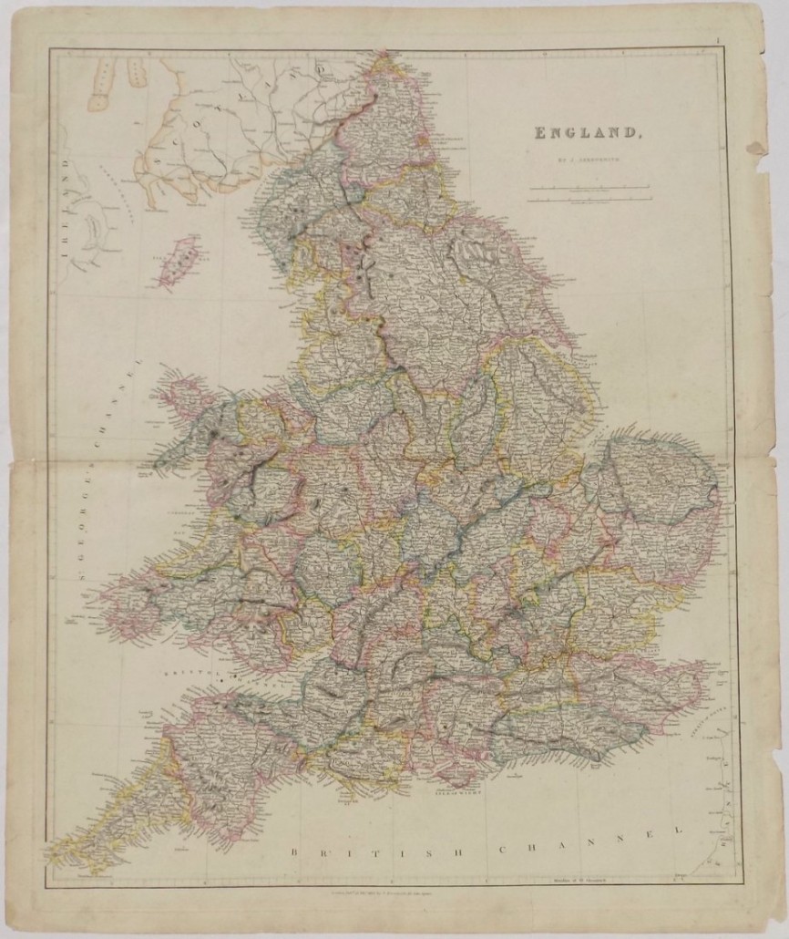
Anyone with English ancestry can trace family history on this detailed map with counties carefully outlined in color. The example was printed by J. Arrowsmith in 1836, a year before Queen Victoria began her long reign.
Dept du Loiret
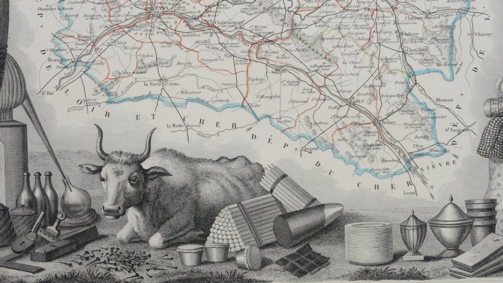
The engraved plates for the Atlas National Illustre by Victor Levasseur (1800-1870) were both decorative and information packed. The map for the Department du Loiret in north central France is surrounded by statistics and lists of celebrities, points of interest, and local products, complete with charming illustrations.
New Zealand, South Island
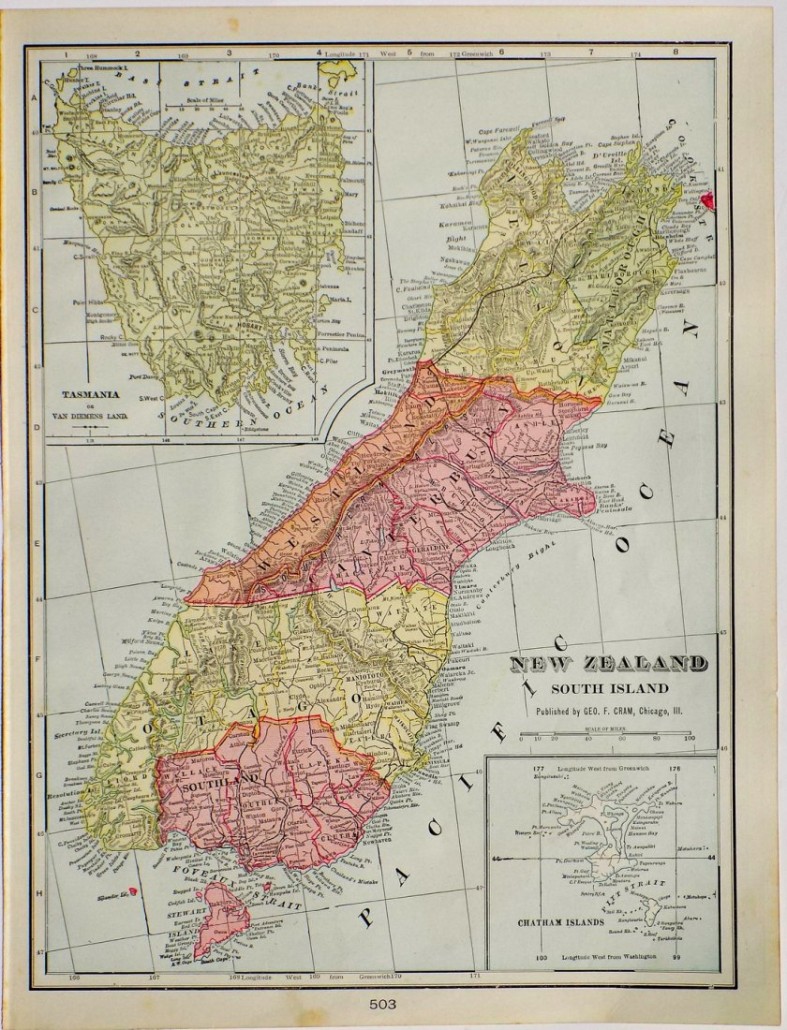
Far away New Zealand, which provided the spectacular scenery for the Lord of the Rings and Hobbit trilogies, is depicted in a pair of 1902 maps printed by George F. Cram in Chicago. One shows the North Island, the other (illustrated here) the South Island with insets of Tasmania and the Chatham Islands.
Richmond, 1868
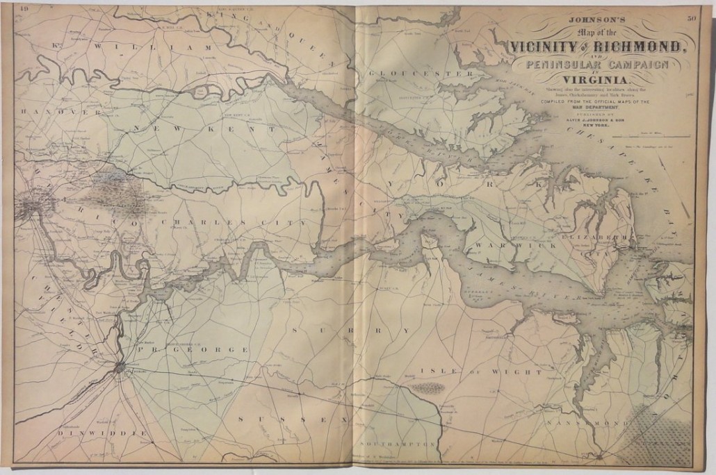
Perfect for Civil War buffs, this map from Johnson’s Atlas of the World was printed in 1868 at the end of the conflict. Compiled from War Department documents, it covers the area around Richmond, Virginia, where the Peninsular Campaign by the Union Army took place in 1862.
British Possessions
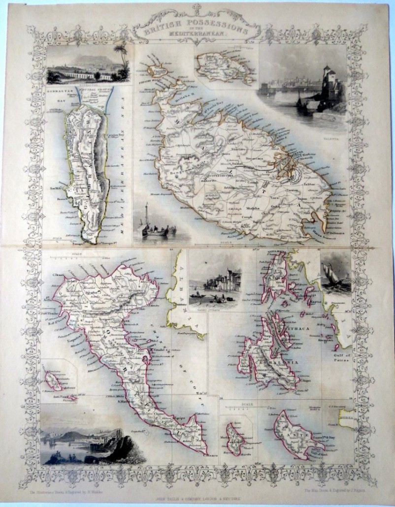
This attractive 1851 map of British Possessions in the Mediterranean, including Malta and Gibraltar, is enhanced with hand-colored detail, an ornamental border, and appealing vignettes of cities along the shore.
If a map is not already framed, pick a shop with experience in mounting fragile documents. Then display a time capsule of history in your home or office.
View the Last Chance Auction of “Antique Maps: All Around the World” at www.LiveAuctioneers.com.
___
By Karla Klein Albertson