

RICHMOND, Va. – A spectacular wall map celebrating the New World – Henry Abraham Chatelain’s Carte Tres Curieuse de la Mer du Sud – and rare maps from 1622 and 1596 were among the top-selling items in Old World Auctions’ latest auction, which ran for two weeks and ended on June 21. Of the nearly 800 lots in the auction, 78% sold, and the event totaled $290,000.
Chatelain’s map of the New World is richly engraved in the tradition of Dutch cartography. It features vignettes of the native culture, and indigenous flora and fauna, such as a beaver dam, rituals of the Aztecs, and Niagara Falls. The 1719 piece achieved $17,250, above its estimate of $14,000-$16,000.
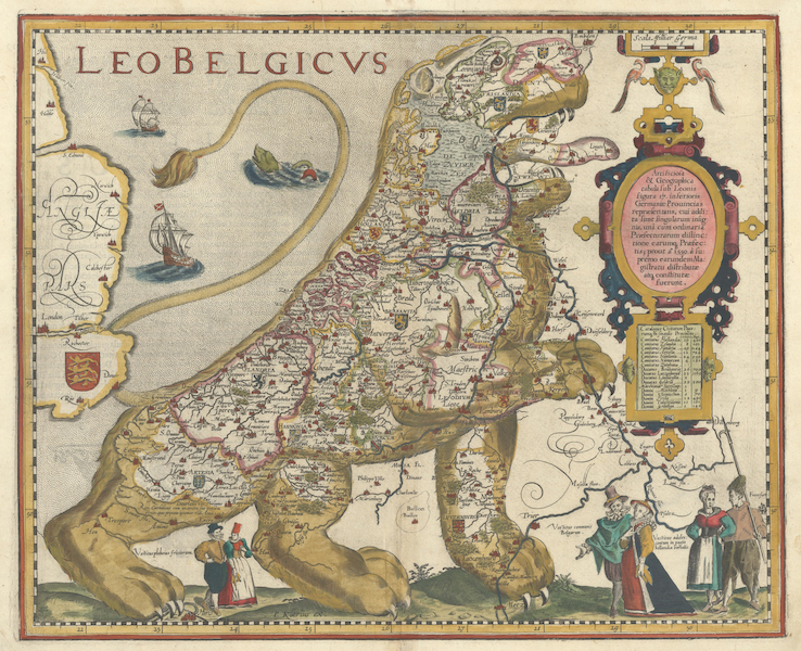
Pieter Van Den Keere’s ‘Leo Belgicus’ map from 1622, $11,500
Pieter Van Den Keere’s Leo Belgicus – the most popular of the so-called “Lions of Belgium” – is a series of arresting maps that depicts the Netherlands and Belgium in the shape of a lion. The 1622 work of cartography sold for $11,500 with an estimate of $14,000-$16,000.
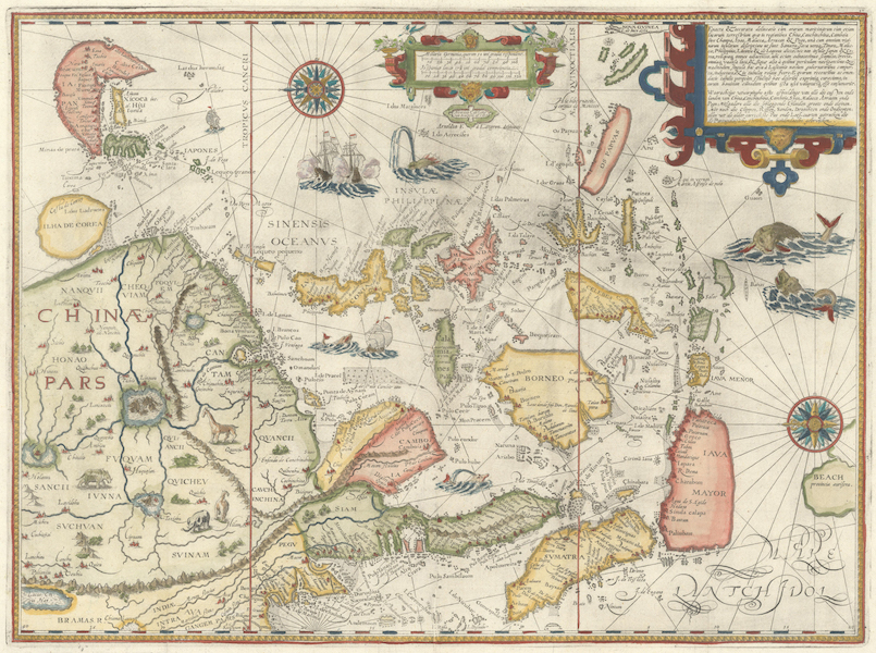
One of the most decorative and influential maps of Southeast Asia, Linschoten’s Exacta & Accurata Delineatio cum Orarum Maritimarum tum Etiam Locorum Terrestrium quae in Regionibus China, is a 1596 map that was the first published map of the Far East to be derived from Portuguese sources. Estimated at $13,000-$15,000, it realized $10,925.
Other highlights from the June 21 auction include:
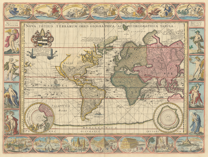
Lot 9, a scarce 1680 edition of a Carte-a-Figures Map of the World, Nova Totius Terrarum Orbis Geographica ac Hydrographica Tabula by Moses Pitt, is one of the most intriguing examples of the internal workings of the map-publishing business in the 17th century. It earned $9,200 against an estimate of $11,000-$13,000.
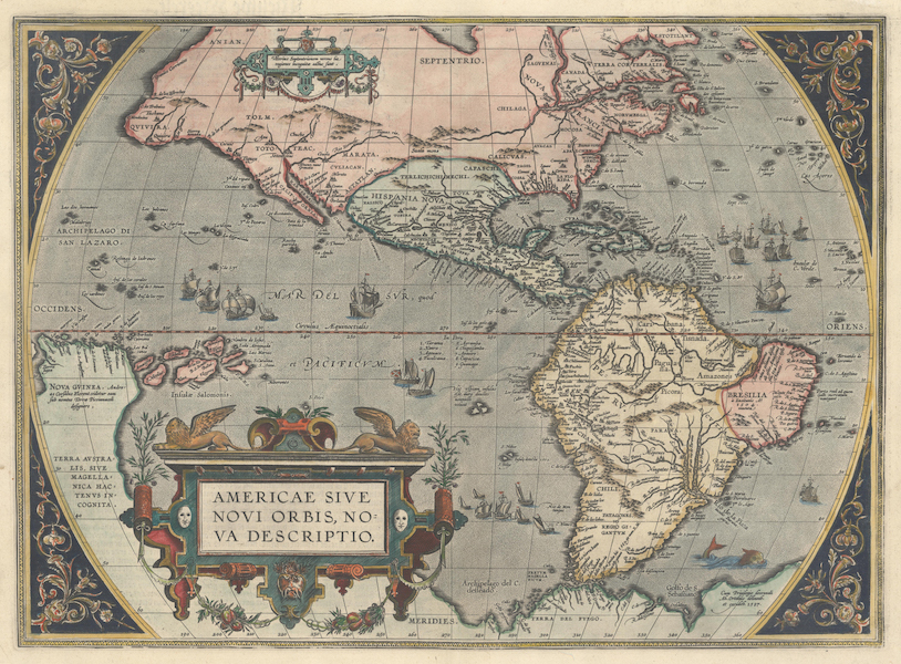
Abraham Ortelius’ influential 1587 map of the New World, Americae sive Novi Orbis, Nova Descriptio, is one of the most famous maps of America and one that had enormous influence on the future cartography of the New World. It attained $8,050 against an estimate of $6,000-$7,000.
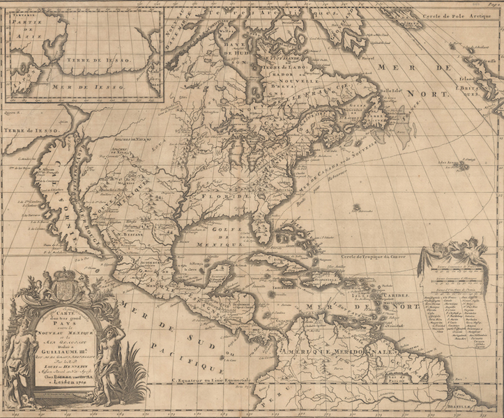
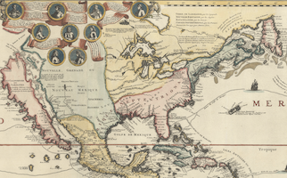
Amerique Septentrionalis Carte d’un Tres Grand Pays Entre le Nouveau Mexique et la Mer Glaciale, an influential 1704 map of North America, is by Louis de Hennepin, a Franciscan missionary who accompanied LaSalle in the explorations of the Upper Mississippi and later was captured by Sioux Indians. Sold for $4,500, it had been estimated at $2,750-$3,500.
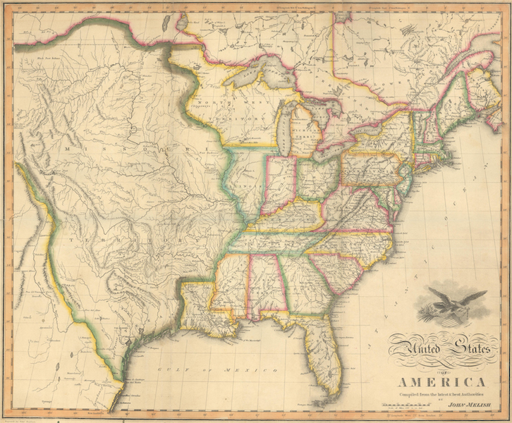
An early and separately issued 1818 version of John Melish’s important map, United States of America Compiled from the Latest and Best Authorities, extends west to the Rocky Mountains and provides a detailed view of the Missouri River based on information from the expeditions of Lewis & Clark, Pike, Humboldt and others. It won $3,600 against an estimate of $2,000-$2,300.

A 1902 map portraying the transportation system built by H.B. Plant, Complete Map of Florida and the South with Index Showing the Semi-Tropical Resorts Reached by the Lines of Atlantic Coast Line by Railroad Co., is a color lithograph map that shows Plant’s rail lines extending throughout Alabama, Georgia, Florida and part of South Carolina. It romped to $3,900 on an estimate of $250-$325.