Sold2019AN ANTIQUE MAP, "Poli Arctici et CircumiacentiumAN ANTIQUE MAP, "Poli Arctici et Circumiacentium Terrarum Descriptio Novissima," CIRCA 1676, hand colored engraving on paper, published by Frederick de Wit (1630-1706), a banner cartouche U/L, "GedrucSee Sold Price
Sold2019AN ANTIQUE MAP, "Accuratissima Angliæ Regni et WalliæAN ANTIQUE MAP, "Accuratissima Angliæ Regni et Walliæ Principatus," AMSTERDAM, CIRCA 1680, hand colored engraving on paper, published by Frederick de Wit (1630-1706), showing most of the British IslSee Sold Price
Sold2017(MAP, SICILY) DE WIT, FREDERICK. Insula sive regnumMAP, SICILY by DE WIT, FREDERICK, Insula sive regnum Siciliae urbibus praecipuis exornatum. Amsterdam, circa 1680. Hand-colored engraved map of Sicily. With inset plans of Messina, Milazzo and PalermoSee Sold Price
Sold2016An important map of Asia, c1680 by Frederick De WitAn important map of Asia, c1680 by Frederick De Wit depicting the area of Asia, including China, Japan, Tibet, India, Russia, Persia, Arab and more (center folding area repair), 19.5"x23"See Sold Price
Sold2023De Wit Map of Zeeland, HollandDE WIT, Frederick (c. 1630-1706). Comitatus Zelandiae tabula... Engraved map with original hand color. Amsterdam, c. 1680. 21 1/2" x 24 3/8" sheet, approx. Antique Map of Zeeland, Netherlands showingSee Sold Price
Sold2023Antique Map of Ireland, Frederick de WittDutch, 1629-1706..REGNI et INSULAE HIBERNIAE, latter 17th century, hand colored copper plate engraving, sight 28 x 19.5 in..toning, areas of foxing and discoloration, creases, under glass, not examineSee Sold Price
Sold2017de Wit: Antique Map of Portugal & Parts of Spain, 1690Title/Content of Map: 1690 de Wit Map of Portugal and Parts of Spain -- Tabula Portugalliae et Algarbia Date Printed: 1690, Amsterdam Cartographer: F de Wit Size: 18.5 x 22.2 in. Condition: Good. ExceSee Sold Price
Sold2022MAP- Frederick De. Wit:MAP- Frederick De. Wit: MAP- Frederick De. Wit: NOVISSIMA PRAE CETERISALIIS ACCURATISSIMA REGNORUM ANGLIAE SCOTIAE HIBERNIAE. Ca. 1690, hand coloured and laid down (560x490mm)See Sold Price
Sold2018Ortelius Antique Map: Cyprus Insula, Candia Olim CretaTitle/Content of Map: Cyprus Insula, Candia Olim Creta Date Printed: 1579 Cartographer: Abraham Ortelius Material/Medium: No color, good impression. Latin text on verso. From the first modern atlas- tSee Sold Price
Sold2018Ortelius Antique Map: Candia Insula, ArchipelagiTitle/Content of Map: Candia Insula, Archipelagi Insularum Aliquot Descrip Date Printed: 1588 Cartographer: Abraham Ortelius Material/Medium: No color. Spanish text on verso. From the first modern atlSee Sold Price
Sold2017[MAP] FREDERICK DE WIT (DUTCH, 1630-1706)Map of Frankfurt in Hesse, Germany, c. 1680See Sold Price
Sold2017[MAP] FREDERICK DE WIT (DUTCH, 1630-1706)Map of the Archbishopric Treves, Germany, c. 1680See Sold Price
Sold2017[MAP] FREDERICK DE WIT (DUTCH, 1630-1706)Map of North Rhine-Westphalia, Germany, c. 1680See Sold Price
Sold2017[MAP] FREDERICK DE WIT (DUTCH, 1630-1706)Map of Cologne and the Lower Rhine Region, Germany, c. 1690See Sold Price
Sold2023Antique Map of England - 1670F. De Wit Antique Print 1670 - Amsterdam Map of England Image Size: 23.5 x 20 in. Overall Framed Size: 33 x 28.75 in. Framed behind glass.See Sold Price
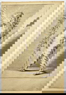
Sold2023Antique Engraving - Frederick de Wit - Female Form - Drawing of Woman FigureTitle/Artist: Antique Engraving - Frederick de Wit - Female Form - Drawing of Woman Figure Medium: Antique engraving originates from "Lumen Picturae: A Classical Drawing Manual" by Frederick de Wit. TSee Sold Price
Sold2023Antique Map Print - Frederick de Witt - Map of The Kingdom of Denmark - EuropeTitle/Artist: Antique Map Print - Frederick de Witt - Map of The Kingdom of Denmark - Europe Date/Period: 1690 Material: Paper Dimensions: 56 cm x 67 cm Description: The Kingdom of Denmark, ComprisingSee Sold Price
Sold2017De Wit Map of AfricaTotius Africa Accuratissima Tabula. Frederick de Wit (1629/1630-1706). Engraved map with original hand color. Amsterdam, c. 1660. 19 1/4 x 23 inches visible, 24 3/4 x 28 1/2 inches framedSee Sold Price
BonhamsAFRICA DE WIT (FREDERICK) Totius Africae Accuratissima Tabula,Amsterdam, Frederick de Wit, [c.16...£10
BonhamsEAST AFRICA DE WIT (FREDERICK) Occidentalior Tractus Indiarum Orientalium a Promontorio Bonae Sp...£300
BonhamsWEST AFRICA DE WIT (FREDERICK) Tractus Littorales Guineae a Promontorio Verde usque ad Sinum Cat...£10
3 hrs LeftTrillium Antique Prints & Rare BooksSanson - Map of Canada or New France with the Great Lakes$75(1 bid)
3 hrs LeftTrillium Antique Prints & Rare BooksSanson - Map of Florida (encompassing most of Southeast North America)$130(2 bids)
3 hrs LeftTrillium Antique Prints & Rare BooksSanson - Map of the British Isles (Ireland, Scotland, England)$75
Jun 08Trillium Antique Prints & Rare BooksSanson - Map of California as an Island, Mexico (Audience de Guadalajara)$75
3 days LeftJasper521755 MAP of RUSSIAN EMPRIRE & INNER ASIA CHINESE TARTARY antique 20 x 27 in.$100(1 bid)
3 hrs LeftTrillium Antique Prints & Rare BooksJournal des Dames et des Modes - Four Volumes with 186 Pochoir Fashion Plates$1,000


![[MAP] FREDERICK DE WIT (DUTCH, 1630-1706): Map of Frankfurt in Hesse, Germany, c. 1680](https://p1.liveauctioneers.com/3820/102962/52635987_1_x.jpg?height=310&quality=70&version=1492789342)
![[MAP] FREDERICK DE WIT (DUTCH, 1630-1706): Circulus Bavaricus](https://p1.liveauctioneers.com/3820/102962/52635903_1_x.jpg?height=310&quality=70&version=1492789342)
![[MAP] FREDERICK DE WIT (DUTCH, 1630-1706): Totius Flumenis Rheni Novissima](https://p1.liveauctioneers.com/3820/102962/52635922_1_x.jpg?height=310&quality=70&version=1492789342)
![[MAP] FREDERICK DE WIT (DUTCH, 1630-1706): Map Lower Saxony, Germany](https://p1.liveauctioneers.com/3820/102962/52635937_1_x.jpg?height=310&quality=70&version=1492789342)
![[MAP] FREDERICK DE WIT (DUTCH, 1630-1706): Electoratus et Palatinatus Rheni](https://p1.liveauctioneers.com/3820/102962/52635902_1_x.jpg?height=310&quality=70&version=1492789342)
![[MAP] FREDERICK DE WIT (DUTCH, 1630-1706): Map of the Alsace, Germany, c. 1680](https://p1.liveauctioneers.com/3820/102962/52635901_1_x.jpg?height=310&quality=70&version=1492789342)
![[MAP] FREDERICK DE WIT (DUTCH, 1630-1706): Map of the Archbishopric Treves, Germany, c. 1680](https://p1.liveauctioneers.com/3820/102962/52635920_1_x.jpg?height=310&quality=70&version=1492789342)
![[MAP] FREDERICK DE WIT (DUTCH, 1630-1706): Map of North Rhine-Westphalia, Germany, c. 1680](https://p1.liveauctioneers.com/3820/102962/52635921_1_x.jpg?height=310&quality=70&version=1492789342)
![[MAP] FREDERICK DE WIT (DUTCH, 1630-1706): Map of Cologne and the Lower Rhine Region, Germany, c. 1690](https://p1.liveauctioneers.com/3820/102962/52635857_1_x.jpg?height=310&quality=70&version=1492789342)
![[MAP] FREDERICK DE WIT (DUTCH, 1630-1706): Circulus Franconicus](https://p1.liveauctioneers.com/3820/102962/52635856_1_x.jpg?height=310&quality=70&version=1492789342)