Sold2017Mitchell: Railroad & Steamboat Map of the US, 1887Map: 1887 Mitchell Railroad and Steamboat Map of the US -- Railroad Map of the United States, Showing the through Lines of Communication from the Atlantic to the Pacific. Together with the Various SteSee Sold Price
Sold20201884 Mitchell Railroad Map of the United States --Title/Content of Map: 1884 Mitchell Railroad Map of the United States -- Railroad Map of the United States, Showing the through Lines of Communication from the Atlantic to the Pacific. Together with tSee Sold Price
Sold20211887 Mitchell Railroad Map of the United States --Title: 1887 Mitchell Railroad Map of the United States -- Railroad Map of the United States, Showing the through Lines of Communication from the Atlantic to the Pacific. Together with the Various SteaSee Sold Price
Sold2019Railroad Map of the United States Showing the ThroughReserve Reduced! Title: Railroad Map of the United States Showing the Through Lines of Communication from The Atlantic to The Pacific... Publication Date: 1886 Cartographer: BRADLEY, WM. M. Publisher:See Sold Price
Sold2021ca. 1929 RAILROAD UNITED STATES MAP SHOWING NEW YORKVintage Railroad Map, "MAP of THE UNITED STATES SHOWING NEW YORK CENTRAL LINES". Map by Rand McNally and Co. Includes printed information on the reverse. Tiny text along bottom partly reads; "NY 4-29"See Sold Price
Sold2016Commercial Map of the US, Principal Lines of RailroadCommercial Map of the United States Showing The Principal Connecting Lines of Railroad David M Warrens 1879, Common School Geography 11.75 x 9.75 inches No Reserve: This lot starts at $1 and has no reSee Sold Price
Sold20211879 Railroad map of the United States. Cowperthwait.Title: 1879 Railroad map of the United States. Cowperthwait. 8.75 x 10.75 Description: "Unusual and thorough hand-colored map showing the network of rail lines in the eastern half of the United StatesSee Sold Price
Sold2021Railroad Map of the United States[America, East Coast] Ensign, Bridgman and Fanning's Railroad Map of the United States showing the Depots & Stations. Engraved map with original hand color. Engraved by W. S. Barnard. New York, 1856.See Sold Price
Sold20211880 Gannett Climate Map of the US with IsothermalTitle: 1880 Gannett Climate Map of the US with Isothermal Minimum Temperature Lines -- Map of the United states Showing the Distribution of Lines of Minimum Temperature… Cartographer: H Gannett / DeSee Sold Price
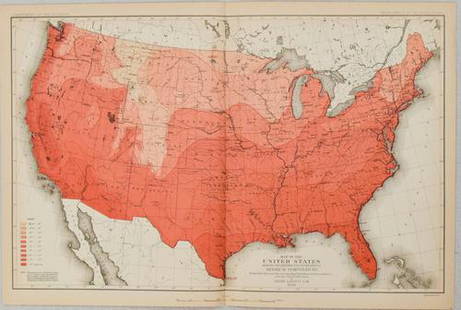
Sold20221879 Powell US Rain Chart Map -- Rain Chart of the United States Showing by Isothermal Lines theTitle: 1879 Powell US Rain Chart Map -- Rain Chart of the United States Showing by Isothermal Lines the Distribution of the Mean Annual Precipitation in Rain and Melted Snow Cartographer: J W Powell /See Sold Price
Sold20191886 Mitchell/Bradley Railroad and Steamboat Map of theTitle: 1886 Mitchell/Bradley Railroad and Steamboat Map of the US -- Railroad Map of the United States Together with the Various Steamship Lines along the Seaboard Date: 1886, Philadelphia CartographeSee Sold Price
Sold2017Smith: Antique Railroad Map of the United States, 1855Map: Map of the United States of America, Showing the Rail Roads. Large, Colorful Railroad Map of U.S. 1855 Publication Date: 1855 Authors: HARPER & BROTHERS, SMITH, J. CALVIN / D. MCLELLAN Publisher:See Sold Price
Sold20191886 RR Map of U. S. also shows Steamship linesVery clean, interesting and informative railroad map of the United States from Mitchell's 1887 New General Atlas, with important information on the late 19th century United States. Titled “RailroadSee Sold Price
Sold2021(RAILROADS.) Rand, McNally & Co. A Correct Map of the(RAILROADS.) Rand, McNally & Co. A Correct Map of the United States of America, Showing the Atchison, Topeka and Santa Fe R.R. and Connections. Color-printed lithographed railroad map. 15½x27See Sold Price
Sold2024American Express/New York Central Railroad Map of the United States-1934This is a railroad map of the United States, as produced by the American Express Company, for distribution by the New York Central Railroad in 1934. New York Central lines are featured on this map, thSee Sold Price
Sold2023Union Pacific Railroad Brochures & Maps of The United StatesUnion Pacific Railroad Brochures & Maps of The United States Group of Brochures & Maps. Along the Union Pacific Railroad brochures in plastic protective covers and showing minimal use with dates of 19See Sold Price
Sold2024Crams Railroad Map of New York-1881This is a Crams Railroad Map of New York dated 1881, Has a great fold-out full color map of the state of New York showing all railroad lines. Has almost no tears or frays. Booklet has 36 pages of counSee Sold Price
Sold2023Chicago & North Western Railroad Line Timetables, Maps, Ink Blotter & Booklets.Chicago & North Western Railroad Line Timetables, Maps, Ink Blotter & Booklets. Large group of Chicago & North Western Line memorabilia. Chicago & North Western Line map of United States 1928 in plastSee Sold Price
Sold2016Traveling map of U.S. by J. Calvin Smith 1849Heading: Author: Smith, John Calvin Title: A New Map for Travelers through the United States of America, Showing the Railroads, Canals & Stage Roads Place Published: New York Publisher:Sherman & SmitSee Sold Price
Sold2023Map With Coca-Cola Advertising, Folded SizeMap With Coca-Cola Advertising, Folded Size, 9.25" x 4.25", 1933 Edition, Rand-McNally United States Showing Railroads, Cities, Towns, Physical Features, National Parks, 1930 Census, Private CollectioSee Sold Price
Sold20171848 Smith Pocket Map of United States1848 Smith Pocket Map of United States -- A New Map for Travelers through the United States of America, Showing the Railroads, Canals & Stage Roads Smith & Son 1848 New York 21 x 26.75 in. A relativelSee Sold Price
Sold20221886 map of Florida showing all RR lines1886 Railroad map of Florida showing the entire state in one view by Phillips & Hunt. From an 1886 edition of People’s Encyclopedia of Universal Knowledge. Shows proposed rail routes from LeesbSee Sold Price
Sold20181855 Smith Map of the MidWest -- Guide through Ohio,Title/Content of Map: 1855 Smith Map of the MidWest -- Guide through Ohio, Michigan, Indiana, Illinois, Missouri, Wisconsin & Iowa Showing the Township Lines of the United States Surveys Date Printed:See Sold Price
Sold20231853 Colton Map of the US Midwest -- Guide through Ohio, Michigan, Indiana, Illinois, Missouri,Title: 1853 Colton Map of the US Midwest -- Guide through Ohio, Michigan, Indiana, Illinois, Missouri, Wisconsin & Iowa. Showing the Township Lines of the United States Surveys … Cartographer: JSee Sold Price
5 days LeftSwann Auction Galleries(UNITED STATES -- RAILROADS.) Edward Stanford. Stanford's Map of the United States Showing the$500
33 Lots AwaySimpson Galleries, LLC.JULIUS BIEN (1826-1909) AN AMERICAN CIVIL WAR RECONNAISSANCE MAP, "Map of Texas and Part of New$100
3 days LeftJasper521880 Map of US Tobacco Production by Type of Tobacco -- Map of the United States Showing the Regions$45
3 days LeftJasper52Rand, McNally & Co.'S New Official Railroad Map of the United States And Dominion of Canada$95
3 days LeftJasper521880 Map of US Wheat Farming -- Map of the United States Showing the Distribution of Production of$45
3 days LeftJasper52Map Showing the Railroad and Canal Lines Used in the Determination of Elevations$25
Jun 23East Coast Fine Arts LLC1777 US Revolutionary War Map French Brion de la Tour Theatre de Guerre$1,000
315 Lots AwaySimpson Galleries, LLC.J.H. Young (1792-1870) AN AMERICAN FEDERAL PERIOD MAP, "Mitchell's Travellers Guide Through the$500
4 days LeftDan Morphy AuctionsPLATE CXIII. MAP OF INDIAN TERRITORY SHOWING DISTRIBUTION OF WOODLAND” FROM THE TWENTY-FIRST$100
4 days LeftDan Morphy AuctionsPHELPS’S TRAVELERS GUIDE THROUGH THE UNITED STATES; CONTAINING UPWARDS OF SEVEN HUNDRED$1,000
5 days LeftSwann Auction Galleries(AMERICAN SOUTHEAST.) Group of 3 engraved maps of the region.$600(1 bid)


![Railroad Map of the United States: [America, East Coast] Ensign, Bridgman and Fanning's Railroad Map of the United States showing the Depots & Stations. Engraved map with original hand color. Engraved by W. S. Barnard. New York, 1856.](https://p1.liveauctioneers.com/1968/203922/103366115_1_x.jpg?height=310&quality=70&version=1620913733)