Sold20191875 US War Dept. Map of Atlanta Civil War Battle --Title/Content of Map: 1875 US War Dept. Map of Atlanta Civil War Battle -- Map Illustrating the Military Operations in Front of Atlanta, Ga. From the Passage of Peach Tree Creek, July 19th 1864, to thSee Sold Price
Sold20191877 US War Dept. Final Map of Atlanta Civil War BattleTitle/Content of Map: 1877 US War Dept. Final Map of Atlanta Civil War Battle -- Map V. Illustrating the Military Opretations of the Atlanta Campaign… Date: 1877, New YorkCartographer: US War DepartSee Sold Price
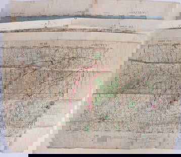
Sold2017"The Atlanta Campaign", Framed 1874 Civil War MapAmerican, last quarter 19th century. "Map IV Illustrating the Military Operations of The Atlanta Campaign", lithograph on paper, published by American Photo-Lithographic Co. (New York) in 1874. LargeSee Sold Price
Sold20211777 1st American Rev War Battle Map: SEAT of WARAmerican Revolution First American Printing Of A Revolutionary War Battle Map "A View of the Present Seat of War, at and near New-York." [1776] Revolutionary War Printed, First American printed RevoluSee Sold Price
Sold20171759 Map Seat of War on Rhine1759 Map Seat of War on Rhine 1759 “Map of the Seat of War on the Rhine”, printed for Gentleman’s Magazine, folding map measures 11 x 8”, Fine. Please note that this lot has a confidential resSee Sold Price
Sold2023Smollett, Tobias 1761 Map. Seat of War, Empire of Germany"An Accurate Map of the seat of War in the Empire of Germany as also in the Kingdom of Prussia" Copper Engraved Map Published 1757-65, London for "A Complete History of England" by Tobias George SmollSee Sold Price
Sold2018Seat of War in the East. Map of Turkey and PartsTitle/Content of Map: Seat of War in the East. Map of Turkey and Parts Adjacent. Cartographer: U.S. ARMY. CORPS OF ENGINEERS Size: 15.75X28.25 "Compiled and published by authority of the Hon. the Sec.See Sold Price
Sold2023WWII U.S MILITARY WAR MAPS OF FRANCE/BELGIUM - (9)171281 WWII U.S MILITARY WAR MAPS OF FRANCE/BELGIUM - (9) WWII U.S. military war maps of France/Belgium to include one sheet 79 Defenses Vierville-Sur-Mer France (12500) war map, two sheet 31/18 S.E.See Sold Price
Sold2023WWII U.S. MILITARY WAR MAPS OF FRANCE - (3)171283 WWII U.S. MILITARY WAR MAPS OF FRANCE - (3) WWII U.S. military war maps of France to include, one sheet 6F/6 Vire France(50000) war map second edition, one sheet 6E/6 Isigny France(50000) war mSee Sold Price
Sold2022Great 1863 Civil War Military Map of U. S. by Johnson & WardWhile America was involved with the Civil War, atlas publishers like Johnson and Ward produced detailed maps to capitalize on the nation’s interest in that conflict. This is the more desirable of thSee Sold Price
Sold20182 Colton Civil War Maps, Military Stations & Forts, 3Two (2) Colton Civil War maps, 3 items total. 1st item: J.H. Colton, Civil War era map of the United States showing Military Stations and Forts, prepared for The Rebellion Record, New York: G.P. PutnaSee Sold Price
Sold2022United States military map during civil war. 1862 byTitle: United States military map during civil war. 1862 by Johnson Date/Period: 1862 Materials: Steel plate engraved Size: 19" x 27" Shows inserts of eight southern ports, interesting boundaries of tSee Sold Price
Sold20171862 Johnson Civil War Military Map of US1862 Johnson Civil War Military Map of US -- Johnson's New Military Map of the United States Showing the Forts, Military Posts &c. all the Military Divisions with Enlarged Plans of Southern Harbors…See Sold Price
Sold2022Civil War Military map - scarce territorial bordersThe Johnson and Ward atlas company produced two memorable, double-page Civil War maps of the United States. This is the more desirable issue, showing the state and territory borders instead of the MilSee Sold Price
Sold20201861 Civil War military map in full hand-colorLarge format, double-page “Johnson’s New Military Map of the United States showing the Forts, Military Posts &c. with Enlarged Plans of Southern Harbors” by Johnson and Ward. Original and vividSee Sold Price
Sold2019Civil War Military Map of the U.S. - 1862Excellent example of the more desirable of the two extant variants of this map. This variant, showing a layout of the states rather than military zones, offers a wonderful insight into the political sSee Sold Price
Sold20211861 Civil War Military Map of the U.S.Johnson's New Military Map of the United States. NY: Johnson & Browning, 1861. 17.5 x 24", in 26.25 x 32.5" frame, under glass.See Sold Price
Sold2017Johnson: Antique 1st Edition Civil War Military Map1st edition Johnson’s Civil War Military Map, Johnson & Browning. Scarce 1861 map by A. J. Johnson showing the military deportment of the United States in 1860, just before war broke out in the statSee Sold Price
Sold2021Civil War "Military Map "Military Map showing the theater of operations in the Tullahoma, Chickamauga and Chattanooga Campaigns, Prepared in 1865, printed in 1896 framed is 49" x 39" overallSee Sold Price
Sold2021Sir Douglas Haig's Despatches (10 Maps)SKU #: 030591 Title: Sir Douglas Haig's Despatches (10 Maps) Description: Military maps from World War I. Complete set of ten (10) color maps in original slipcase box in very good condition. Folded maSee Sold Price
Sold2018Map of the Seat of War, American Conflict 18651865 Civil War Era War Map. Map of the Seat of War to accompany the American Conflict. Hartford: Published by O. D. Case & Co. Measures 40" x 23.5" with professional frame. Fair condition, stains andSee Sold Price
Sold2019United States. Civil war era military map. ShowingTitle/Content of Map: United States. Civil war era military map. Showing southern ports Date: 1863 Cartographer: By Johnson & Ward. From, Johnson’s New Illustrated Family Atlas Size: 18x 26 1/4”.See Sold Price
Sold2024Johnson’s 1863 Family Atlas with Seat of War mapColton, J. H., and A. J. Johnson (compilers). Johnson’s New Illustrated Steel Plate FAMILY ATLAS, with Physical Geography, and with descriptions Geographical, Statistical, and Historical, includSee Sold Price
Sold2024Rare Civil War map: Bird's Eye View Seat of War, Prang, 1862BIRD'S EYE VIEW OF THE SEAT OF WAR, 1862, Civil War lithograph map published by Louis Prang & Co., Boston. Depicts key sites of the conflict including Washington, Baltimore, Harper's Ferry, Richmond,See Sold Price
4 days LeftJasper52World War 2 Europe Battle of the Atlantic 1939-43 Axis Expansion limits 1959 map$15
7 days LeftSimpson Galleries, LLC.JULIUS BIEN (1826-1909) AN AMERICAN CIVIL WAR RECONNAISSANCE MAP, "Map of Texas and Part of New$100
Echoes of Glory International Military Auction HouseRARE US Navy Korean War era Pilot's Seat Parachute (KDW)$130(18 bids)
1 day LeftSchilb Antiquarian Rare Books1871 Alfred the Great King of England MAP Battle of Ashdown Vikings Thom Hughes$125(3 bids)
3 days LeftJasper521694 de Fer Three Maps of the Versailles Canal (Not Completed) -- I., II., III., Partie du Nouveau$120
Jun 23Schilb Antiquarian Rare Books1918 Robert E Lee Civil WAR Confederate General CSA Battles MAPS Illustrated$1(1 bid)
1 day LeftSchilb Antiquarian Rare Books1899 STONEWALL JACKSON Civil War Confederate Military + Wolseley PROVENANCE$5(5 bids)
BonhamsCHINA - FIRST OPIUM WAR Military Sketch of the Operations against the City of Chin-Keang on the ...£300
Jun 28Rail & Road AuctionsNew York, New Haven & Hartford Railroad "The Kid in Upper 4" World War II Advertising / Travel$50
BonhamsBRADFORD (WILLIAM) Sketches of the Country, Character, and Costume in Portugal and Spain Made Du...£500
Jun 08Early American History Auctions16th Century, Handcrafted Hand-Wrought Iron and Wooden authentic War Flail$600
2 days LeftMynt Auctions1931 Stotsenburg Philippines First Flight Postcard Cover To Batangas 74 Flown !$390
1 day LeftMynt Auctions1910 Shanghai China PPC Postcard Cover to Italian Navy Cruiser CAlabria Local$280


![1777 1st American Rev War Battle Map: SEAT of WAR: American Revolution First American Printing Of A Revolutionary War Battle Map "A View of the Present Seat of War, at and near New-York." [1776] Revolutionary War Printed, First American printed Revolu](https://p1.liveauctioneers.com/218/230033/119008047_1_x.jpg?height=310&quality=70&version=1639440290)