Sold2024Zatta map of Alaska region 1776Heading: Author: Zatta, Antonio Title: Nuove Scoperte de' Russi al Nord del Mare del Sud si nell' Asia, che nell' America Place Published: Venice Publisher: Date Published: 1776 DescriSee Sold Price
Sold20231776 Zatta Map of South America -- America Meridionale divisa ne' suoi principali StatiTitle: 1776 Zatta Map of South America -- America Meridionale divisa ne' suoi principali Stati Cartographer: A Zatta Year / Place: 1776 Venica Map Dimension (in.): 12 X 15.8 in. This is a handsome mapSee Sold Price
Sold2018LOT ASSORTED ENGRAVED MAPS, CALIFORNIA, OREGON ANDLOT ASSORTED ENGRAVED MAPS, CALIFORNIA, OREGON AND ALASKA COASTAL REGIONS, 19/20TH CENTURY. VARIOUS SIZESSee Sold Price
Sold20191776 map of France by Zatta w/huge marginsReserve Reduced! "Lovely and large double-page copperplate engraved map of France from the most comprehensive world atlas produced in Italy in the 18th century. Original hand-color in outline with lovSee Sold Price
Sold20211858 map of N. America showing Gold RegionsMap dated 1858 and found in an 1869 edition of Mitchell’s School Atlas. An early map showing Alaska as U. S. territory. Alaska labeled “Russia America; Ter’y of United States.”See Sold Price
Sold2019Group of Three Maps by Antonio Zatta (1757-1797,Group of Three Maps by Antonio Zatta (1757-1797, Venice), "L'America divisa ne' suoi Principali Stati," 1776; "Regni d'Aracan del Pegu di Siamdi Cambogue e di Laos," 1785; and "America Meridionale DivSee Sold Price
Sold2019Group of Three Maps by Antonio Zatta (1757-1797,Group of Three Maps by Antonio Zatta (1757-1797, Venice), consisting of "Li Regni, di Valenza, e Murcia," 1775; "Li Regni Galizia, Asturies, Leon, Castiglia Vecchia," 1776; and "Li Circon D'Austria eSee Sold Price
Sold2019Group of Three Maps by Antonio Zatta (1757-1797,Group of Three Maps by Antonio Zatta (1757-1797, Venice), consisting of "II Regno di Scozia," 1776; "Carte Septentrinale lnghilterra Principato ai Galles," 1778; and "Carte Meridionale Galles," 1778,See Sold Price
Sold2019Group of Three Maps by Antonio Zatta (1757-1797,Group of Three Maps by Antonio Zatta (1757-1797, Venice), consisting of "L'Esremadura a la Castiglia Nuova," 1776; "Andalusia e Granada," 1776; and "La Catalogna Li Regni Di Aragona ed Alta Navarra,"See Sold Price
Sold2018North & South America in 1776Heading: Author: Zatta, Antonio Title: L'America Divisa ne suoi Principali Stati di Nuova Projezione... Place Published: Venice Publisher: Date Published: 1776 Description:See Sold Price
Sold20231775 Zatta Map of Southeast Asia -- Regni D'Aracan Del Pegu Di Siam Di Camboge E Di Laos . . .Title/Content: 1775 Zatta Map of Southeast Asia -- Regni D'Aracan Del Pegu Di Siam Di Camboge E Di Laos . . . Cartographer: A Zatta Year/Place: 1775, Venice Dimensions: 15.8 X 12.5 in. Description: ThSee Sold Price
Sold20241777 Zatta Map of Asia -- L'Asia divisa ne' suoi principali Stati di Nuova ProjezioneTitle: 1777 Zatta Map of Asia -- L'Asia divisa ne' suoi principali Stati di Nuova Projezione Cartographer: A Zatta Year / Place: 1777, Venice Map Dimension (in.): 11.9 X 15.5 in. This is a lovely mapSee Sold Price
Sold2024Preiso Antonio Zatta, Map of the WorldIl Mappamondo o sia Descrizione Generale Del Globo, Venice 1774, engraving with hand colors. Sight: 11-1/2"h x 17"w Overall: 18"h x 23-1/4"wSee Sold Price
Sold2023Revolutionary War Map 1776A copperplate engraving of a map titled “Sketch of the Country Illustrating the late Engagement in Long Island”, which is a Revolutionary War map featuring Long Island and the site of the Battle oSee Sold Price
Sold2018Zatta: Map of Lake Superior, Florida/Bahamas inset 1778Il Paese de Selvaggi Outauacesi e Kilistinesi intorno al Lago Superiore/Supplemento alla Florida Oriental The remarkable map of the Lake Superior area with a large scrolled inset of Florida (measuringSee Sold Price
Sold20241781 Antonio Zatta Map Of The West IndiesDESCRIPTION: Antique hand colored map entitled "Stabilimenti de Francesi, Inglesi, E Spagnuoli nelle Isole Anteille Di nuova Projezione" by Antonio Zatta depicting the West Indies and portions of FlorSee Sold Price
Sold2020Figurine présentant un personnage debout laFigurine présentant un personnage debout la poitrine mise en évidence symboliquement. Bois léger, patine brune et miel Inuit, Alaska, Région du Grand Nord, première moitiéSee Sold Price
Sold20221776 Santini's Map of Canada and the NortheastHistoric Maps 1776 Map, PARTIE ORIENTALE DU CANADA, AVEC LA NOUVELLE ANGLETERRE, L'ACADIE, ET LA TERRE-NUEVE, by P. Santini 1776-Dated First Edition, Hand-Colored Map, PARTIE ORIENTALE DU CANADA, AVECSee Sold Price
Sold2020(6) ARCHAIC YUP'IK CHILDREN'S TOYSAll gathered in the Bethel, Alaska region, including: a 5" Carved Wood Doll; PLUS (5) Game Pieces (?) in fossilized mastadon tusk; a frowning human, a water fowl (ptamigan?), a polar bear transformatiSee Sold Price
Sold2020(6) ARCHAIC YUP'IK ESKIMO USED BEAR CLAWSRanging in size from 1 1/4" to 3 1/4", the largest with carving, a medium sized one is split in two, gathered in the Bethel, Alaska region. Provenance: From the Collection of William F Bergen, D.O.See Sold Price
Sold2018Zatta: Antique Map of Northern Netherlands, 1778Title/Content of Map: 1778 Zatta Map of Northern Netherlands -- Le Provincie di Frisia, Groninga et Over-Yssel con parte dell' Ollanda Propria… Date Printed: 1778, Venezia Cartographer: A Zatta SizeSee Sold Price
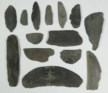
Sold2020(14) ARCHAIC YUP'IK ESKIMO SLATE ULU KNIFE BLADESIn varying design, condition, but nearly all retaining a sharp edge. 1 3/4" to 6 1/4". Gathered in the Bethel, Alaska region. Provenance: From the Collection of William F Bergen, D.O.See Sold Price
Sold2017Mitchell: Antique Map of Alaska, 1869Title/Content of Map: Alaska by Mitchell Date Printed: 1869 Cartographer: Augustus S. Mitchell Material/Medium: Paper Size: 12" x 15" Hand colored engraved Map. From 'Mitchell's New General Atlas.' PuSee Sold Price
Sold2023Alaska 1895Title/Content of Map: Alaska 1895 Date Printed: 1895 Material/Medium: paper Size: 10.75"x13.75" Rand, McNally & Co. Reserve: $35.00 Shipping: Domestic: Flat-rate of $15.00 to anywhere within the contSee Sold Price
7 days LeftEarly American History Auctions1776 Map, PARTIE ORIENTALE DU CANADA, AVEC LA NOUVELLE ANGLETERRE, L'ACADIE... by P. Santini, Framed$950
3 days LeftJasper521853 Williamson Map of California's Tejon Pass Region -- Map and Profile of the Cañada de las$55
3 days LeftJasper521908 Rand McNally Map of the Panama Canal [verso] Alaska -- Map of the Canal Zone… [verso]$35
Jun 12Dan Morphy AuctionsPHELPS’S TRAVELERS GUIDE THROUGH THE UNITED STATES; CONTAINING UPWARDS OF SEVEN HUNDRED$1,000
6 days LeftFreeman's | HindmanHOMANN, Johann Baptist. Amplissimae Regionis Mississipi Seu Provinciae Ludovicianae. Nuremburg, [ca$425(2 bids)
6 days LeftFreeman's | Hindman[MAP]. ORTELIUS, Abraham. Peregrinationis Divi Pauli Typus Corographicus. 1592.$150(1 bid)
6 days LeftHolabird Western Americana CollectionsMining Districts-Sketch Gen. Reilly's Route 1849 [178901]$450


![1908 Rand McNally Map of the Panama Canal [verso] Alaska -- Map of the Canal Zone… [verso] (1 of 2)](https://p1.liveauctioneers.com/5584/331064/178466470_1_x.jpg?height=282&quality=70&version=1716924723)


![[MAP]. ORTELIUS, Abraham. Peregrinationis Divi Pauli Typus Corographicus. 1592. (1 of 2)](https://p1.liveauctioneers.com/197/329395/177650535_1_x.jpg?height=282&quality=70&version=1715364962)


![Early French Map of Great Lakes [179300] (1 of 1)](https://p1.liveauctioneers.com/2699/331495/178785744_1_x.jpg?height=282&quality=70&version=1717094933)
![Mining Districts-Sketch Gen. Reilly's Route 1849 [178901] (1 of 3)](https://p1.liveauctioneers.com/2699/331495/178785791_1_x.jpg?height=282&quality=70&version=1717094933)