Antiquarian Maps of Europe 2018-07-17 Auction - 143 Price Results - Jasper52 in NY - Page 5
LiveAuctioneers Logo

1570 Septentrionalium Regionum Descrip.1609 Irlandiae Accurata Descriptio, Auctore Baptist1623 Portugalliae que olim Lusitania, Novissima et
Done
New York, NY, United States
Auction Details

Antiquarian Maps of Europe

Jasper52

Jasper52

badge TOP RATED
Explore both land and sea with this array of maps of Europe and the United Kingdom. With this focused yet diverse auction, discover a rare Ortelius view of Iceland from 1585, or revel in hand colored masterpieces by Homann, Munster, Janssonius, and more. Not only will these maps serve as decorative pieces, but they also will reveal innumerable ways to view our world.
Auction Curator:
Steve Kovacs
Steve Kovacs
Maps Expert
Lot Number: Lowest
24
Map of Ireland: Cartographer: John James LettTitle: Map of IrelandMedium: Ink on PaperDimensions: 14" X 17" Map of Ireland dated 1885. Engraved by John James Lett and Company for his Atlas. Published in London,
0102: Map of IrelandEst. $150-$200Lot Passed
Map of Russia: Cartographer: A.J. JohnsonTitle: Map of RussiaMedium: Ink on PaperDimensions: 18" X 26" Map of Russia dated 1867 published by A.J. Johnson in New York. Hand colored and hand drawn. Map key located
0103: Map of RussiaEst. $350-$400Lot Passed
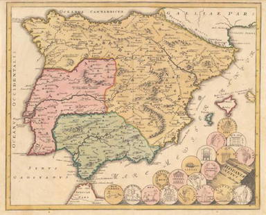
1720 Hispania Vetus: By: Johann Christoph Weigel Date: 1720 (Published) Nuremberg Dimensions: 12.5 x 15.4 inches (31.8 cm x 39 cm) This remarkable authentic antique hand-colored map depicts Hispania and the northern tip
0118: 1720 Hispania VetusEst. $200-$250Lot Passed
1824 Nouveau Plan de Moscou: By: G.L. De Laveau Date: 1824 Dimensions: 23 x 31 inches (53.3 cm x 78.7cm) This lovely rare authentic antique traveler’s folding guide of Moscow by G.L. De Laveau is dated 1824, a mere twelve
0120: 1824 Nouveau Plan de MoscouEst. $450-$550Lot Passed
View:
24
TOP