


Done
New York, NY, United States
Auction Details
16th-20th Century Antiquarian Maps
Explore both land and sea with this array of maps, which preserves the geography of nearly every region imaginable. Unlike modern maps, these original engravings trace borders as they evolved throughout history. Discover centuries-old views of every corner of America or a map of Portugal and parts of Spain from 1645! Not only will these maps serve as decorative pieces, but they also will reveal innumerable ways to view our world.
Auction Curator:
Steve Kovacs
Maps ExpertLot Number: Lowest
24


0002: 1866 Johnson Map of Washington DC -- Johnson's Georgetown and the City of Washington the Capital ofEst. $100-$120Lot Passed


0006: 1863 Johnson Map of US West -- Johnson's California Territories of New Mexico Arizona ColoradoEst. $200-$250Lot Passed
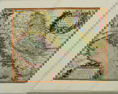
0007: 1595 Ortelius Map of the Dalmatian Coast to Hungary -- Pannoniae, et Illyrici Veteris TabulaEst. $500-$600Lot Passed

0008: 1930s Philip Transportation Map of London -- Philips' Tape Indicator Map of London Divided intoEst. $300-$350Lot Passed


View:
24
Auction Details

Bid Increments
PriceBid Increment
$0$1
$10$5
$100$10
$200$20
$500$50
$1,000$100
$2,000$200
$5,000$500
$10,000$1,000
$20,000$2,000
TOP