


Done
New York, NY, United States
Auction Details
16th-20th Century Antiquarian Maps
Explore both land and sea with this array of maps, which preserves the geography of nearly every region imaginable. Unlike modern maps, these original engravings trace borders as they evolved throughout history. Discover centuries-old views of every corner of America or a map of Portugal and parts of Spain from 1645! Not only will these maps serve as decorative pieces, but they also will reveal innumerable ways to view our world.
Lot Number: Lowest
24

0001: 1694 de Fer Three Maps of the Versailles Canal (Not Completed) -- I., II., III., Partie du NouveauEst. $200-$250Lot Passed

Sold
0003: 1817 Hall Map of Persia to Kazakhstan -- Map of the Eastern Part of Persia with Afghanistan,Est. $250-$300
See Sold Price

0004: 1866 Johnson Map of Maryland and Delaware -- Johnson's Delaware and MarylandEst. $70-$80Lot Passed
Sold
0005: 1818 Walch Map of India and Southeast Asia -- Karte von OstindienEst. $80-$100
See Sold Price
![1900 Census Map of British Natives in the US -- Density of Natives of Great Britain [with]: Title: 1900 Census Map of British Natives in the US -- Density of Natives of Great Britain [with] Proportion of Natives of Great Britain…Cartographer: US Census BureauYear / Place: 1900, Washington](https://p1.liveauctioneers.com/5584/307945/164512527_1_x.jpg?height=310&quality=70&version=1699391907)
0006: 1900 Census Map of British Natives in the US -- Density of Natives of Great Britain [with]Est. $70-$80Lot Passed

![1898 Cram Map of Nashville [verso] Memphis -- Nashville [verso] Memphis: Title: 1898 Cram Map of Nashville [verso] Memphis -- Nashville [verso] MemphisCartographer: G CramYear / Place: 1898, ChicagoMap Dimension (in.): 12.9 X 10 in. This is a very nice and detailed maps](https://p1.liveauctioneers.com/5584/307945/164512529_1_x.jpg?height=310&quality=70&version=1699391907)


0013: 1758 Akerman Map of Germanic States -- Area Belli Germanici Praesentis…Est. $120-$150Lot Passed


0020: 1753 Homann Atlas Title Page -- Atlas Compendiarius Seu it a dietus Scholasticus MinorEst. $70-$80Lot Passed

0021: 1748 Homann Map of the Low Countries -- Belgii Universi seu Inferioris Germaniae quam XVIIEst. $150-$200Lot Passed
0022: 1833 Woodbridge World Map -- Map of the World Adapted to Woodbridge's GeographyEst. $60-$70Lot Passed

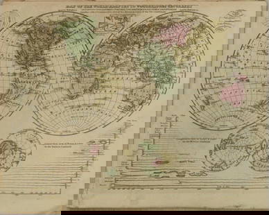
0023: 1640 Blaeu Map of the Anjou Region and Loire River -- Ducatus Andegavensis… AniouEst. $150-$200Lot Passed


View:
24
Auction Details

Bid Increments
PriceBid Increment
$0$1
$10$5
$100$10
$200$20
$500$50
$1,000$100
$2,000$200
$5,000$500
$10,000$1,000
$20,000$2,000
TOP