


Done
New York, NY, United States
Auction Details
Antique Maps and Prints of the Pacific Ocean
This auction offers antique maps & prints of the Pacific Ocean & its smaller islands, archipelagos, shipping routes, currents & people. We have old maps & prints of Polynesia, Melanesia & Micronesia including Fiji, Samoa, the Cook Islands, Marshall Islands, New Caledonia and the Solomon Islands. See separate country categories for the Hawaii archipelago, Galapagos, Easter island, New Zealand, Japan, Indonesia, Philippines etc.
Lot Number: Lowest
24
![Isles de la Société. Society Islands. Huaheine Raiatea Polynesia. BONNE 1788 map: TITLE/CONTENT OF MAP: [Cook 3e Voyage] Carte des Isles de la Société // Isle de Noël // Havre d'Owarre dans Huaheine // Havre d'Oopoa dans Ulietea // Havre d'Ohamaneno dans Ulietea](https://p1.liveauctioneers.com/5584/310511/166159555_1_x.jpg?height=310&quality=70&version=1701205563)
0001: Isles de la Société. Society Islands. Huaheine Raiatea Polynesia. BONNE 1788 mapEst. $60-$70Lot Passed

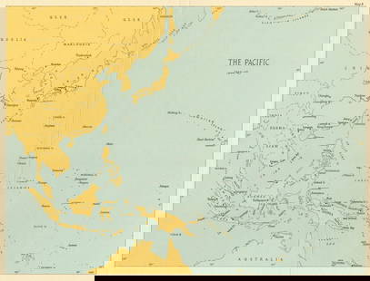
0002: The Pacific showing Command Areas 1942-43. World War 2 1961 old vintage mapEst. $20-$30Lot Passed

0003: Pacific Ocean inc. Oceanica. Sandwich or Hawaiian Islands. COWPERTHWAIT 1852 mapEst. $200-$250Lot Passed
Sold![Côte NO de l'Amérique & côte NE de l’Asie. Alaska & Kamchatka. BONNE 1790 map: TITLE/CONTENT OF MAP: [Cook 3e Voyage] Carte de la côte Nord-Ouest de l'Amérique et de la côte Nord-Est de l’Asie // Plan de l'Entrée de Nootka [Cook's 3rd Voyage - Map of](https://p1.liveauctioneers.com/5584/310511/166159558_1_x.jpg?height=310&quality=70&version=1701205563)
0004: Côte NO de l'Amérique & côte NE de l’Asie. Alaska & Kamchatka. BONNE 1790 mapEst. $90-$110
See Sold Price
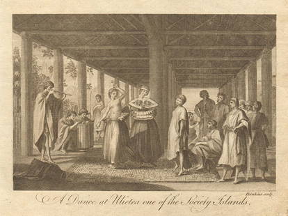
0005: A dance at Ulietea one of the Society Islands. Raiatea, Polynesia. BANKES 1789Est. $20-$30Lot Passed
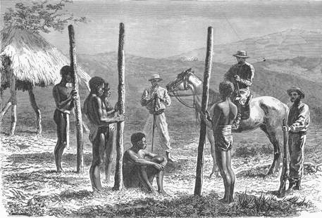
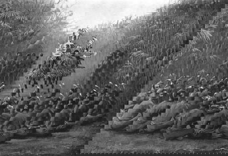
0006: NEW CALEDONIA. Caledonians building house 1880 old antique print pictureEst. $20-$30Lot Passed
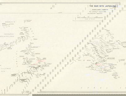
0007: World War 2. Guadalcanal Campaign. Landing 7 Aug 1942 & Concurrent Ops 1959 mapEst. $30-$40Lot Passed
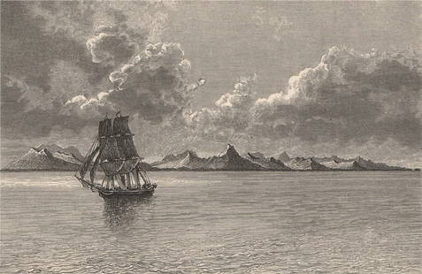
0008: General view of Ualan (Kosrae) Island, Caroline Islands, Micronesia 1885 printEst. $20-$30Lot Passed
0009: MELANESIA. Initiation ceremony Torres straits; secret society 1900 old printEst. $20-$30Lot Passed
Sold
0010: PACIFIC OCEAN & ISLANDS. Australasia. Currents. LETTS 1884 old antique mapEst. $20-$30
See Sold Price
![Carte de l'Isle de Bourbon, autrefois Mascareigne'. Réunion. BELLIN 1750 map: CAPTION PRINTED BELOW PICTURE: Carte de I’Isle de Bourbon, autrefois Mascareigne [Map of the island of Réunion, formerly Mascarenhas] DATE PRINTED: 1750 IMAGE SIZE: Approx 21.5 x 25.5cm,](https://p1.liveauctioneers.com/5584/310511/166159565_1_x.jpg?height=310&quality=70&version=1701205563)
0011: Carte de l'Isle de Bourbon, autrefois Mascareigne'. Réunion. BELLIN 1750 mapEst. $120-$150Lot Passed
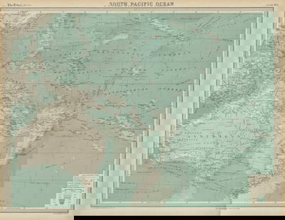
0012: South Pacific Ocean. Oceania Polynesia Melanesia Micronesia. TIMES 1922 mapEst. $30-$40Lot Passed
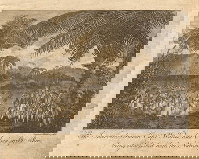
0013: Capt. Wallis meeting Oberea upon peace treaty. Queen Purea, Tahiti. BANKES 1789Est. $20-$30Lot Passed
![Hawaii & American Samoa. Pictorial state map by Ruth Taylor White 1935 old: CAPTION PRINTED BELOW PICTURE: Territory of Hawaii // [American] Samoa DATE PRINTED: 1935 IMAGE SIZE: Approx 30.5 x 23.5cm, 12 x 9.25 inches (Large) TYPE: Vintage colour pictorial map. The buyer](https://p1.liveauctioneers.com/5584/310511/166159568_1_x.jpg?height=310&quality=70&version=1701205563)
0014: Hawaii & American Samoa. Pictorial state map by Ruth Taylor White 1935 oldEst. $250-$300Lot Passed
Sold
0015: PACIFIC OCEAN Sandwich Islands/Hawaii Australia New Zealand &c. WELLER 1863 mapEst. $110-$150
See Sold Price
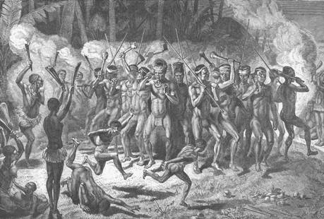
0016: PACIFIC ISLANDS. The Pilou-Pilou Dance of Now Caledonia 1890 old antique printEst. $20-$30Lot Passed
Sold![Carte de L'Océanie. Oceania. Pacific Ocean Australasia. MALTE-BRUN c1871 map: TITLE/CONTENT OF MAP: 'Carte de l'Océanie [Map of Oceania]' DATE PRINTED: c1871 IMAGE SIZE: Approx 33.5 x 46.0cm, 13.25 x 18.25 inches (Large); Please note that this is a folding map. TYPE:](https://p1.liveauctioneers.com/5584/310511/166159571_1_x.jpg?height=310&quality=70&version=1701205563)
0017: Carte de L'Océanie. Oceania. Pacific Ocean Australasia. MALTE-BRUN c1871 mapEst. $50-$60
See Sold Price
Sold
0018: Oceania & the Pacific Ocean. BARTHOLOMEW 1893 old antique map plan chartEst. $20-$30
See Sold Price

0019: PACIFIC ISLANDS. Hawaii Samoa Fiji New Caledonia Society Islands 1952 old mapEst. $20-$30Lot Passed
0020: Pacific Ocean theatre 1944/45. World War 2 1965 old vintage map plan chartEst. $20-$30Lot Passed
![Carte réduite de la Mer du Sud'. South Pacific. Australia. BELLIN 1753 map: CAPTION PRINTED BELOW PICTURE: Carte réduite de la Mer du Sud [Map of the South Seas] DATE PRINTED: 1753 IMAGE SIZE: Approx 21.5 x 37.0cm, 8.5 x 14.5 inches (Large); Please note that this is a](https://p1.liveauctioneers.com/5584/310511/166159575_1_x.jpg?height=310&quality=70&version=1701205563)
0021: Carte réduite de la Mer du Sud'. South Pacific. Australia. BELLIN 1753 mapEst. $400-$500Lot Passed
![Océanique. Iles des Amis #47. Tonga. Lau & Moala, Fiji. VANDERMAELEN 1827 map: TITLE/CONTENT OF MAP: Océanique - Iles des Amis [Note sur les îles des Amis] - No. 47 The Islands of Tonga and the Lau and Moala Island groups, eastern Fiji DATE PRINTED: 1827 IMAGE SIZE:](https://p1.liveauctioneers.com/5584/310511/166159576_1_x.jpg?height=310&quality=70&version=1701205563)
0022: Océanique. Iles des Amis #47. Tonga. Lau & Moala, Fiji. VANDERMAELEN 1827 mapEst. $250-$300Lot Passed

0023: Polynesia. Fiji, Hawaiian & Samoan islands. Vanua/Viti-Levu. THE TIMES 1895 mapEst. $50-$60Lot Passed

0024: PACIFIC AND INDIAN OCEAN. Command areas 1942-43 1956 old vintage map chartEst. $30-$40Lot Passed
View:
24
Auction Details

Bid Increments
PriceBid Increment
$0$1
$10$5
$100$10
$200$20
$500$50
$1,000$100
$2,000$200
$5,000$500
$10,000$1,000
$20,000$2,000
TOP