2 Antique Maps of New England, Johnson & Ward, Mitchell
Similar Sale History
View More Items in Militaria & War MemorabiliaRelated Militaria & War Memorabilia
More Items in Militaria & War Memorabilia
View MoreRecommended Collectibles
View More


Item Details
Description
**First Time At Auction**
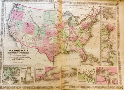
Alvin Jewett Johnson (American, 1827-1884). "Johnson's Massachusetts, Connecticut, and Rhode Island." ca. 1862 AND Samuel Augustus Mitchell (American, 1792-1868). "Connecticut" ca. 1849. A wonderful pair of antique maps of New England. First, an Alvin Jewett Johnson map of Massachusetts, Connecticut, and Rhode Island created after the outbreak of the Civil War and set in a custom matte. The map includes the regions from Vermont to Long Island and the Long Island Sound as well as from New York to the Atlantic Ocean. All is surrounded by a beautiful strapwork border used in Johnson's maps from 1860 to 1863. The steel plate engraved map was created for publication in the 1862 edition of his New Illustrated Atlas - the first edition of Johnson's Atlas with the Johnson and Ward imprint. Size including margins: 18" L x 26.3" W (45.7 cm x 66.8 cm)
Joining the Johnson and Ward map is an Samuel Augustus Mitchell map of Connecticut, focussing on Middlesex and Hartford, but also extending eastward from Fairfield to Windham and New London to address the entire state. On the upper left is a statistical table that lists the populations of towns, counties, and different time periods. A beautiful map that is engraved and nicely colored in Mitchell's signature style with pastel pink, yellow, and green as well as his decorative green border. This map was published in the 1849 edition of the New Universal Atlas. Interestingly, it was the final edition that Mitchell published of the atlas before he sold the rights to the atlas and his plates to Thomas Cowperthwait in 1850. Size including margins: 13.875" L x 17.3" W (35.2 cm x 43.9 cm)
Provenance: private John and Mary Williams collection, Boulder, Colorado
All items legal to buy/sell under U.S. Statute covering cultural patrimony Code 2600, CHAPTER 14, and are guaranteed to be as described or your money back.
A Certificate of Authenticity will accompany all winning bids.
PLEASE NOTE: Due to recent increases of shipments being seized by Australian & German customs (even for items with pre-UNESCO provenance), we will no longer ship most antiquities and ancient Chinese art to Australia & Germany. For categories of items that are acceptable to ship to Australia or Germany, please contact us directly or work with your local customs brokerage firm.
Display stands not described as included/custom in the item description are for photography purposes only and will not be included with the item upon shipping.
#165613
Condition
"Johnson's Massachusetts, Connecticut, and Rhode Island" has normal toning to paper, minute nicks to peripheries, and a few minor stains. Image, text, and coloring are still strong. Please note there is a Geographical Index on the verso. The Mitchell "Connecticut" map shows expected toning commenurate with age, minute tears/losses to peripheries that do not impact the map itself, and a few stains. The imagery, text, decorative border, and coloring are still strong.
Buyer's Premium
- 24.5%
2 Antique Maps of New England, Johnson & Ward, Mitchell
Estimate $400 - $600
2 bidders are watching this item.
Shipping & Pickup Options
Item located in Louisville, CO, usOffers In-House Shipping
Local Pickup Available
Payment

Related Searches
TOP


![[CIVIL WAR] Rare Florida POW Letter from Elmira: Autograph letter signed by John W. Brett, Co. I, 5th Battalion Florida Cavalry. Military Prison, Ward No. 31, Elmira, New York, 29 November 1864. 1 page, 7 3/4 x 3 7/8 in. With original yellow envelop](https://p1.liveauctioneers.com/7226/325455/175169080_1_x.jpg?height=310&quality=70&version=1712370394)


![Two framed CDVs of a noted Civil War amputee: [CIVIL WAR] STRATTON, ALFRED. Two CDVs of Stratton in a carved wood period frame of this Civil War amputee. One CDV is by Fredricks & Co, Fifth Ave; the other by Ormsbee, Broadway. A few repaired](https://p1.liveauctioneers.com/292/326828/175962956_1_x.jpg?height=310&quality=70&version=1713473479)
![The Supreme Court's decision in the Dred Scott case, in original wrappers: [DRED SCOTT CASE] HOWARD, BENJAMIN C. A Report of the Decisions of the Supreme Court of the United States and the Opinions of the Judges Thereof, in the Case of Dred Scott, versus John F.A. Sandford.](https://p1.liveauctioneers.com/292/326828/175962982_1_x.jpg?height=310&quality=70&version=1713473479)
![The History of the Massachusetts 54th Regiment, basis for the film Glory: [CIVIL WAR] EMILIO, LUIS F. History of the Fifty-Fourth Regiment of the Massachusetts Volunteer Infantry, 1863-1865. [A Brave Black Regiment.] Boston: Boston Book Company, 1891. First edition. Publish](https://p1.liveauctioneers.com/292/326828/175962992_1_x.jpg?height=310&quality=70&version=1713473479)
![First edition of Twain's landmark of American literature: TWAIN, MARK [CLEMENS, SAMUEL] Adventures of Huckleberry Finn (Tom Sawyer’s Comrade). New York: Charles L. Webster, 1885. First edition, first issue points listed below. Publisher's green cloth,](https://p1.liveauctioneers.com/292/326828/175962994_1_x.jpg?height=310&quality=70&version=1713473479)
![The 1787 Constitution of the Pennsylvania Society for Promoting the Abolition of Slavery: [FRANKLIN, BENJAMIN, as President]. The Constitution of the Pennsylvania Society, for Promoting the Abolition of Slavery, and the Relief of Free Negroes, Unlawfully Held in Bondage. Begun in the Year](https://p1.liveauctioneers.com/292/326828/175962971_1_x.jpg?height=310&quality=70&version=1713473479)


![George Washington Signed Discharge: Partly printed discharge document signed by George Washington, as Commander in Chief of the Armies of the United States. Newburgh, [New York], 4 January 1783. 1 page, ## x ## in. Undersigned by Washin](https://p1.liveauctioneers.com/7226/322253/173251475_1_x.jpg?height=310&quality=70&version=1710004847)
![[Ambrotype] Texas Confederate Soldier: Sixth plate ambrotype. Full leatherette case. Portrait of a possible Texas Confederate soldier. A silver star device was used to pin up the brim of his light-toned headgear, a look often seen in image](https://p1.liveauctioneers.com/7226/322253/173251509_1_x.jpg?height=310&quality=70&version=1710004847)
![Captured Bowie Knife w/ Period Note of Provenance: Captured Confederate D-hilt Bowie knife. [Kenansville, North Carolina]: [Louis Froelich factory]. With original metal and leather sheath with affixed period notes. First note with only remnants. Secon](https://p1.liveauctioneers.com/7226/325455/175169154_1_x.jpg?height=310&quality=70&version=1712370394)

![[CIVIL WAR] 1st Texas Infantry in Camp: Outdoor half plate ambrotype of the 1st Texas Infantry. Full leatherette case. Significant, large half plate ambrotype of members of the 1st Texas Infantry at ‘Splinterville,’ the regiment’s win](https://p1.liveauctioneers.com/7226/322253/173251512_1_x.jpg?height=310&quality=70&version=1710004847)
![[HANCOCK, John] Washington’s Spy, Officer’s Commission: Partly printed document signed by John Hancock as President of the Continental Congress, for Epaphras Bull (1748-1781). [Philadelphia, Pennsylvania], 10 January 1777. 1 page, ## x ## in. Completed in](https://p1.liveauctioneers.com/7226/322253/173251471_1_x.jpg?height=310&quality=70&version=1710004847)
![[Civil War] Bullet Which Nearly Killed Soldier: Lead bullet encased in gold acorn fob with chain. Finely engraved: "W.D. Fiske / 14th Regt. C V / Fredericksburg / Dec 17, 1863." Acorn approx. 1 1/2 x 1 in. Overall length 6 1/2 in. Published in "Her](https://p1.liveauctioneers.com/7226/325455/175169103_1_x.jpg?height=310&quality=70&version=1712370394)
![[CIVIL WAR] Black Soldier & Wife: CDV-sized tintype photograph WITH gem-sized tintype. Full thermoplastic case. Portrait of an unknown African American Civil War soldier who holds the rank of sergeant. He looks directly at the camera](https://p1.liveauctioneers.com/7226/322253/173251671_1_x.jpg?height=310&quality=70&version=1710004847)
![Historic Einstein Signed Program from Lincoln University Visit: Conferences on Objectives. Lincoln University, [Oxford], Pennsylvania, 3 May 1946. SIGNED BY ALBERT EINSTEIN. Tipped into Horace Mann Bond (1904-1972). The Education of the Negro in the American Socia](https://p1.liveauctioneers.com/7226/322253/173251693_1_x.jpg?height=310&quality=70&version=1710004847)


