


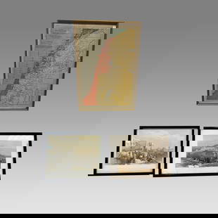
1873 Palestine Map
Similar Sale History
View More Items in Maps & Atlases


![1876 Mitchell Map of China, India and SouthEast Asia: Reserve Reduced! Title/Content of Map: 1876 Mitchell Map of China, India and SouthEast Asia [verso] Palestine -- Map of Hindoostan, Farther India, China, Tibet [verso] A New Map of Palestine or the Ho](https://p1.liveauctioneers.com/5584/131384/66769315_1_x.jpg?height=310&quality=70&version=1542734392)


Related Maps & Atlases


More Items in Maps & Atlases
View More


Recommended Transportation & Travel Collectibles
View More


Item Details
Description
Map of Palestine dated 1873. Part of Zell's Descriptive Hand Atlas of the World. Published in Philadelphia by T. Ellwood Zell. Drawn and printed by John Bartholomew. Key upper left. Double folio map. Inset of Jerusalem. With division of tribes. Colored coded for territorial divisions. Nice border. Printed on latitudinal and longitudinal grid. Detailed. Crisp.
Reserve: $45.00
Shipping:
Your purchase is protected:
Photos, descriptions, and estimates were prepared with the utmost care by a fully certified expert and appraiser. All items in this sale are guaranteed authentic.
In the rare event that the item did not conform to the lot description in the sale, Jasper52 specialists are here to help. Buyers may return the item for a full refund provided you notify Jasper52 within 5 days of receiving the item.
Condition
Good for age
Buyer's Premium
- 15%
1873 Palestine Map
Estimate $50 - $60
1 bidder is watching this item.
Shipping & Pickup Options
Item located in Georgia, US$19.99 shipping in the US
Payment
Accepts seamless payments through LiveAuctioneers
See More Items From This Jasper52 Seller

Auction Curated By

Maps Expert
TOP