2 Southern Maps: Kentucky, 1800 and Southern U.S. 1797
Similar Sale History
View More Items in Maps & AtlasesRelated Maps & Atlases
More Items in Maps & Atlases
View MoreRecommended Transportation & Travel Collectibles
View More


Item Details
Description
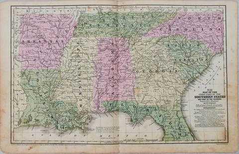
1st item: THE STATE OF KENTUCKY WITH THE ADJOINING TERRITORIES FROM THE BEST AUTHORITIES 1800, engraved by John Scoles for "New Encyclopaedia" by John Payne, published by John Low, New York, 1800. Copper plate engraved map of Kentucky and the surrounding areas including the "Northwestern Territory" of Illinois and Virginia and the "Southwestern Territory" including the "Tennessee Government", parts of Georgia and South Carolina depicting towns and roads, county lines, names of counties, rivers, mountains, and forts. Title, lower left. "Long W from Phila.", top right above map, "West from London", lower left below map. Map surrounded by scale notations and line border. Housed and matted under glass in a black wooden frame with gilt trim. Sight: 7 3/4" H x 9 1/8" W. Framed: 13 1/2" H x 14 3/4" W. 2nd item: MAP OF THE SOUTHERN PARTS OF THE UNITED STATES OF AMERICA, drawn by Abraham Bradley, Jr., engraved by Samuel Hill, from THE AMERICAN GAZETTEER, published by Jedidiah Morse, Boston, 1797. Copper plate engraved map depicting the Southern United States, including Part of Virginia, North Carolina, South Carolina, Georgia and the Georgia Western Territory, West Florida and East Florida, Tennessee, and Part of Kentucky, bordered to the west by the Mississippi River, depicting towns and roads, county lines, names of counties, rivers, and mountains with other points of interest labeled including the locations of Native American settlements. Title and scale of miles, center and lower right. Surrounded by scale notations and a line border. Housed and matted under glass in a black wooden frame with giltwood trim. Sight: 8" H x 15 1/2" W. Framed: 13 3/4" H x 21 3/8" W.
The Estate of Raymond White, Nashville, Tennessee.
The Estate of Raymond White, Nashville, Tennessee.
Condition
1st item: Overall good condition with light toning, few scattered minute foxing spots. 3/4" tear, lower left outside of image. Not examined outside of frame. 2nd item: Overall good condition with areas of dampstaining/acid burn, largest visible area 1 1/2" x 1 3/4", 3/4" tear to lower center crease line. Not examined outside of frame.
Buyer's Premium
- 28%
2 Southern Maps: Kentucky, 1800 and Southern U.S. 1797
Estimate $400 - $500
24 bidders are watching this item.
Shipping & Pickup Options
Item located in Knoxville, TN, usSee Policy for Shipping
Local Pickup Available
Payment
Accepts seamless payments through LiveAuctioneers

TOP


![Amér Sep Grandes Antilles 73 Jamaica Pedro Bank San Andrés VANDERMAELEN 1827 map: CAPTION PRINTED BELOW PICTURE: Amér. Sep. - Grandes Antilles [Ile Jamaïque] - No. 73 The map covers the Caribbean Sea between the southern coast of Jamaica, the Pedro Bank & Cays, and the Co](https://p1.liveauctioneers.com/5584/327764/176591209_1_x.jpg?height=310&quality=70&version=1714507756)
![1575 Braun and Hogenberg Views of Southern Spanish Towns -- Le Brixa [on Sheet with] Settenil: Title: 1575 Braun and Hogenberg Views of Southern Spanish Towns -- Le Brixa [on Sheet with] Settenil Cartographer: Braun and Hogenberg Year / Place: 1575, Koln Map Dimension (in.): 12.5 X 16.2 in. The](https://p1.liveauctioneers.com/5584/327462/176400785_1_x.jpg?height=310&quality=70&version=1714507756)


![[Maps] Martin Zeiler, Itinerarium Italiae, 1640: [Maps] Martin Zeiler, Itinerarium Italiae, 1640, Martini Zeilleri. Itinerarium Italiae Nov-Antiquae: oder, Raiss-Beschreibung durch Italien, Matthaus Merian, Frankfurt, 40 plates, most double-page, in](https://p1.liveauctioneers.com/188/326797/176317459_1_x.jpg?height=310&quality=70&version=1713847031)


![[Maps] Gio. Ant. Magnini, Italia, 1620: [Maps] Gio. Ant. Magnini, Italia, 1620, Giovanni Antonio Magnini. Italia, data in luce da Fabio suo figliuolo al Serenissimo Ferdinado Gonzaga Duca di Matoua edi Monserrato etc. Bologna, for Sebastian](https://p1.liveauctioneers.com/188/326797/176317457_1_x.jpg?height=310&quality=70&version=1713847031)


