


 Discovery- InteriorsBonhamsSponsored.Your ad here?
Discovery- Interiors
Bonhams
Sponsored.Your ad here?


Discovery- InteriorsBonhamsSponsored.Your ad here?
Discovery- Interiors
Bonhams
Sponsored.Your ad here?

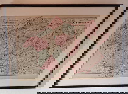
3 FRAMED CHARLESTON COUNTY MAPS
Similar Sale History
View More Items in Maps & Atlases


Related Maps & Atlases


More Items in Maps & Atlases
View More


![[Maps] Martin Zeiler, Itinerarium Italiae, 1640: [Maps] Martin Zeiler, Itinerarium Italiae, 1640, Martini Zeilleri. Itinerarium Italiae Nov-Antiquae: oder, Raiss-Beschreibung durch Italien, Matthaus Merian, Frankfurt, 40 plates, most double-page, in](https://p1.liveauctioneers.com/188/326797/176317459_1_x.jpg?height=310&quality=70&version=1713847031)


![[Maps] Gio. Ant. Magnini, Italia, 1620: [Maps] Gio. Ant. Magnini, Italia, 1620, Giovanni Antonio Magnini. Italia, data in luce da Fabio suo figliuolo al Serenissimo Ferdinado Gonzaga Duca di Matoua edi Monserrato etc. Bologna, for Sebastian](https://p1.liveauctioneers.com/188/326797/176317457_1_x.jpg?height=310&quality=70&version=1713847031)


Recommended Transportation & Travel Collectibles
View More


Item Details
Description
Three (3) Framed Charleston County Maps showing Neighborhoods. Includes 1- The Peninsula of Charleston.2- East Cooper; Mt. Pleasant, Isle of Palms, Sullivans Island. 3- Sea Islands; Kiawah, Seabrook, Johns Island and Wadmalaw. Weight combined 11 pds. PROVENANCE: A Private Charleston SC Estate.
Condition
good
Buyer's Premium
- 18% up to $50,000.00
- 15% up to $1,000,000.00
- 10% above $1,000,000.00
3 FRAMED CHARLESTON COUNTY MAPS
Estimate $225 - $300
9 bidders are watching this item.
Shipping & Pickup Options
Item located in Mt. Pleasant, SC, usOffers In-House Shipping
Local Pickup Available
Payment
Accepts seamless payments through LiveAuctioneers

TOP