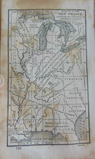
Van Keulen Map of New France, 1720
Similar Sale History
View More Items in Maps & AtlasesRelated Maps & Atlases
More Items in Maps & Atlases
View MoreRecommended Transportation & Travel Collectibles
View More


Item Details
Description
VAN KEULEN, Gerard (1678-1727).
Carte de la Nouvelle France on se voit le cours des Grandes Rivieres de S. Laurens & de Mississippi...
Engraved map with original hand color.
Amsterdam, ca 1720.
23 1/4" x 39 1/2" sheet, 34 1/4" x 51" framed.
A Rare Large Scale Eighteenth Century Land Map of North America.
The map includes all of present-day Texas on a quite large scale, and with a plethora of detail. The map extends as far west as Arizona (to the Casa Grande area) and far north into Montana, Canada, etc. The Great Salt Lake is located. The detail in New Mexico, Arizona, and Northern Mexico is excellent, too. Van Keulen had the advantage of borrowing from Delisle’s superb Carte de la Louisiane, but Van Keulen’s map extends considerably further west than Delisle’s. Van Keulen’s map is not listed in Wheat, Transmississippi West. This map makes an excellent example of the cartographic war carried out by Europeans making claims to territory in North America.
Buyer's Premium
- 25%
Van Keulen Map of New France, 1720
Estimate $12,000 - $18,000
8 bidders are watching this item.
Shipping & Pickup Options
Item located in New York, NY, usOffers In-House Shipping
Local Pickup Available
Payment

Related Searches
TOP


![VAN DER AA - Map of America, Leiden 1720: VAN DER AA, Pieter (1659-1733). Nouvelle Carte de l'Amerique. Leiden: [circa 1720]. Copper-engraved map. Sheet size: 18 x 21 1/4 inches. (Expert restoration along the side margins). Decorative early 1](https://p1.liveauctioneers.com/7533/208644/106251140_1_x.jpg?height=310&quality=70&version=1624641782)


![[MAP]. TODESCHI, Pietro. [Nova et Acurata Totius Americae Tabula auct. G.I. Blaeu] America quarta: [MAP]. TODESCHI, Pietro. [Nova et Acurata Totius Americae Tabula auct. G.I. Blaeu] America quarta pars orbis quam plerunq, nuvum orbem appellitant primo detecta est anno 1492 a Christophoro Columbo...](https://p1.liveauctioneers.com/197/329395/177650542_1_x.jpg?height=310&quality=70&version=1715364962)


![[MAPS]. HOMANN, Johann Baptist, HOMANN HEIRS, and Georg Matthäus SEUTTER. [Composite Atlas].: [MAPS]. HOMANN, Johann Baptist (1663-1724), HOMANN HEIRS, and Georg Matthäus SEUTTER (1678-1757). [Composite Atlas]. [Nuremberg, Augsburg, and others: Homann Heirs and others, maps dated between](https://p1.liveauctioneers.com/197/329395/177650530_1_x.jpg?height=310&quality=70&version=1715364962)


![[MAP]. ORTELIUS, Abraham. Turcici Imperii Descriptio.1592.: [MAP]. ORTELIUS, Abraham (1527-1598). Turcici Imperii Descriptio. Antwerp, 1592. Engraved map with hand-coloring. Matted, framed, and double glazed, sight 406 x 521 mm (unexamined out of frame). Decor](https://p1.liveauctioneers.com/197/329395/177650538_1_x.jpg?height=310&quality=70&version=1715364962)
![[MAP]. ORTELIUS, Abraham. Americae Sive Novi Orbis, Nova Descriptio. 1573.: [MAP]. ORTELIUS, Abraham (1527-1598). Americae Sive Novi Orbis, Nova Descriptio. Antwerp, 1573. Engraved map with hand-coloring. Framed and double glazed, visible area 375 x 521 mm (unexamined out of](https://p1.liveauctioneers.com/197/329395/177650534_1_x.jpg?height=310&quality=70&version=1715364962)

![[MAP]. ORTELIUS, Abraham. Aevi Veteris, Typus Geographicus. 1601.: [MAP]. ORTELIUS, Abraham (1527-1598). Aevi Veteris, Typus Geographicus. Antwerp, 1601. Engraved map with hand-coloring. Matted, framed, and double glazed, visible area 343 x 470 mm (unexamined out of](https://p1.liveauctioneers.com/197/329395/177650532_1_x.jpg?height=310&quality=70&version=1715364962)


![[FLAGS]. 31-star American parade flag. Ca 1850-1859.: [FLAGS]. 31-star American parade flag. Ca 1850-1859. 22 x 36 1/2 in. cotton flag with 31 printed stars, configured in a double medallion surrounding a much larger central star, that is haloed in both](https://p1.liveauctioneers.com/197/329785/177758218_1_x.jpg?height=310&quality=70&version=1715625218)


